
"Where's the trail to Cold Mountain?"
It is a question I've heard from numerous hikers during my hikes in the Shining Rock Wilderness area. It's a question I HAVE ASKED!! The trail to Shining Rock is easy enough to find, but the trail north towards Cold Mountain generally takes several tries to find!
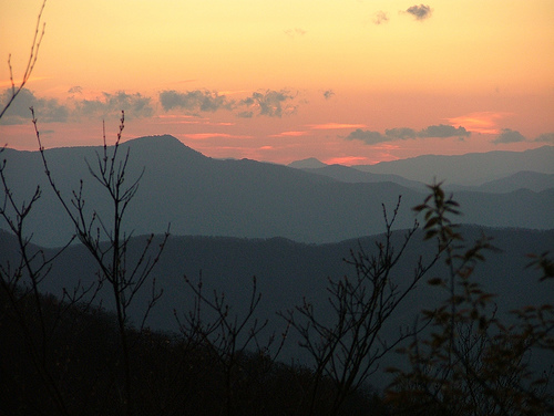
Sunset, as seen from Cold Mountain
Photo by Andy Kunkle
On a recent hike, I finally found the rather obscure, hidden turnoff that takes the hiker from Shining Rock's base north, on towards Cold Mountain.
I have yet to make it all the way to Cold Mountain's summit (the one way distance from Black Balsam Trailhead to Cold Mountain is 8.6 miles, meaning a round trip hike of over 17 miles if you do it as a day hike). The day I did this hike was late November, when daylight is in shorter supply. Additionally, storm clouds were forming, arriving in full force just as I got back to the car!
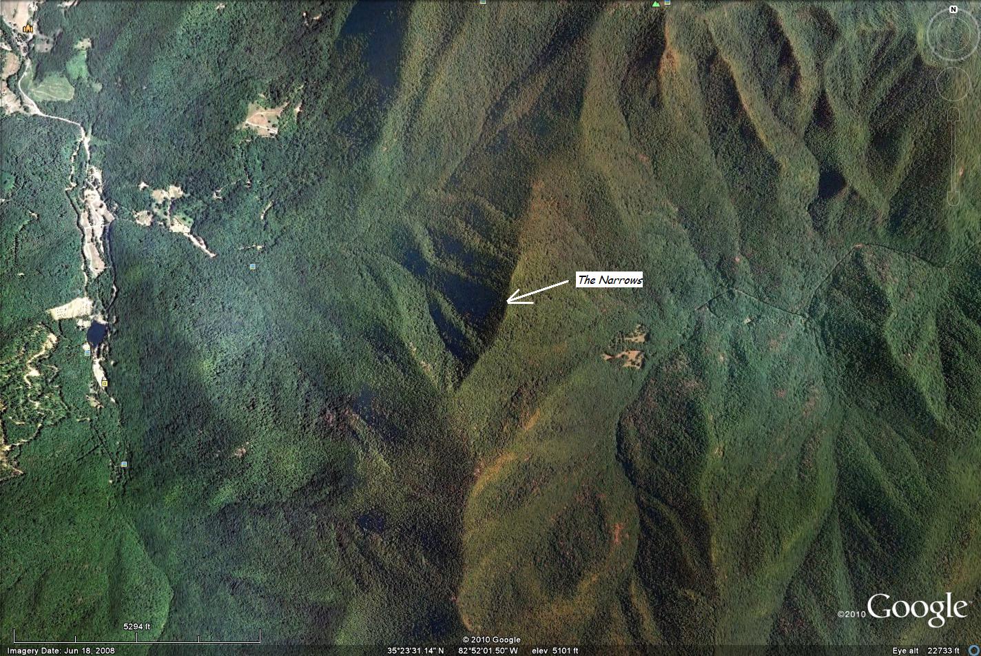
But, I got as far as "The Narrows", a 0.6 mile section of trail that follows a "knife-edge" ridge. The terrain to your left and right falls away at close to a 50% grade on either side. It's so distinctive, one can even see it in Google Earth!
My turnaround point was the northern-most point of "The Narrows", just before the 900 foot descent to Deep Gap. Right at this spot there is a tremendous look out spot, both to the left and right of the trail that provides some of the most incredibly beautiful views to the west and east.
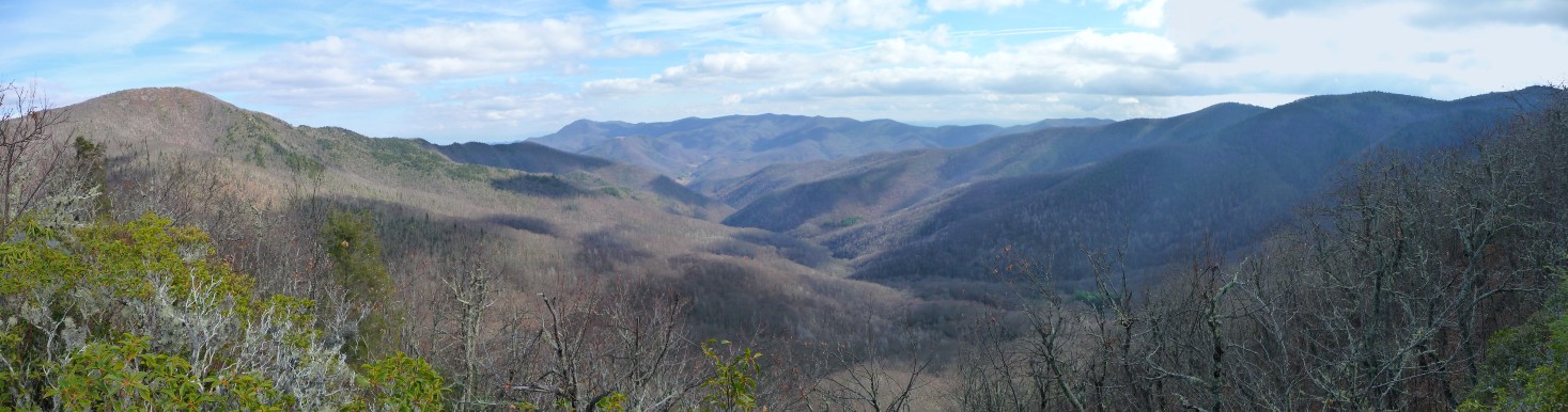
This panorama shot is a 180 degree scene, stitched together from 4 photos looking east from this spot. Cold Mountain is seen at the far left of the photo, and Shining Rock Summit is to the far right.
For a better view, download the large image (1.23 MB). For a smaller file, click here (0.17 MB)
Click here to see the map full screen GPX data for download: Black Balsam to Shining Rock and north towards Cold Mountain. Black Balsam Trailhead is located at the end of Black Balsam road, a (sort of) paved road that turns north off the Blue Ridge Parkway, just west of Graveyard Fields. If coming from the Asheville area, you'll pass Graveyard Fields, and then, just past mile marker 420, you'll see the easy to find Black Balsam road (FR 816). Drive to the end (enjoying the panoramic view of Graveyard Fields that you are treated to when looking to your right just after turning onto the road ... if you're an early morning person, this is one of THE BEST areas to view a sunrise!). The road ends at a parking area that is also equipped with two pit toilets and trash containers. The trail to Shining Rock and Cold Mountain starts at the east end of the parking lot (where the road and parking area meet). For the first 2.4 miles, you follow a very wide, very flat, very rocky, and often very wet 4 wheeled drive road which brings you to Ivestor Gap, and the southern edge of Shining Rock Wilderness Area. (For a much prettier hike to this same spot, follow Art Loeb Trail to this point, taking in the panoramic Tennent Mountain.) Which is not to say there are not gorgeous views from the 4 wheeled drive road either: Map and GPX data
DIRECTIONS
Once at Ivestor Gap, you'll notice a variety of trails. Take the single track trail to the far left. In the next 1.9 miles you'll pass 5 different springs that originate on the west-facing slopes of Grassy Cove Top and Flower Knob (making this section also often very wet). You are treated to some wonderful views of Fork Mountain to the west.
After just over a mile, the trail you're following makes a big turn, first to the left (west), then to the right, and begins heading due east to intersect again with Art Loeb Trail. At the big right turn, you'll see the eastern terminus of Little East Fork Trail, that descends down to the Daniel Boone Boy Scout Camp, south of Canton, NC. (See marked Waypoint on map, above)
At the 4.3 mile mark, the trail you're on comes to "T" at Art Loeb trail. Just before this "T" is a campsite, with a small fire circle (note: No open fires are permitted in the Shining Rock Wilderness Area ... cook stoves only are to be used).
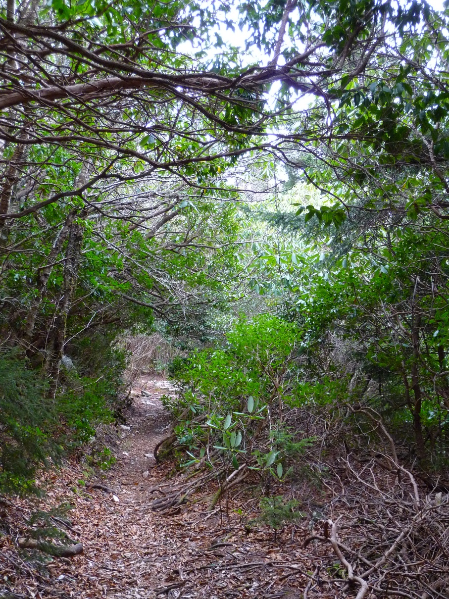
To find the trail that continues on to Cold Mountain, DO NOT go to Art Loeb. Instead, walk to the left, around the fire circle, turning almost completely back 180 degrees. You'll first see a trail that heads into some pines, but do not take this.
However, once you pass that trail, up ahead you'll see a well worn trail that goes down a couple log steps. THIS is the trail to Cold Mountain.
If you join Art Loeb, and turn left, you will come to the base of Shining Rock in less than one tenth of a mile. There may be bushwhack trails from there down to this trail to Cold Mountain, as I saw two fairly evident trails coming in from my right as I continued north (See marked Waypoints on map, above). On this day's hike, I also ran into a group of 3 hikers who said they'd done just that looking for this trail: hiking to Shining Rock's base and then bushwhacking west looking for this trail. Their words, "That was quite an adventure," describing getting through all the rhodos. (!!)
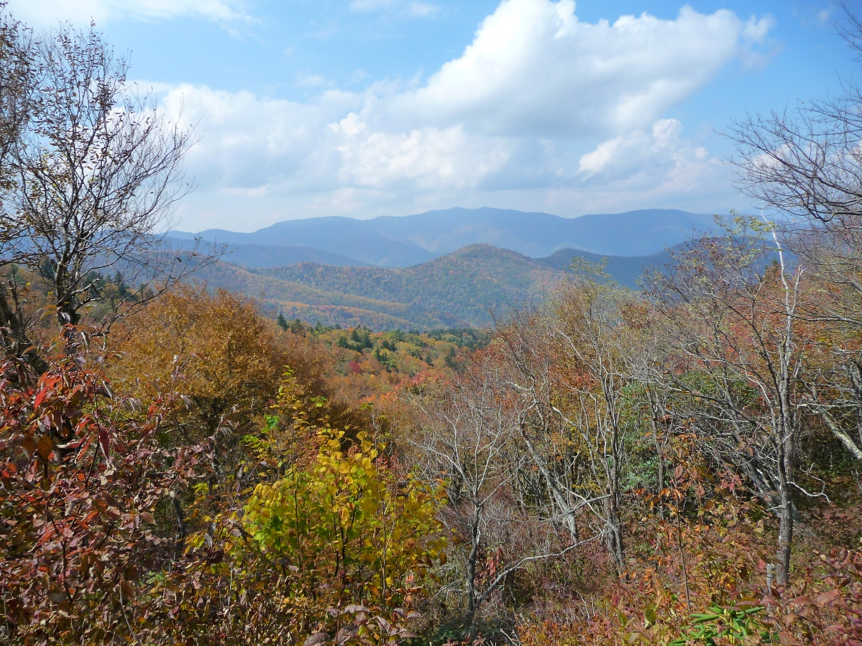
Once on the trail, you'll find it well worn and easy to follow. This scene is just due west of Shining Rock's Summit:
In 0.9 mile, you come to the summit of Stairs Mountain (the name only applies if coming from the NORTH ... you'll have a lot of climbing to get here in that direction, but coming from the south, it is almost a level trail.)
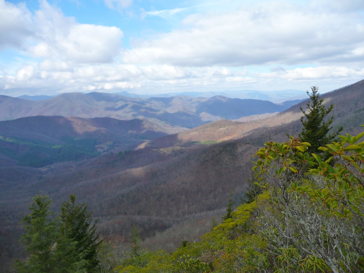
The summit gives you some nice views to the east, including Frying Pan Mountain and Pisgah Mountain.
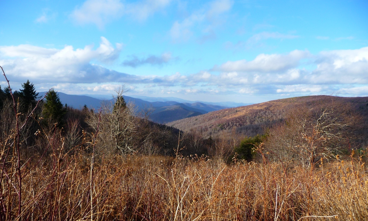
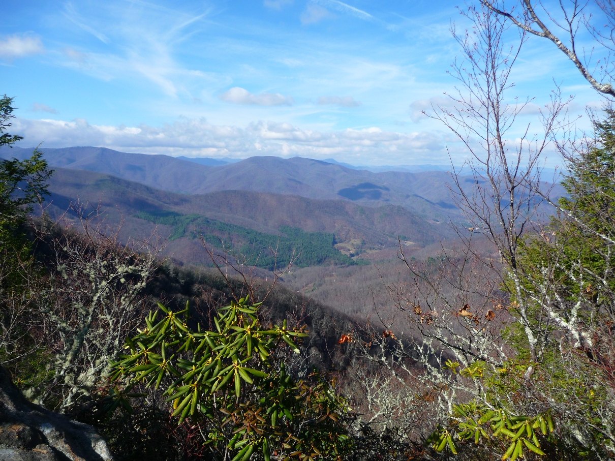
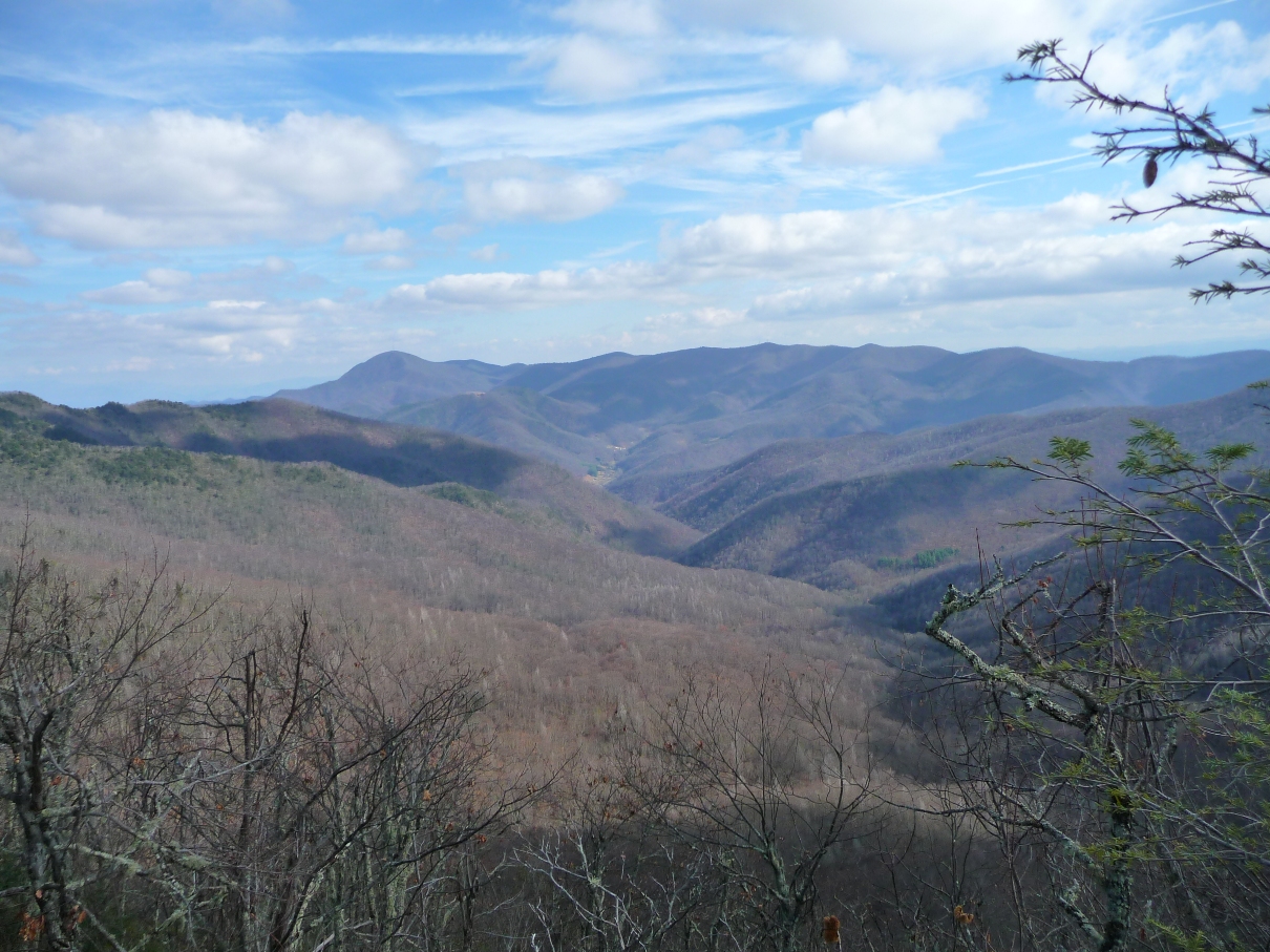
Continuing on another 0.9 mile from Stairs Mountain's peak, you come to a great campsite on your left (just before a significant downhill descent). From here, you get some great views of Deep Gap and Cold Mountain to the north, and Fork Mountain Ridge and areas west of there:
On today's hike, I went 0.7 mile further to the section of trail mentioned above: "The Narrows", taking in the views to the east and west.
Whether you continue on to Cold Mountain's summit, or turn around here as I did, you'll return via the same path you came.
Do keep an eye on the southwestern sky as you hike ... the three times I've hiked in this area, some massive storms have developed over the course of the day. Since so much of your hiking in this area is in open areas, it would be a rough area to hike through in a storm. If the storm includes lightning, you'd definitely want to find more protected areas.
On this day, I spent the entire day in sunshine, but from mid-day on, noted clouds forming in the west (pretty white ones, yet a horizon full of them.)
By the time I got back to the trailhead, here's what the pretty white clouds had turned into:

