Buck Spring Trail
Buck Spring Trail is a 6.2 mile long (one-way) trail that begins from a trailhead on US276 and ends at the Pisgah Inn, located on the Blue Ridge Parkway. There is over 1000 feet of elevation gain over the course of this trail, but most of that comes near the end, making most of this trail a very pleasant hike that weaves in and out of the various coves that lie along the southeast face of the mountain ridge that rises up above Pink Beds.
It's one of my favorite trails for a number of reasons:
- It makes a great shuttle hike ... driving distance between the beginning and end is only 6 miles.
- With Pisgah Inn as the ending (or starting) point, a great way to do this hike as a shuttle is to incorporate a meal at the Inn.
- I like to end at the Inn, relaxing with a big lunch (or dinner, depending upon start time!!)
- Others start at the Inn with a nice breakfast or lunch, and then hike to the US276 trailhead.
- The area has tons of wildflowers, as well as blooming mountain laurel, rhododendron, and flame azalea
- If you do the hike in the wintertime, you get almost constant views off to the southeast
- Numerous creek crossings (playing in the water is fun!)
- Since the first 4 miles have very little elevation gain, when I'm in the mood for an easy hike with lots of scenery, this fits the bill perfectly. I just hike as far as I feel like, and turn around and retrace my steps back to the car.
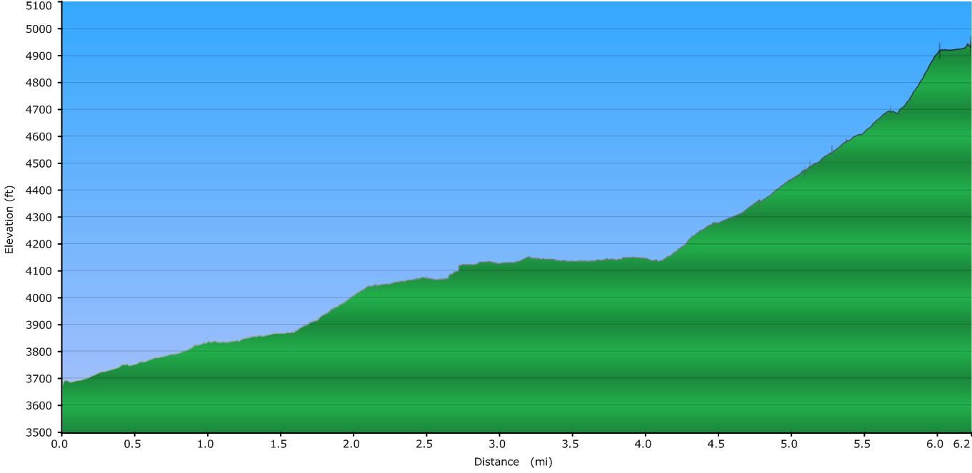
Elevation Profile
Click for larger image
Click here for a larger map
GPX data for download (zip file which includes both GPX format, as well as GDB format for Garmin users): Buck Spring Trail.
DIRECTIONS
I almost always do this hike beginning at US276 and ending at the Pisgah Inn, and I almost always do it as a shuttle. However, if a hike in the range of 13 miles is within your ability, doing this as an out-and-back hike is very doable. Combined with a meal at the Inn, you get a great chance to relax and fuel up before beginning your return trip. That return trip is all downhill, and except for the first mile closest to the Inn, it's a very gentle downhill, so easy on the legs. (Plus, there's ROCKING CHAIRS to relax in!!)
If you do this hike as an out-and-back in the winter (when the Inn is closed and the Parkway often is too), you won't get the chance for a meal but you'll get a chance to relax and play in an area with superb views that normally has lots of visitors, but you'll have it all to yourself.
This trip report will be in the uphill direction, beginning at the US276 trailhead.
This trailhead is located on the east side of US276 (right side as you're driving up to the Blue Ridge Parkway from Brevard). It comes 1 mile past the turn for Yellow Gap Road (FS 1209) and 2.3 miles down from the junction of US276 and the Blue Ridge Parkway.
The parking area is right before the highway makes a very sharp (360 degree) turn to the left (if travelling up to the BRP). You'll notice a spot along the shoulder that has room for 4 cars or so. A trail marker with the trail's name is off to the right at the beginning of the trail.

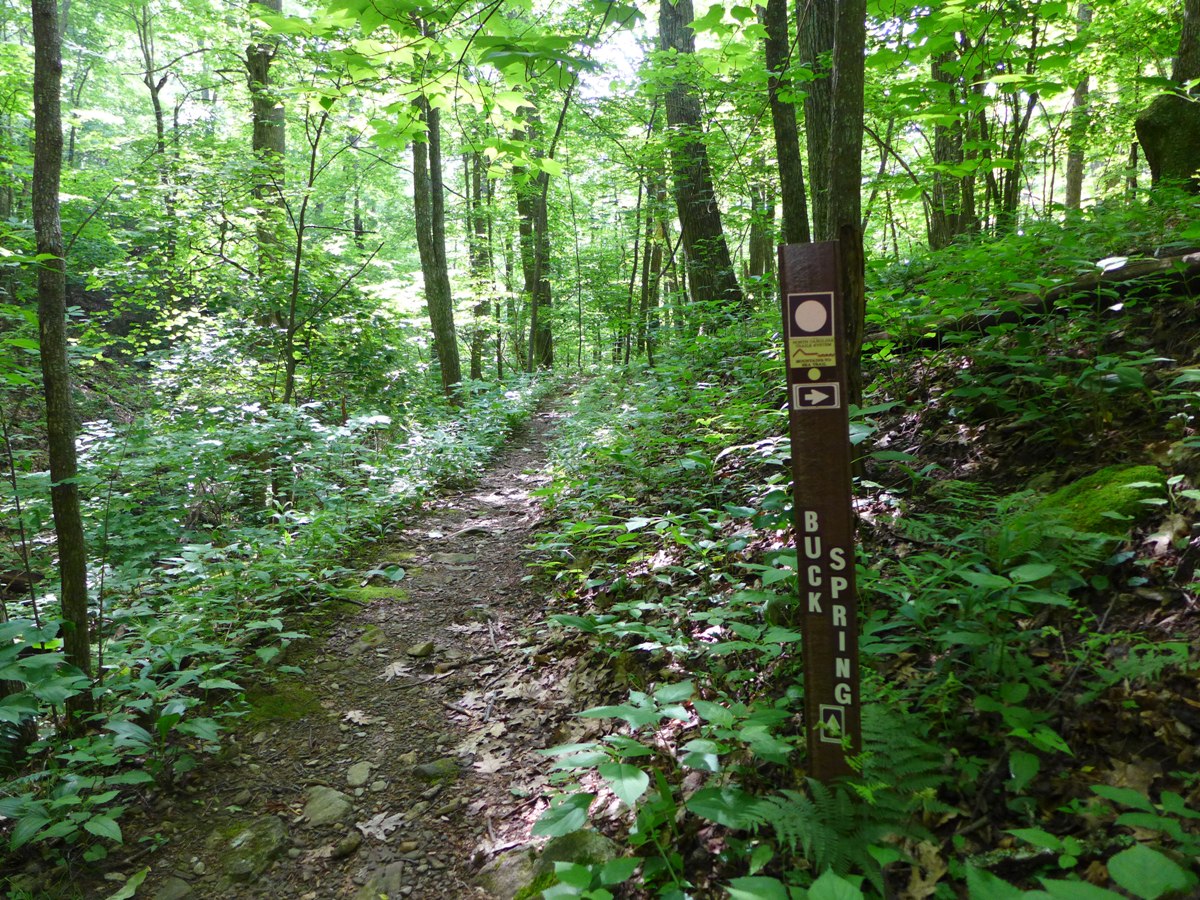
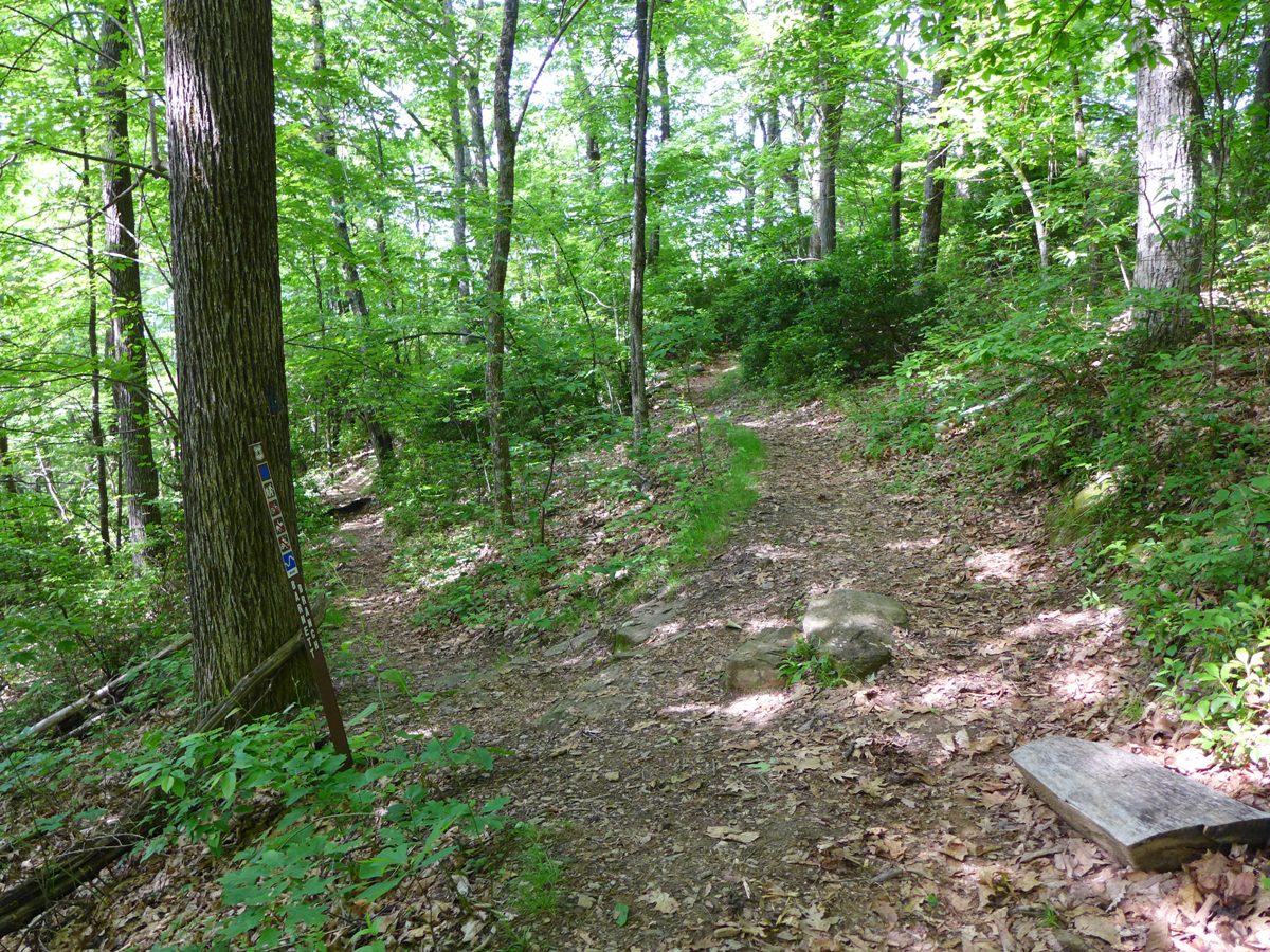
Buck Spring Trail
After a short descent down from the parking area down a few rock steps, the trail quickly begins its delightful path through the surrounding woods, as shown in the photo above. The trail is wooded the entire way.
I mentioned that there are numerous stream crossings; none are big enough to worry about getting wet feet ... they are all easily rock-hopped. In fact, in the hotter, drier summers, some of these will be dry. In my most recent hike, I counted 10 crossings that actually had water in them. The further along you get (towards Pisgah Inn), the smaller the streams become.
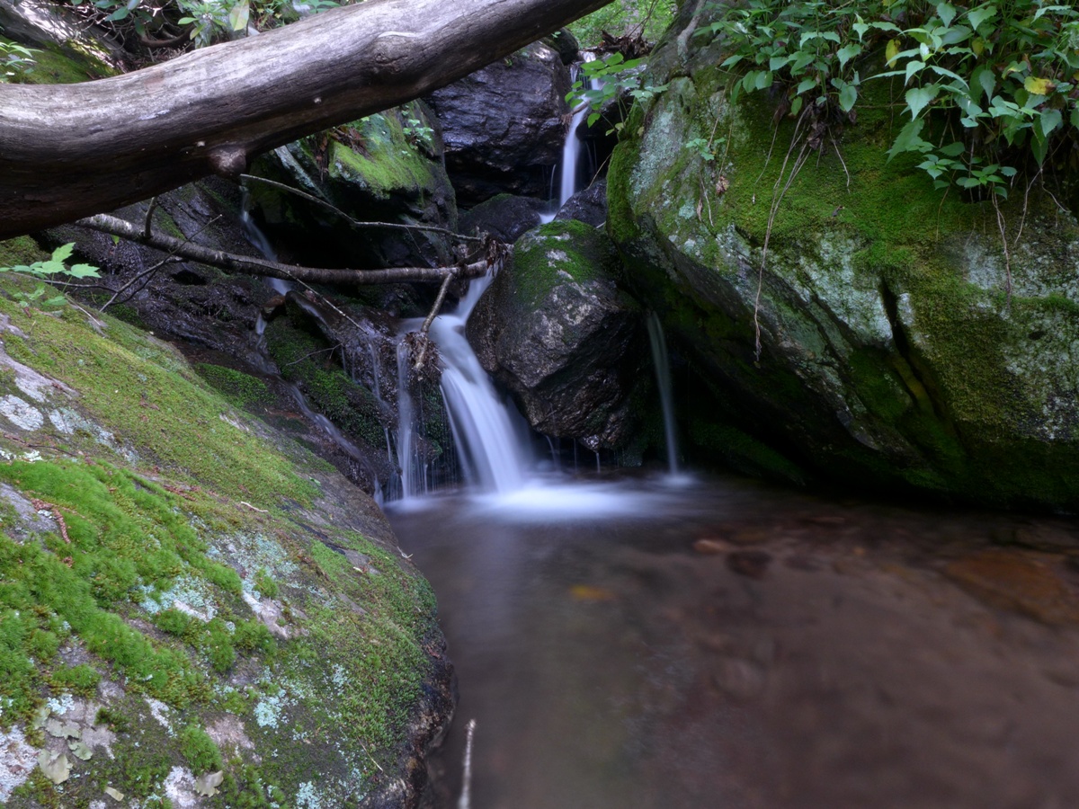
Small cascade by one of Buck Spring Trail's stream crossings
There are two trails which intersect Buck Spring Trail --- both occur very close to the lower end. 1.0 mile from the US276 trailhead, the Mountains to Sea trail comes in from the left (north). That intersection is shown in the top photo on this page.
0.2 mile further, Barnett Branch comes in from the south (right).
Buck Spring / Barnett Branch Intersection
Barnett Branch is on the left; Buck Spring on the right
The above photo is shot from the perspective of following Buck Spring Trail downhill ... beginning at Pisgah Inn and ending at US276. When going in this direction, one could end up on Barnett Branch Trail if you're not paying attention. Barnett Branch descends very steeply to the southeast, ending up on FS1209.
Once you pass the turnoff to Barnett Branch, there are no other trail intersections along Buck Spring Trail's entire route to Pisgah. You do pass one campsite, located roughly half way between the trail's two end points.
The trail is very easy hiking until you get towards the last portion of the trail. Between the 4.2 and 5.7 mile marks, the trail climbs about 550 feet of elevation. Certainly gentle enough, but enough to start getting your legs a little tired.
Then the fun really starts in the next 0.3 mile, where you gain another 200+ feet of elevation.
Just when you're getting REALLY tired, you come to THE BEST PART of the trail:
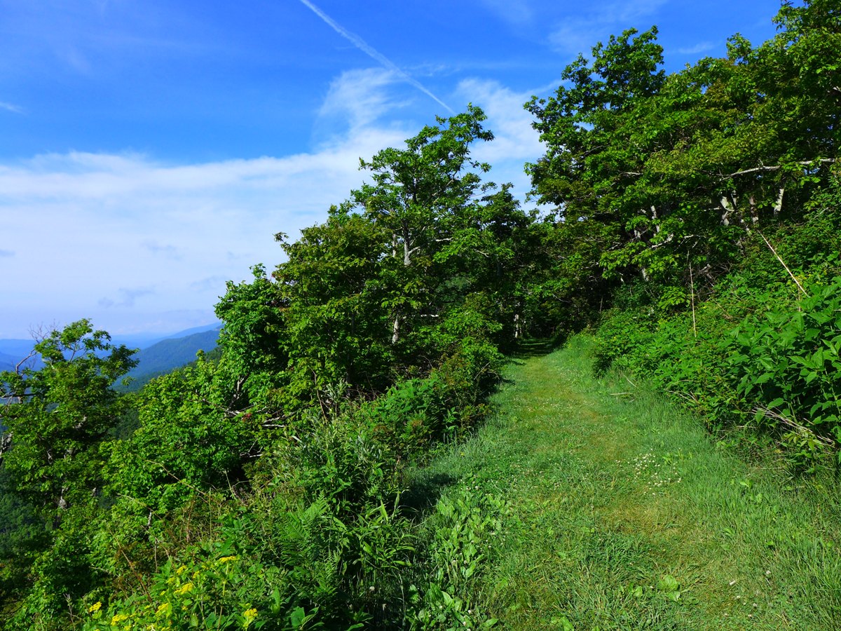
Lush, Grassy Trail
I call this "the Grassy Swath". The previous 0.3 mile of steep climbing is rocky, and in the summer, quite hot. And then, at the top, you suddenly come out onto this gorgeous, grassy, shaded level stretch of trail!
And views galore ... all the previous portions of the trail, because it remains constantly in the woods, permit only brief, limited long range views. But once you're on the "grassy swath" you have uninterrupted views:

Long Range Views from the End of Buck Spring Trail
And, if that's not enough ... you get rocking chairs!!
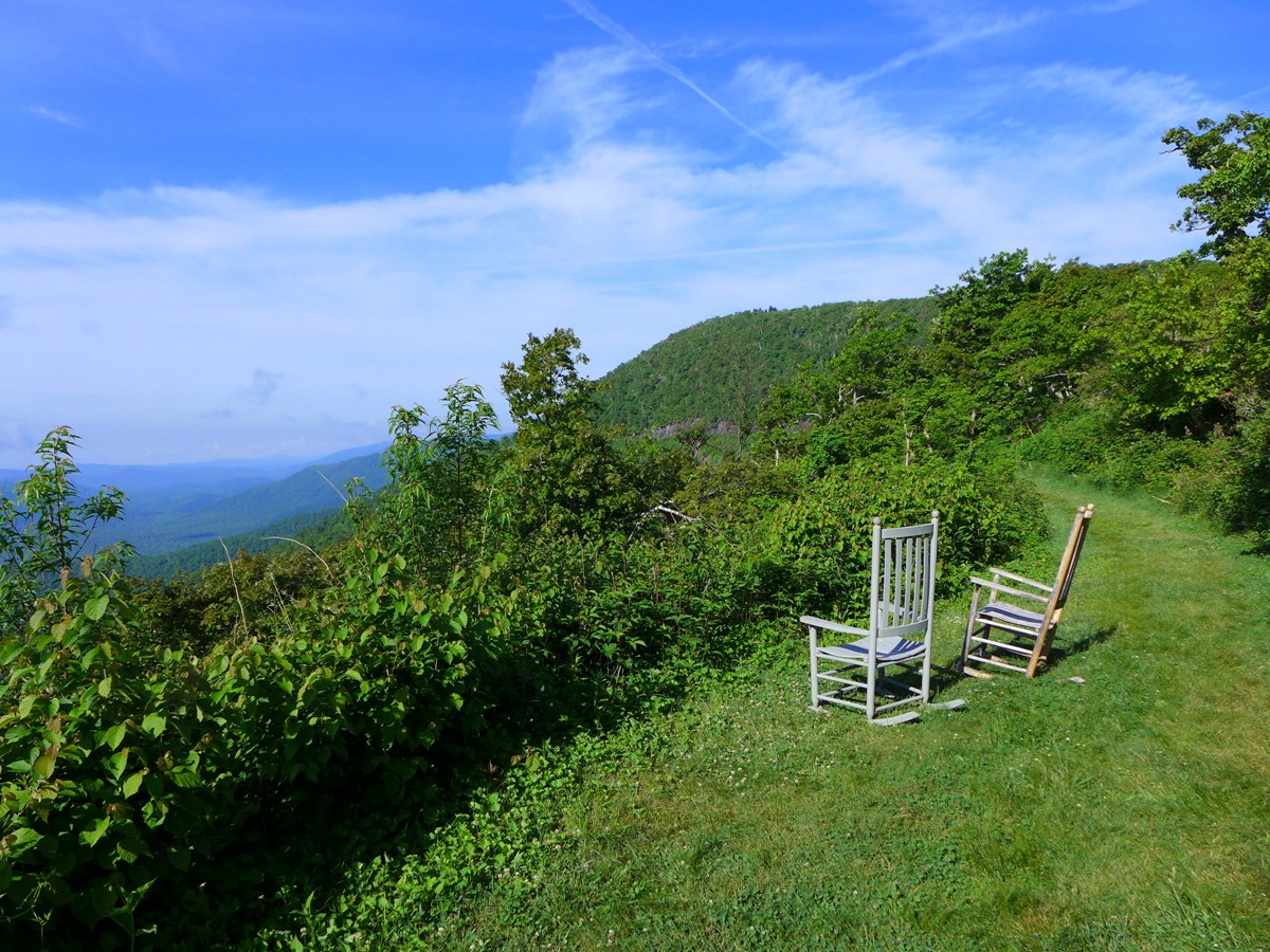
Rocking Chairs Greet you as you come up towards the Pisgah Inn
The trail ends right at Pisgah Inn; the last several hundred feet of trail having you hiking along the lower side of the restaurant. You'll come to a paved walkway with steps which will bring you to the parking area of the Inn.
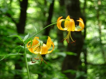
WILDFLOWERS
This trail has tons of wildflowers along it at various times of year.
Turks Cap
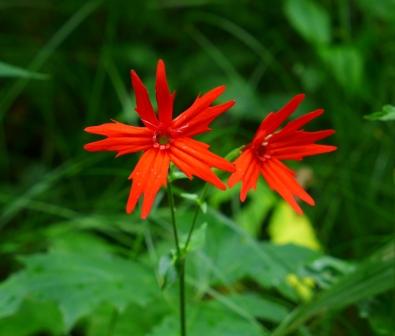
Fire Pink

Jack in the Pulpit
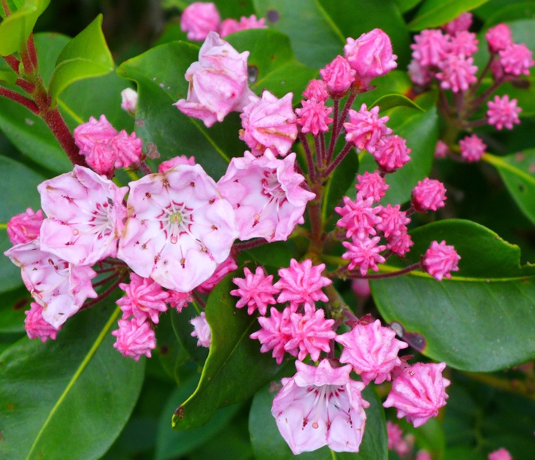
Mountain Laurel
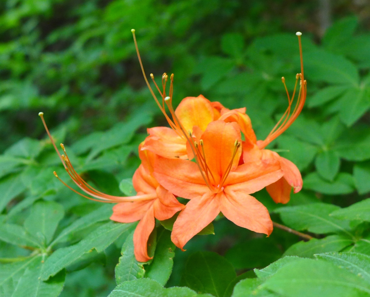
Flame Azalea
These are just a few of the many treasures to be found along this trail!
More photos in my SmugMug gallery.