
Overmountain Trail
from
Hampton Creek Cove to the Appalachian Trail
Click on any of the images on this page for full size/full resolution pic
This trail was a very serendipitous find ... I was perusing some topo maps and found a hiking trail that went from the end of Hampton Creek Road (outside the small community of Roan Mountain, Tennessee) up to the Appalachian Trail at Yellow Mountain Gap. The distance from the end of the road (where I figured one could park) to the gap was just under a mile. I figured this would make a nice one way hike, going up to the AT, heading south, and hiking to Carvers Gap, where the AT crosses TN highway 143.
When my plan to have a friend drop me off here and pick me up later at Carver's Gap fell through, I figured I'd head up there anyway, and scout out the area, and do as much on the AT as I felt like, knowing that I might very well feel like heading all the way to Carver's Gap and back (estimated round trip distance - 10 to 11 miles or so.) Having spent more than one planned hike in an unfamiliar area doing nothing more than wandering around looking for a non-existent trail, I figured this would work out well anyway, giving me time to find what might be an overgrown trail, with no time frame limiting me.
How well all this worked out!!
I found Hampton Creek Road with no problem, and enjoyed the very scenic drive as it headed up the cove. The road kept getting narrower and narrower, so I figured I was getting close to its end when ...... I ended up in someone's carport.
Literally!! (If the homeowners are reading this ... my apologies!!).
Hampton Creek Road actually ends right in someone's driveway, which winds around to the back of their home, ending in their carport. I wasn't sure whether to get out and explain how I ended up there, or just quickly and quietly leave. Not seeing anyone around, either outside the house or inside, I chose the latter option!
So, I headed back down the road, wondering how I should restructure the day, when I passed by a small parking area on the right (a mile or two from the house). There was a sign board and cute little gate there, so I pulled in to investigate, and so discovered this deliciously wonderful trail.
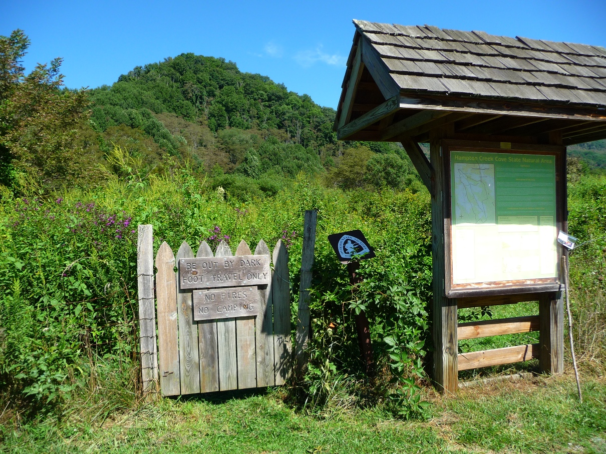
The sign board was most informative, describing the area, its history, and the 3 trails present in this recreation area. The longest one, Overmountain Victory Trail, follows the Left Prong of Hampton Creek upstream, then heads west and south into the Cherokee National Forest and up to the Appalachian Trail at Yellow Mountain Gap.
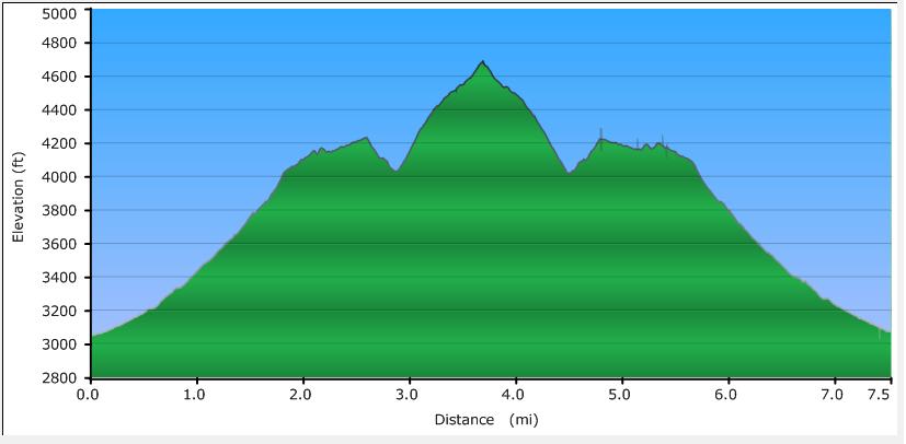
Lacking any other immediate ideas for hiking, I decided to check out this trail, although I was very aware that heading anywhere towards Carvers Gap was now out of the question, as the mileage to Yellow Mountain Gap alone was 3.75 miles (one way) from this trailhead (and viewing my GPS data later, almost 2000 feet of elevation gain).
Elevation Profile
Click for larger image
Click here for a larger map
GPX data for download: Overmountain Trail.
Passing through the picket fence gate begins your hike.
Hampton Creek Cove is designated as a
"Class I Scenic-Recreational State Natural Area" by the state of Tennessee. Comprising almost 700 acres, it lies in the Southern Appalachian Mountains between 3,000 to 4,800 feet elevation. The upper boundary is contiguous to the Cherokee National Forest. The National Forest area is where the upper reaches of the Left Prong of Hampton Creek originate. The creek is a prominent feature bisecting the length of the natural area, draining young and mature forests, seeps, and farmland in the cove. The Left Prong is considered one of the most productive native trout streams in East Tennessee and is presently undergoing brook trout restoration.
Seeps, which were once the source of drinking water here, are fairly common and often found on slopes. One such seep forms a small scrub and shrub bog near a low elevation pasture that supports a diversity of wetland species.
The old field/forest succession at the lower mountain elevation provides excellent nesting habitat for the relatively rare golden-winged warbler.
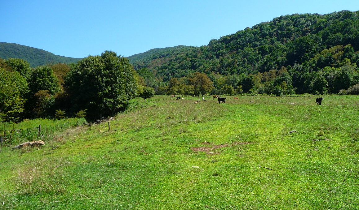
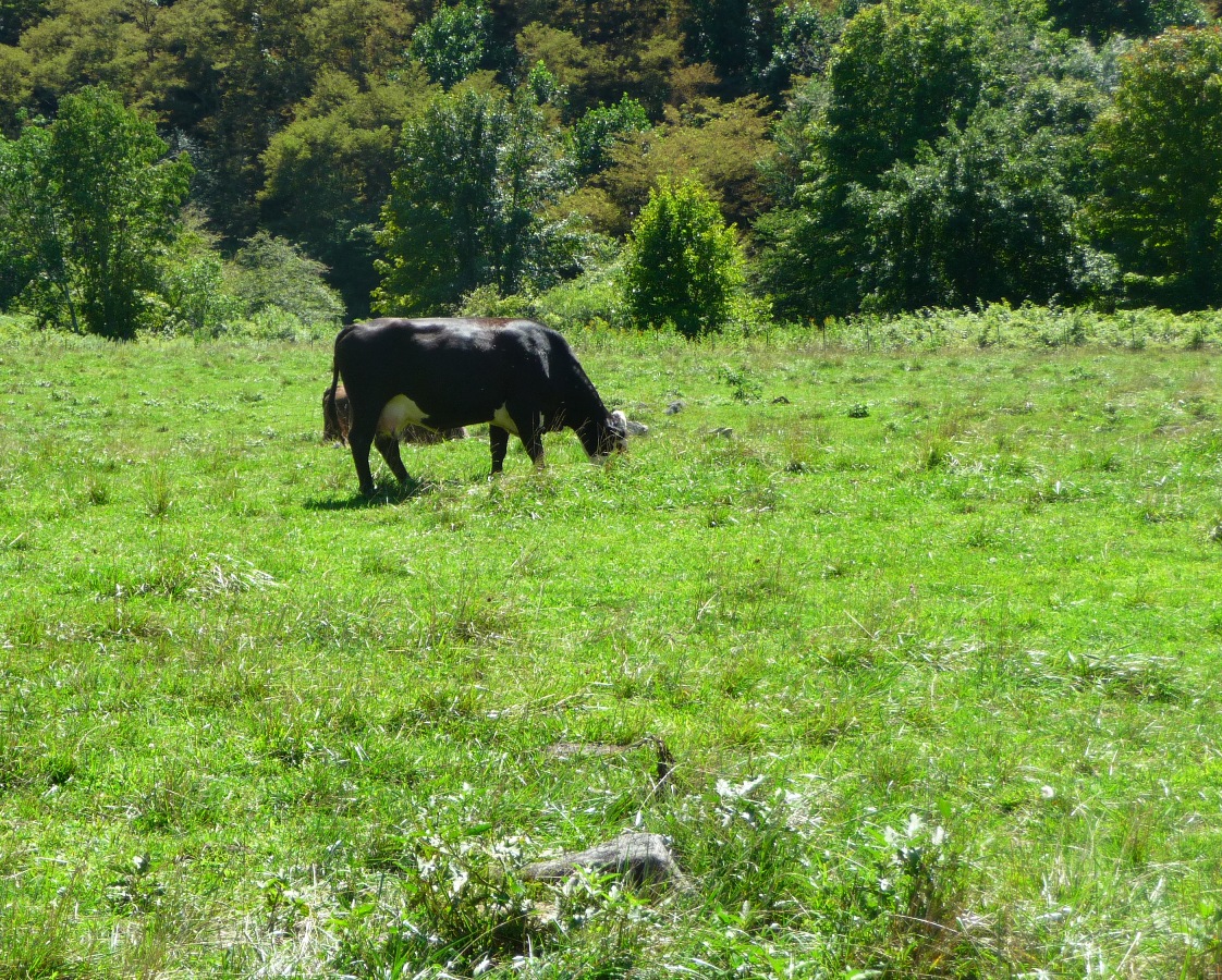
Hampton Creek Cove is managed by the Southern Appalachian Highlands Conservancy (SAHC) land trust. SAHC employs a caretaker, born and raised at Hampton Creek Cove, who grazes cattle and horses on approximately 100 acres of pastureland. Fencing along the creek and other riparian restoration activities have been implemented to demonstrate the compatibility of natural area preservation and agricultural practices. Past land use is apparent at places like an old cabin ruins, vestiges of a mature grove of butternut trees, apple trees, and remnants of stonewalls.
(Information taken from State of Tennessee's Department of Environment and Conservation page).
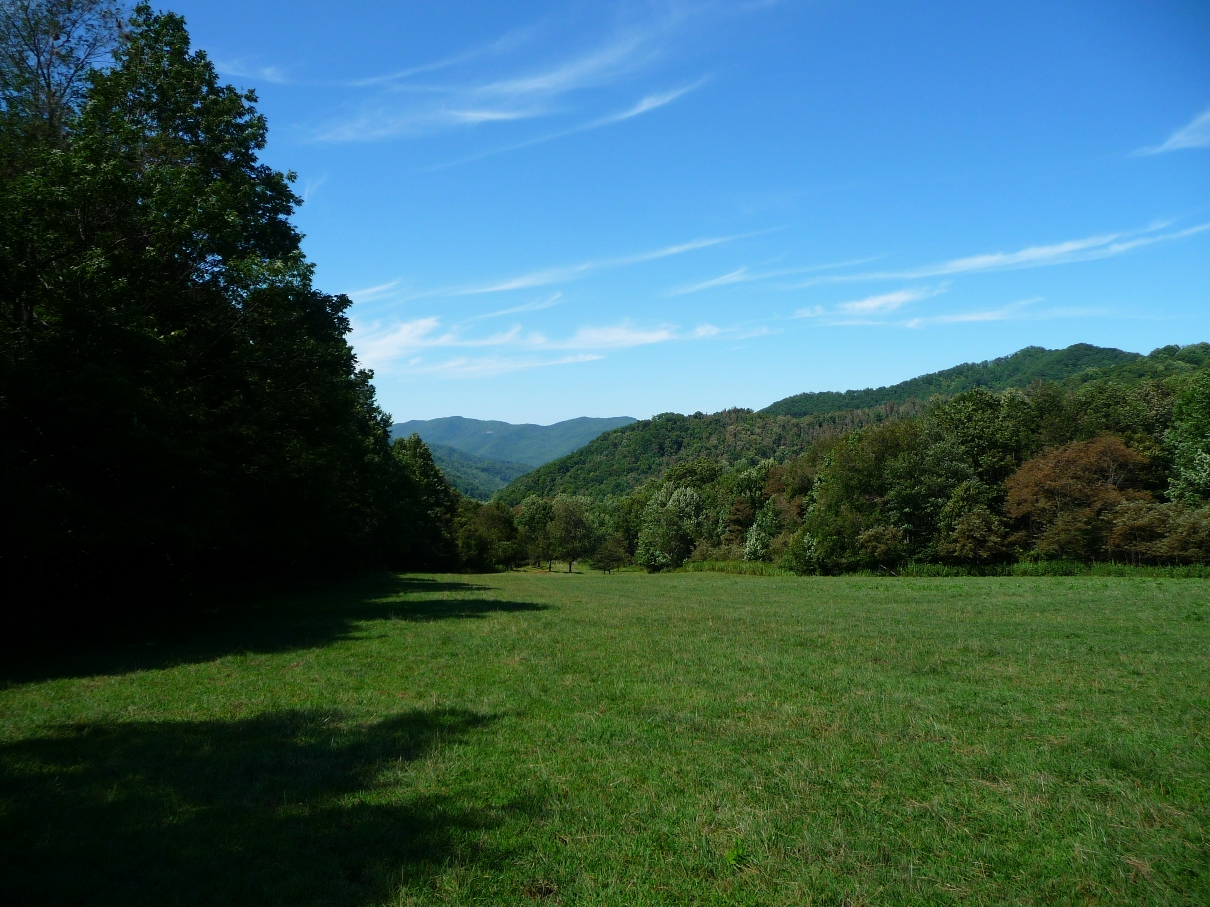
It is this concurrent use of pastureland and recreation land that lends this trail its most unique and beautiful features. The photo at the top of the page is one of many high mountain pastures that one gets to wend through on your way up to the Appalachian Trail, with its associated drop-dead gorgeous scenery.
I started my hike around 9am, and there was still a lot of early morning fog blanketing the area.

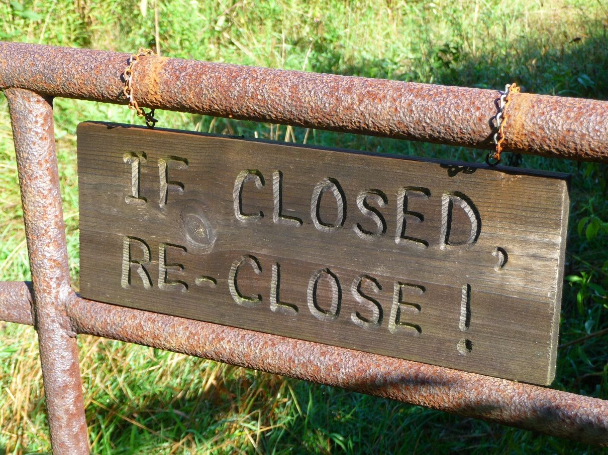
The trail is very well labeled the entire way. As you travel up the cove, you pass through various gates, opening and closing them as you go.
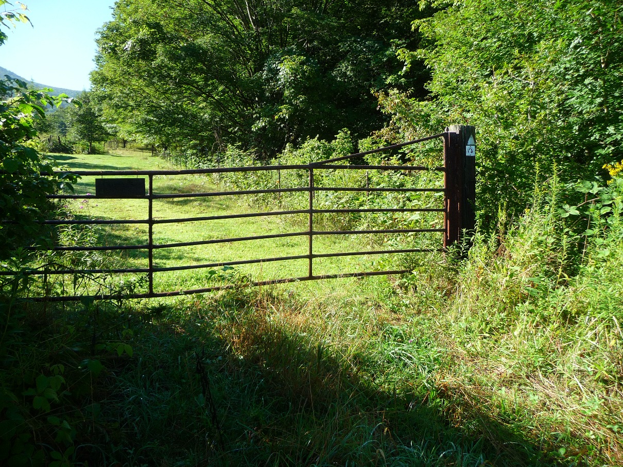
You share the trail with livestock and horses, neither of whom seem to mind your presence!
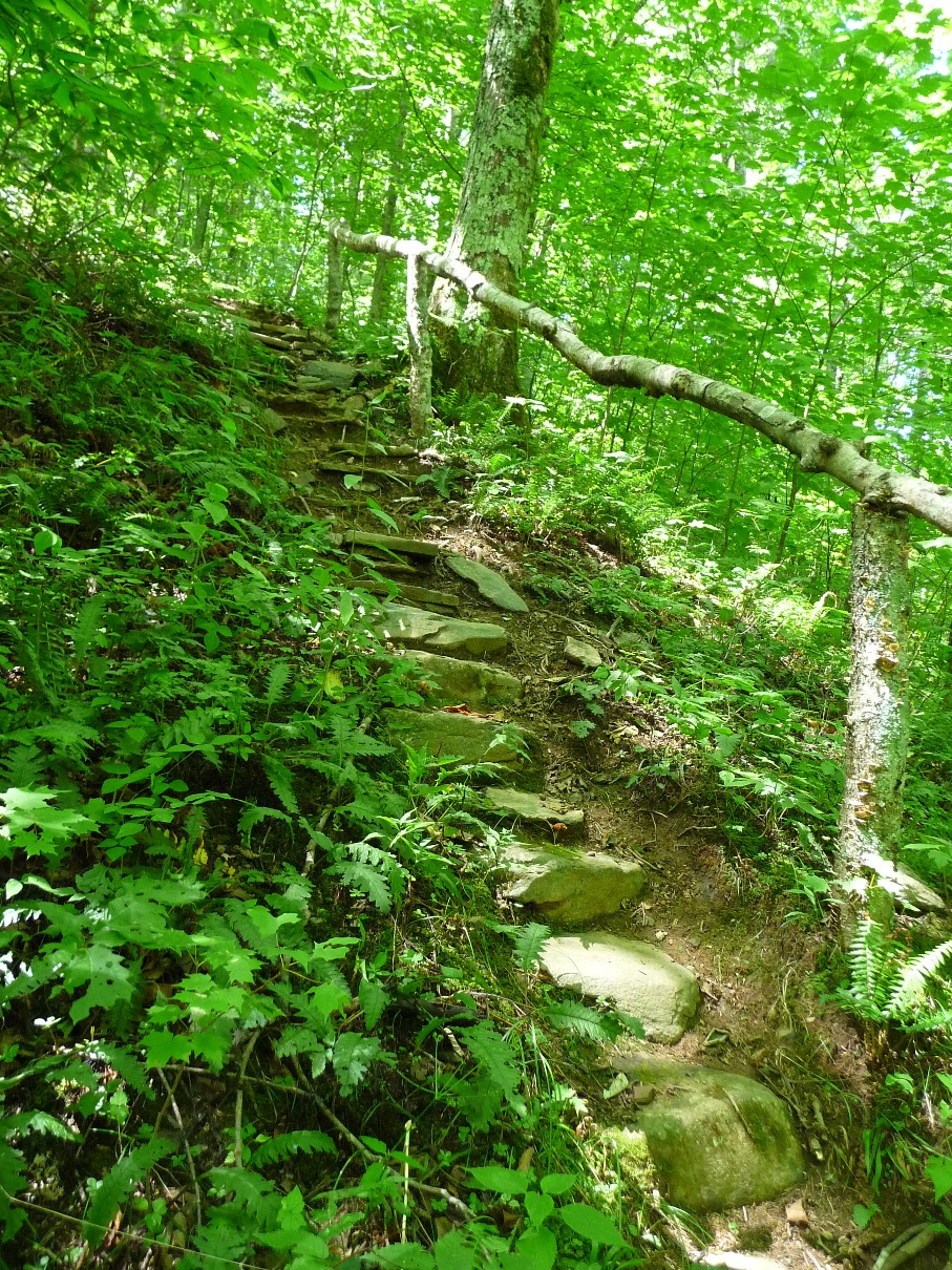
Once you leave the Natural Area and head into the Cherokee National Forest, the trail enters and remains in forested area all the way to the gap where one intersects the Appalachian Trail. This is also where the most significant elevation gains occur.
There are not many options for making any sort of loop hike out of this trail. One is pretty much looking at an out and back trip, and the scenery is so breathtaking both going and coming, that if one has to do an out and back type of hike, this is the one to do.
The day I did this hike, once I reached the AT, I turned south on the trail (right), and followed it for a ways. Along this section, it is a very flat, pleasant hike, heading up towards Low Gap. After about a mile, I just turned around, and retraced my steps back to the trailhead.
The trail lends itself to a car shuttle type of hike very well ... you could head south on the AT towards Carvers Gap. Leaving a second vehicle there would make for a total hike in the neighborhood of 9.5-10 miles, and the driving distance back to the starting point on Hampton Creek road would not be excessive at all.
DIRECTIONS
Hampton Creek Cove Recreation area is located in Tennessee, near the small community of Roan Mountain, which is located on US19E, and just east of Roan Mountain State Park.
Even if coming (as I did) from North Carolina, the easiest and quickest way here is probably to take Interstate 26 west to the Unicoi exit in Tennessee. In Unicoi, take highway 107 towards Limestone Cove. Watch for the turn off to highway 173 in Limestone Cove, which comes soon after you pass a white church with a white steeple on your left. Turn left onto highway 173 and follow that to the juncture with 19E. Turn right onto 19E, and follow that to the community of Roan Mountain, where you will turn right onto TN 143.
At this point, you'll have to watch carefully for road signs .... You will immediately cross a bridge over the Doe River. Just after that bridge, turn left on Stratton Street. At the first stop sign, turn right, then bear left at the big curve on West Street and travel by the old commercial district buildings of Roan Mountain. Just past these old buildings, take the first right on Old Highway 143, then turn left on the bridge that crosses the creek (across from the old school building). This is Hampton Creek Road. The parking area is on the left just past Gray's Chapel approximately three miles from town.
If you miss that first turn off from TN 143 (as I did), just stay on highway 143 till you come to Sugar Hollow Road (on the left). This road is several miles up highway 143, and comes after the State Park's Information Center. The turn onto Sugar Hollow is located in a 90 degree right hand curve of highway 143.
Turn left onto Sugar Hollow road, then left on Dark Hollow Road. Follow Dark Hollow road until it intersects Hampton Creek Road. Turn right at the intersection, and the parking area will be on your left, soon after you pass Gray's Chapel.
Total driving time from Asheville was just over 2 hours (minus the detour to the homeowner's carport!!).