
Rock Jock Trail
in
Linville Gorge
Click on any of the images on this page for full size/full resolution pic.
In February, 2012 I finally made my first trip to Linville Gorge. I had read many trip reports from the area, and seen photos, but none of that compared to actually seeing it in person. As with just about everything .. photos never do justice to what one sees in real life!
I went with a friend who has been to the area numerous times. He was able to provide not only great wayfinding, but also lots of info about the area: its two devastating forest fires, trail building tales, and identification of the various knobs and peaks we saw throughout out hike.
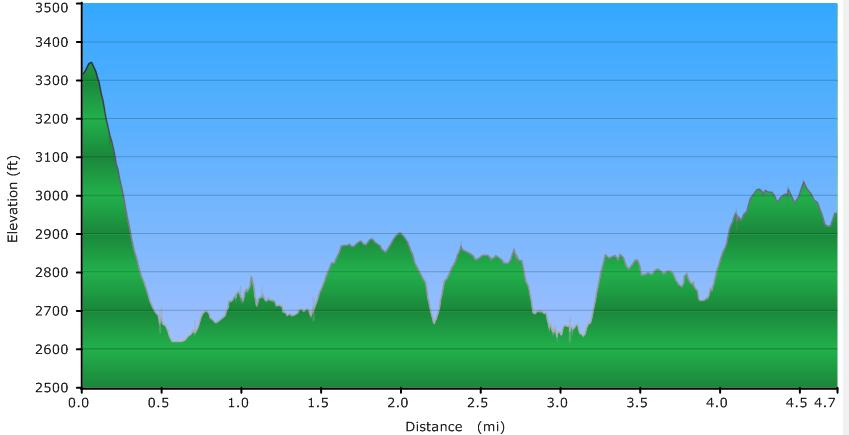
Rock Jock Trail is just under 5 miles long, including trips down several short side trails to some incredible overlooks, and it took us 4 1/2 hours to hike it. Most of the trail is deceptively level-looking when you look at it on a map, seeming to follow just above or along the 2600 foot contour line on the map. In actuality, one does a lot of up and down hiking -- see the elevation profile below! The trail is incredibly rocky along most of its course, so you are always picking your way through rocks and around boulders of varying size along the trail. The views are so incredible the entire way that all you want to do is look at all the scenery around you, but you cannot navigate the trail AND look at the scenery at the same time!! One or the other, but not both!!
Elevation Profile of the trail
Click for larger image
Click here for a larger map
GPX data for download: Rock Jock Trail.
DIRECTIONS
This hike lends itself very nicely to a car shuttle hike, which is how we did it. We left one car at the northern end of the trail, and drove back to the southern terminus, beginning our hike there.
The trail is on the western rim of the gorge, with both the northern and southern termini located on Kistler Highway (labeled on some maps as "Old NC Highway 105"). If coming from the south, the southern terminus is approximately 7.9 miles from where Kistler Hwy begins, as it veers off Highway 126, north of Lake James State Park. Coming from the north, this trail is 7.8 miles along Kistler Hwy from where it leaves Hwy. 183. The road is gravel for most of the way.
We left a car at the point where the northern part of Rock Jock joins the southern part of Conley Trail, which is only several hundred feet from the road. There is room for a couple cars here. The car shuttle portion along Kistler Hwy. was 2.3 miles. There is no real parking area at the southern terminus; just find a spot wide enough to pull off onto the side of the road.
As you can see on the elevation profile graphic above, the southern portion of the trail has a straight down/straight up section where you have a 700 foot elevation change in just over one half mile. My hiking companion recommended that the hike be done in a south to north direction, and having done the trail, I certainly second that advice. Normally, my knees prefer to go UP steep inclines rather than down, but this would have been an incredibly tough pull at the very end of a very hard hike. Going in a south to north direction has you ending the hike on some of the easiest portion of the trail, and at least my legs were thankful for that at that point!

Southern Terminus of Rock Jock Trail
This trail was completely destroyed by the two forest fires that came thru this area in 2000 and 2007 and originally extended much farther both to the north and south. Committed volunteers, aka "The Gorge Rats" helped rebuild and maintain the current section.
Beginning your hike here, you quickly drop the above mentioned 700 feet in elevation, coming out to your first (of many) view points:

Overlook that is at the lower end of the
700 foot elevation drop on Rock Jock Trail
After 3/4 mile of hiking, you come to a large rock formation (again, one of MANY!) that you can climb out on to. Note the small hole at the base! This formation is called "Balanced Rock".
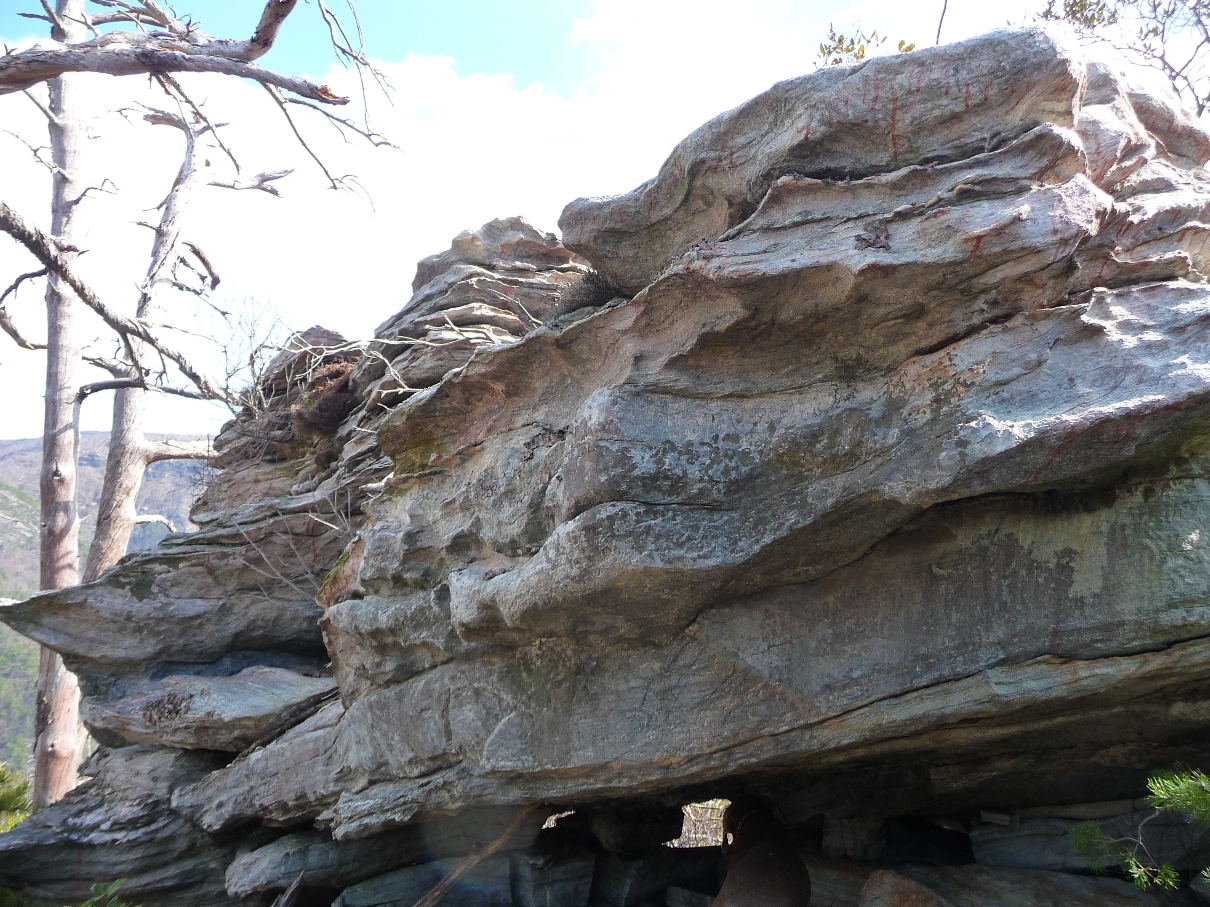
Balanced Rock
At the 1.4 mile mark, you come to another outcropping, entitled "T-Shirt Point".
Some of the most impressive views come at the 2.0 mile mark ... take a side trail that goes 0.2 mile and 250 feet in elevation down to an outcropping named "Sunshine Point". The picture below gives you a great feel for the vast, vast distances here as noted by how far and distant my hiking companion is in this photo (see arrow). Best seen full size:
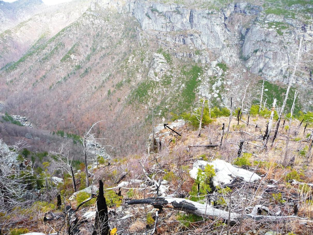
View of Sunshine Point
0.4 mile further down Rock Jock Trail from the turn off to Sunshine Point brings you to a turn off to two other overlooks: Zen Point and Razors Edge. Both give incredible views of the terrain below you, but Razor's Edge is quite dramatic. It involves following a trail down, then scrambling up to get to a tremendous overlook of the gorge, as well as the eponymous rock formation that gives this point its name:
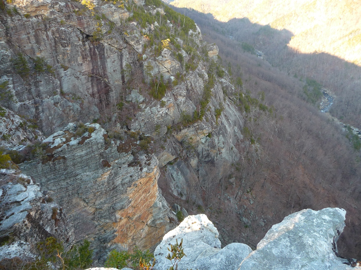
View of Razors Edge
Note the large, very skinny, narrow "razor's edge" like rock formation in the lower left quadrant of the photo above!
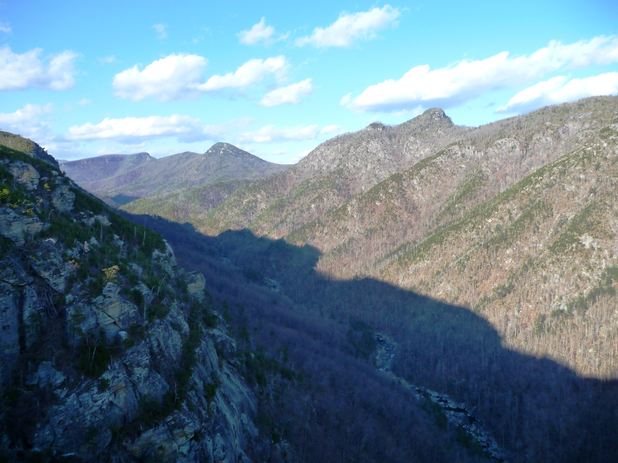
View to the North from Razors Edge
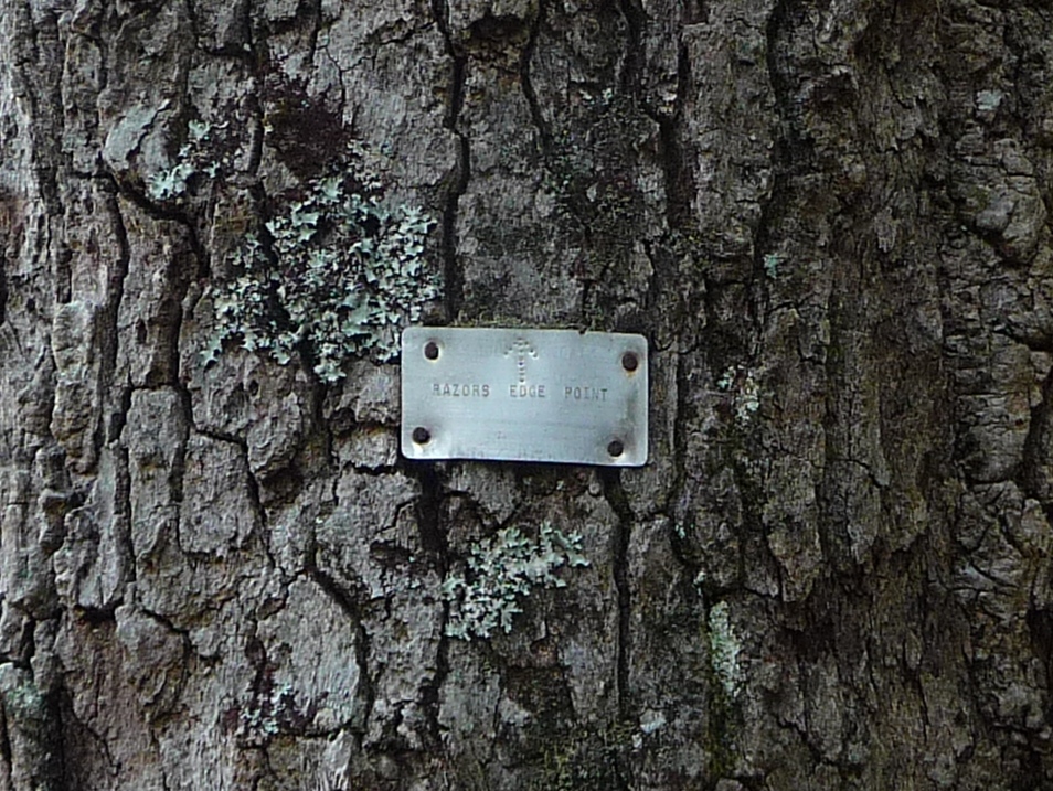
Along this section of the trail, one sees some of the old trail markers:
Besides all these overlooks and views, this trail takes you in and out of coves, appropriately called "canyons" given how rocky they all are. Given one's elevation and rocky terrain, you'd not expect to find any water sources, but indeed you pass over several streams, and by other "waterfalls" ... one area, named "Blue Jay Falls" is a luscious, moist, moss covered area of rock with water dripping down over its entire surface. You also see other areas of waterfall below you along various points on the trail. Near the northern terminus is a small bog named Lost Dog Pond.
And, given the extremely rocky area, you come across many rock cairns along the trail:
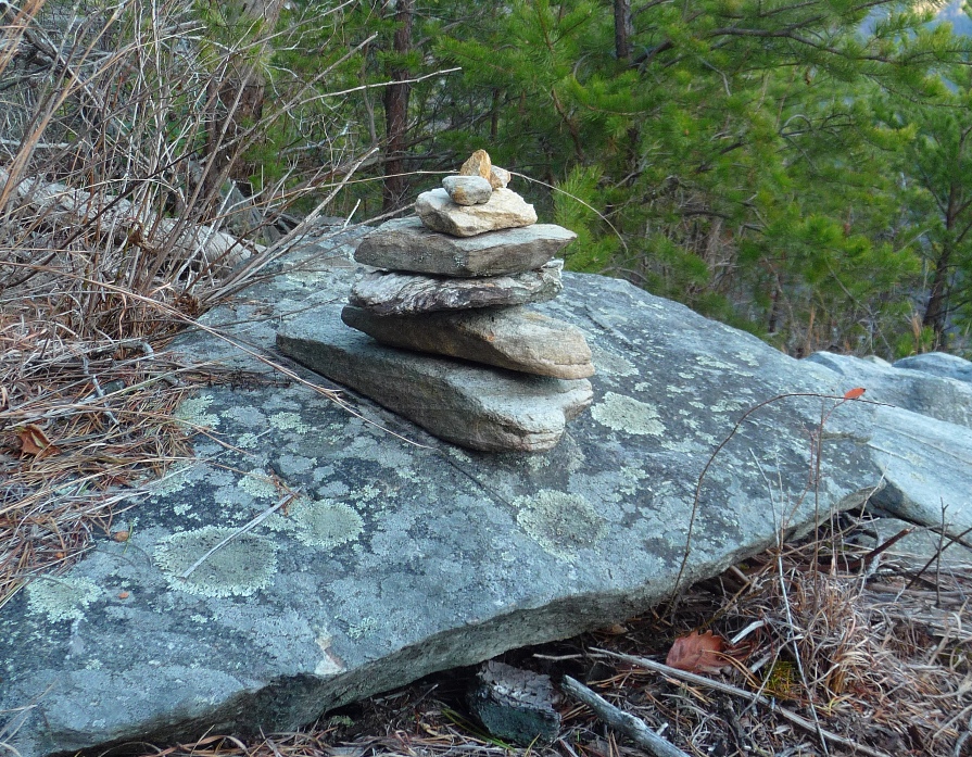
One of many rock cairns along the trail
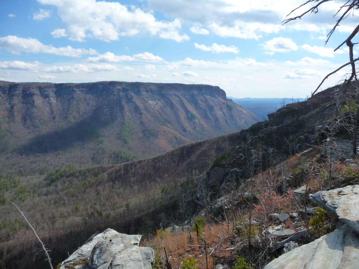
The views from the trail change constantly, giving you differing views of ShortOff Mountain, Table Rock, The Chimneys (all on the eastern rim of the gorge), as well as varying views to the north and south of the gorge. I'd recommend allotting an entire day to explore this trail .. that will give you plenty of time to explore all the overlooks, take in the scenery, and enjoy the unique beauty of this "Grand Canyon of the East".