
Twin Falls Trail
in Pisgah Forest National Park
Click any of the photos on this page for full size/full resolution image
***If you're looking for the Twin Falls that are in South Carolina, please see this webpage***.
The hike to Twin Falls is a 4.1 mile (round trip -- out and back) is an easy to moderate hike located in Pisgah National Forest in Transylvania, NC. In reality it should be called Triple Falls, as you pass a third waterfall about 500 feet or so before arriving at the "Twin Falls". In those 4.1 miles, you gain 500 feet in elevation, most of it done as you gradually walk upstream towards the falls (makes the return trip in this out and back hike quite easy and quick!)
Also, see below for 2 loop options, which can increase your hiking options to either a 5.8 mile hike or a 7.2 mile one.
This hike is wonderful to do any time of year ... spring time gives you lots of wildflowers, but all year long the hike along Avery Creek (which makes up the first half of the hike) and along Henry Branch (which makes up the latter half) provides a delightful hike along these rivers, both of which will treat you to rapids here and there.
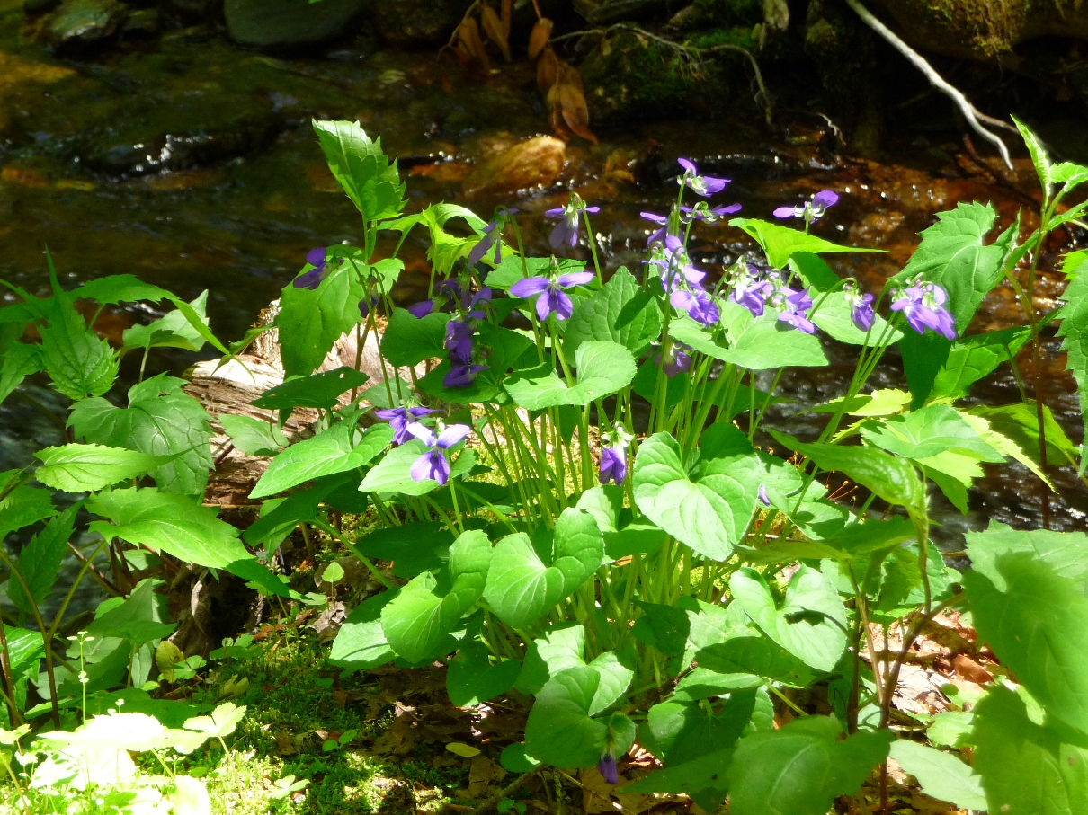
Wildflowers along Avery Creek
The best time to do this hike is right after one of this area's torrential rainstorms; that will help ensure some great waterflow for these waterfalls. Both are near the very beginnings of their respective creeks. Consequently, the volume of the waterflow is quite variable. However, the portion of the hike along Avery and Henry creeks is always pleasant, and always provides some great water interest.
Elevation Profile
Click for larger image
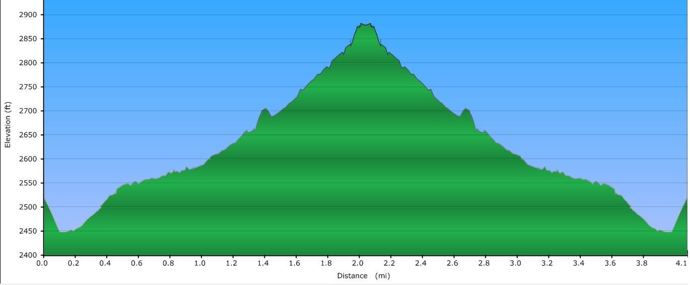
Elevation Profile for the 4.1 mile hike option
Click here for a larger map
Map's tracks show the 3 different hike options for this hike
Green Track shows the out and back 4.1 mile option.
Red Track shows 5.5 mile loop option.
Blue Track shows the 7.2 mile option.
GPX data for download (zip file which includes both GPX format, as well as GDB format for Garmin users): Twin Falls Hike.
DIRECTIONS
To reach the trail head for this hike, get yourself to the intersection east of Brevard, NC, where highways 280, 276, and 64 all intersect. There is a big shopping center on one of the corners of this intersection that has a Bi-Lo grocery store, Pizza Hut restaurant, and WalMart.
Turn onto 276 north, heading towards Pisgah National Forest. Stay on 276 until you pass the Pisgah Forest Ranger Station on the right. Continue on 276, and turn right onto the first gravel road (Avery Creek Road, FS 477) past the ranger station (you'll see a sign for the Riding Stables). Once on the gravel road, continue until you come to the stables (about a mile and a half or so).
You can either park here, and hike 0.6 mile up the gravel road to the trailhead or continue driving about 0.5 mile up the road where, just before the trailhead there is a pull out with room for one or two cars on the right.
Between this pull off for parking and the start of the trail itself, you will see the section of Avery Creek road that was repaired following a mudslide several years ago. Peering over the edge to the right shows the long way down to the creek where the slide took out the road, and everything downhill from it!
Avery Creek trail begins just ahead of this repaired slide area, dropping down off the road to the right with a moderately steep downhill grade, taking you down to the creek level.
The first mile parallels Avery Creek, starting out on the west side of the creek, crossing over to the east side soon into the hike. Once on the east side of Avery Creek, the trail passes by some of the prettiest sections of the creek, including a nice 10 foot high waterfall, rapids, a cascade, and a neat swimming hole.

Small Waterfall along Avery Creek
If there's been a lot of rain recently, you'll also cross over a small tributary coming in from your right that passes over a small, but picturesque rock face.

Water engorged small cascade feeding into Avery Creek
Further on into the hike, you'll once again cross over to the east side of the creek.
Part of this trail's enjoyment are the numerous log bridges one crosses as the trail crisscrosses Avery Creek and Henry Branch. (Each of the above mentioned crossings of Avery Creek have involved a log bridge). Below shows the bridge where, in order to reach Twin Falls you leave Avery Creek Trail (blue blazed), and pick up Buckhorn Gap Trail (red blazed). This is one mile from the trail's beginning.
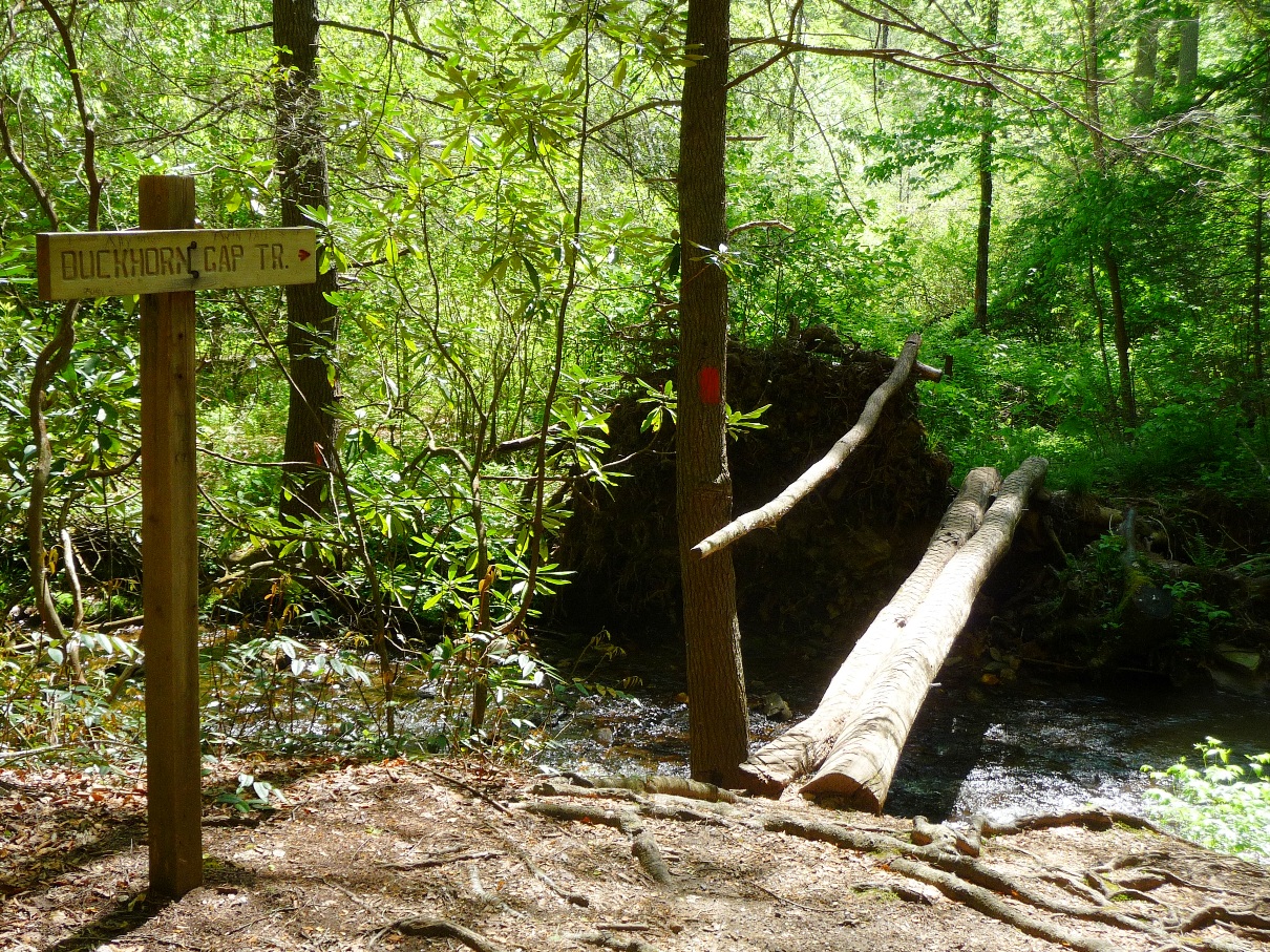
Bridge across Avery Creek
Be alert for this trail intersection as there are 3 different ways you can proceed here: northeast following Henry Creek (this is the way you want to go to get to Twin Falls and is RED blazed), northwest following Avery Creek (this trail continues to follow Avery Creek upstream, then leaves the creek, and begins a steep, rocky ascent to Club Gap. BLUE blazed), and south back to Avery Creek road following Buckhorn Gap Trail south along the south side of a tributary that feeds into Avery Creek (this is one of the loop options mentioned below).
Because this trail is used by both mountain bikers as well as hikers, every bridge crossing has an associated crossing for cyclists that goes through the water (since the log bridges would be a bit tough to navigate with a bike!). If you find yourself at a water crossing with no bridge, just go back and look up the trail a little for a bridge.
The sign below shows one of these "bikes go one way, hikers go the other" signs. The sign actually says "Horse Ford", but of all the times I've been on this trail, I've never run into a horseback rider, or any horse poop, so I do not believe this trail is used by horses. The stables mentioned above DO lead a hike to Twin Falls, but they go by way of Clawhammer Road, a gated, forest service jeep road, which is a third option, described below for making a loop hike to Twin Falls.)
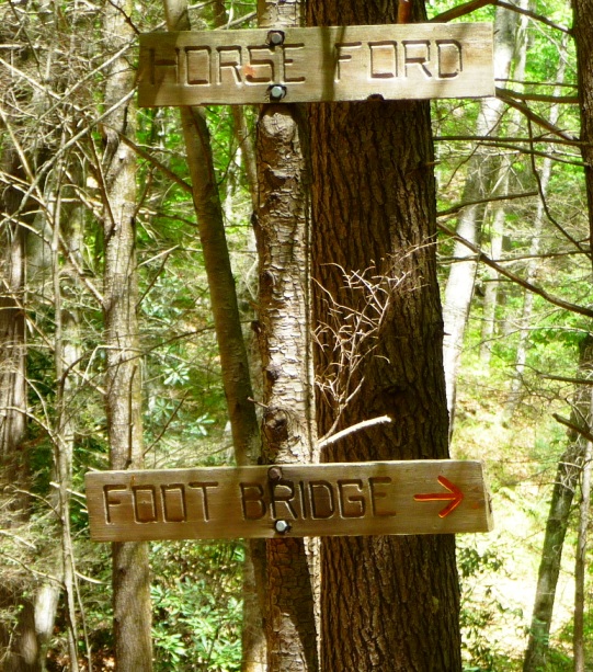
Sign showing route for hikers vs bikers
Once you leave Avery Creek Trail, and turn onto Buckhorn Gap Trail, you begin following Henry Creek. It is smaller than Avery Creek which you have been following, but is just as picturesque.
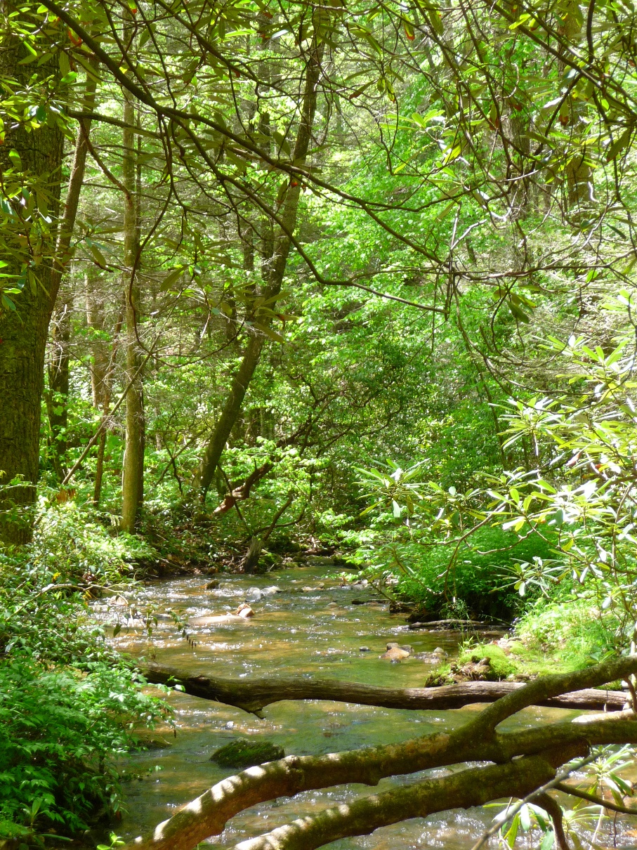
Along Henry Creek heading towards Twin Falls
Your next intersection to watch for is the short side trail to Twin Fall that drops off to the left off Buckhorn Trail. In the photo below, note the trail sign on the far left of the picture.
Turn off for Twin Falls
If you miss this turn off, no problem. You will still come very close to the base of both falls on Buckhorn Gap Trail, and will have to opportunity to cross over to the left to head directly up to the base of each waterfall.
Just before reaching Twin Falls, the Twin Falls Trail crosses a small tributary coming in from the left; if rainfall has been sufficient, this tributary forms a waterfall as it comes down the hillside (See waypoint labeled "First Waterfall" on GPS map above). While not nearly as picturesque as Twin Falls (there is a huge downed tree right in the middle of the falls' drop), it does provide a third waterfall to enjoy. There is a trail along the upper side of the tributary, that ascends rather steeply up to the base of the falls.
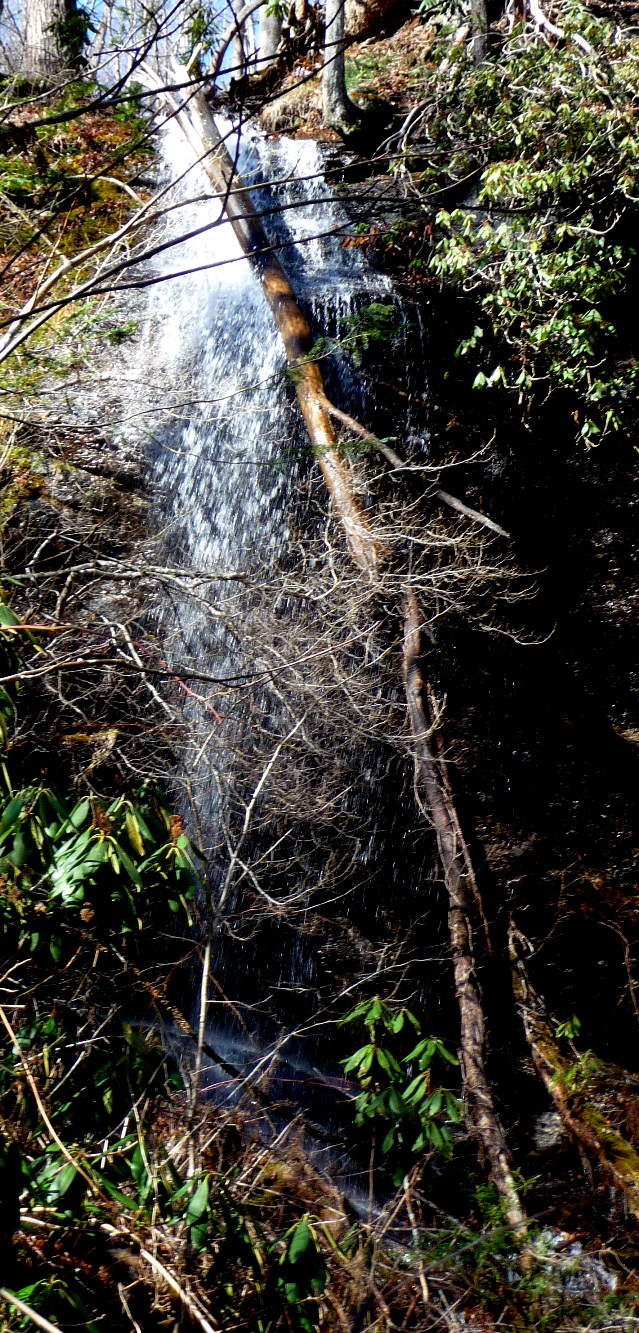
First Waterfall, photographed after 2 days of heavy rains
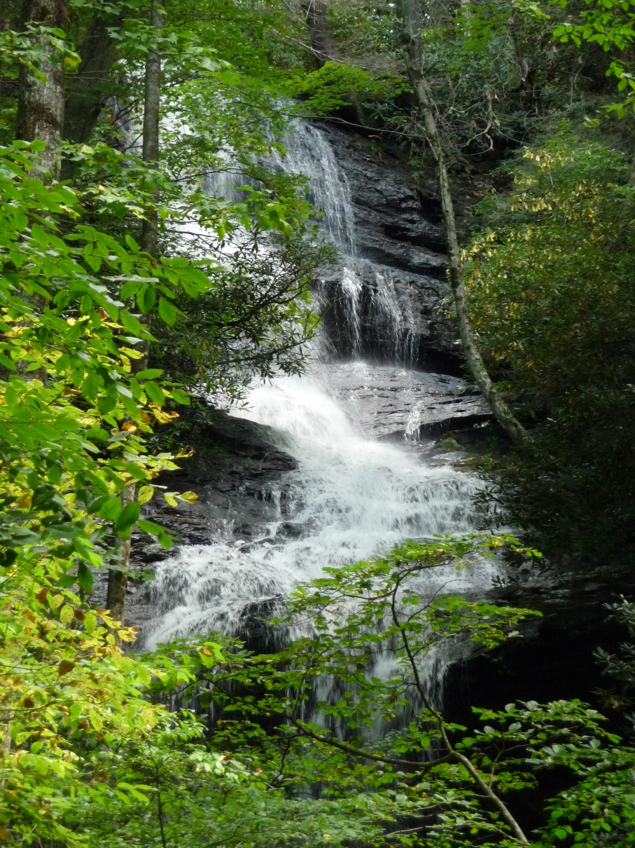
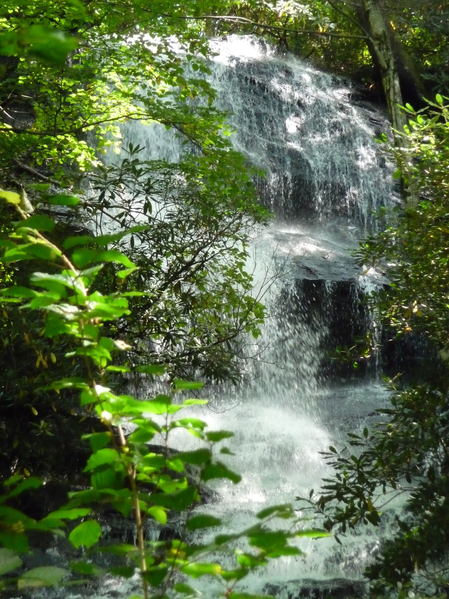
Once you pass this waterfall, Twin Falls is just ahead, and you will be able to see and hear both falls.
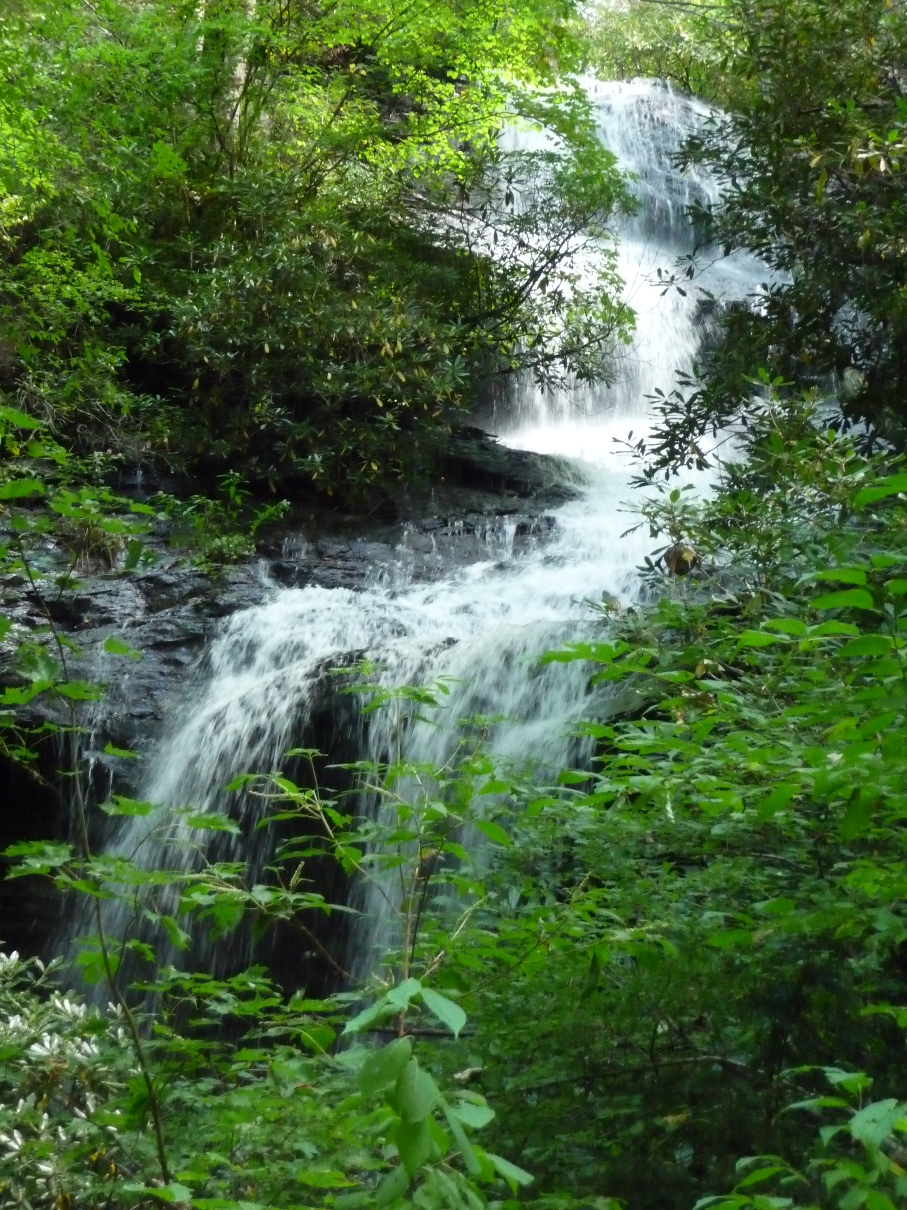
Upper portion of the righthand portion of Twin Falls
Upper Portion of one of the Twin Falls

One of the Twin Falls
Upper portion of the Twin Falls
Once at the waterfalls, you can get to the base of each for photos, waterplay, etc.
Once you've reached the falls, for the 4.1 mile hike option, back track and return the way you came.
CLAWHAMMER COVE LOOP
For a 5.8 mile option, that makes this a loop hike (see the red track on GPS map, above), once you are ready to leave the falls, find the spot near the end of Twin Falls Trail where there is a campsite/fire ring on an elevated spot, just above the spot where you can head down to the left-hand fall of Twin Falls. You'll notice a (faintly) blazed yellow trail that goes down a short, steep section and crosses the creek which is formed at the base of the two waterfalls. Continue to follow this yellow trail a short ways (going away from the waterfalls) until you come to a flat wide area, with a hitching area for horses. You'll now be at Buckhorn Gap Trail (red blaze). This is where you would end up if you missed the turnoff to Twin Falls Trail, mentioned above.
Going straight (south) along this red blazed trail, following the creek, would bring you back the way you came.
To continue with the 5.8 mile loop option, turn left (east) onto red blazed Buckhorn Trail. The trail will begin climbing along a rough, rocky trail.
In 0.4 mile, you will come to a spot where you can head straight (continuing uphill on some rock and log steps), go left (although there is a sign which ways "Trail Closed Dead End" if you try and go this way), or bear to the right along a more or less level, wide trail. To continue, take this last option, bearing right. The photo below shows this intersection with the first two options captured in the picture.
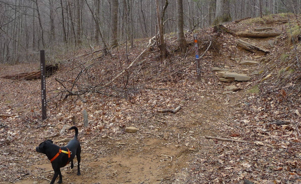
Buckhorn Gap Intersection
(wintertime shot)
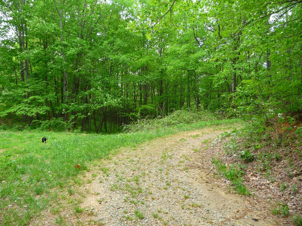
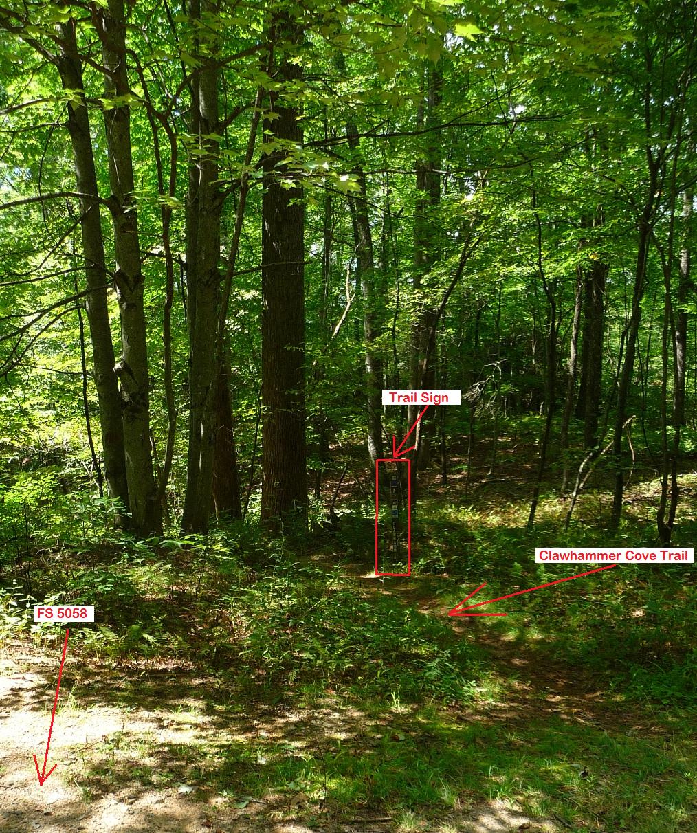
For the next 0.8 mile, this trail will wind in and out of the coves, following a gentle uphill climb, eventually coming out onto a gated, 4-wheeled drive road (FS 5058). The two photos below show this intersection from the perspective of a hiker walking TOWARDS the camera. Continue straight on the Forest Service road (do not make a hard left onto the road). If doing this loop in the opposite direction (heading TOWARDS Twin Fall at this point), a landmark to look for is the small, grassy field seen off to the left. There is a trail sign located between the trail and the road, although it is positioned such that you do not see it until you are already off the Forest Service road and onto the trail.

Both photos (above and below) show this intersection. Orientation is looking north TOWARDS the trail.
Follow this Forest Service road for 0.7 mile.
Your next landmark to watch for is a bit tricky to find, since the trail sign is again located well off the road in some underbrush. You are looking for Clawhammer Cove Trail, blazed blue, which will be a turnoff to your right. Unfortunately, there are no significant landmarks to look for, although it is signed, with the sign a hundred feet or so off the Forest Service Road, down towards Clawhammer Trail's upper end. I often recommend folks who do this loop, to do it the first time coming UP Clawhammer Cove Trail, up to this Forest Service Road, in order to see where the trail comes out. Should you miss this turn off, in another 1.9 miles you would end up at the riding stables on Avery Creek Road, 0.6 mile down from Avery Creek Trail's beginning.
Click the picture below to see landmarks drawn in on the full size image.
Once you've made the turn onto Clawhammer Cove Trail, you will be treated to what is in my opinion, one of the prettiest trails in the area. The trail is 0.6 mile long, and over the course of that distance, drops 600 feet in elevation as it descends into Clawhammer Cove, joining Avery Creek and Avery Creek Trail.
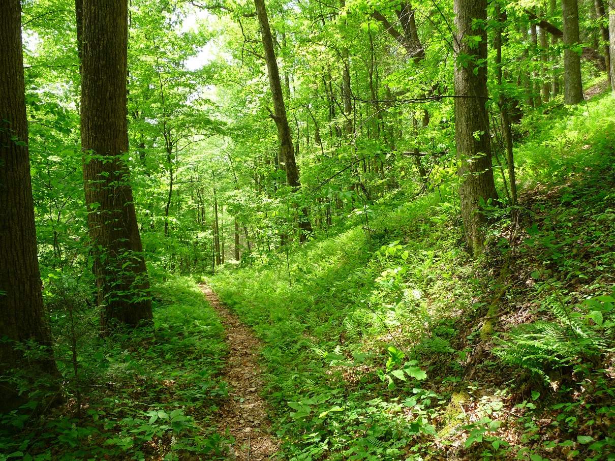
Clawhammer Cove Trail
Clawhammer Cove Trail's lower end connects with Avery Creek Trail, right at the first bridge crossing of Avery Creek, 0.3 mile from the trail's beginning on Avery Creek Road. Turn left onto Avery Creek Trail, cross the log bridge, and climb the trail back up to the road.
7.2 MILE LOOP OPTION
To make a 7.2 mile loop hike out of this trail, begin your hike at the Buckhorn Gap Trailhead, which is approximately 0.25 mile farther up Avery Creek Road from where Avery Creek Trail's beginning is. There is a pull off at this trailhead, with some large boulders lining the pull off area. Head down blue blazed Buckhorn Gap Trail until you come to Avery Creek and the juncture with Avery Creek Trail. Then, continue with the directions above, heading up to Twin Falls, then up Buckhorn Gap Trail to FS 5058, over to Clawhammer Cove Trail. Once at the bottom of Clawhammer Cove, turn RIGHT onto Avery Creek Trail, and follow it to the juncture with Buckhorn Trail (0.7 mile from the base of Clawhammer Cove). Then turn left onto Buckhorn Gap Trail, and follow it the 0.9 mile back up to Avery Creek Road (FS 477).
More pictures in my flickr set.