
Waterfalls along
Bee Cove Creek
in Oconee Co, SC
Click on any of the images on this page
for full size/full resolution pic.
This hike brings you to a series of 5 waterfalls found along Bee Cove Creek (also labeled as Bee Creek on some maps) in Oconee County, South Carolina. A 0.3 mile bushwhack will bring you to yet another waterfall on Wilson Creek, just upstream from where it joins Bee Cove.
The hiking to each of the waterfalls is moderate to strenuous ... most of the way you have some semblence of a trail to follow, flagged with red tape along the trees, but the terrain is very steep in places, and requires lots of scrambling, sliding, ducking under, and climbing over things.
The bushwhack to the Wilson Creek Waterfall is quite tough, although on the way back, we managed to find a fairly open forest to walk through, after having gone through rhododendron hell on the way down there!!
The 2+ mile hike that brings you to the start of the scramble to the waterfalls, on the other hand, is a delightful walk thru the woods on a very easy to hike forest service road.
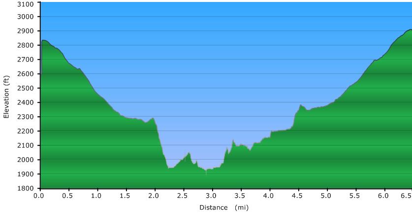
Elevation Profile of the trail
Click for larger image
Click here for a larger map
GPX data for download (zip file which includes both GPX format, as well as GDB format for Garmin users):
Waterfalls Along Bee Cove Creek in Oconee County, SC.
I have labeled the 5 different drops along Bee Cove Creek with letters (A-E) via waypoints on the map above. Clicking on the larger map will list these waypoints on the side. Choosing Google Aerial as the underlying map (from the dropdown box in the upper right hand corner) will allow you to zoom in to a larger degree and spread the 5 different waterfalls out a bit along the creek.
One note on the GPS track ... normally, I've found my GPS to be very accurate in its mapping, elevation recordings, etc, but on this hike there is a lot more "play" than I'd like to see, probably due to poor satellite feed due to the thick, dense undergrowth this hike takes you through much of the time. Even the elevation profile shows that we ended the hike 100 feet higher than we began, despite starting and ending from the same spot!!
DIRECTIONS
The trailhead for this hike is off SC highway 107. If coming from North Carolina, heading south on 107, once you pass Wiginton Road (State Road S-37-413 -- the road that connects highways 107 and 130), at 1.5 miles past this road is a paved semi-circle pull off on the right. Park here, and walk back up highway 107 (going north) for about 300 feet, and look for a 4-wheeled forest service road to your right. It is labeled (FS 702), but the forest service sign is well hidden by overgrowth!
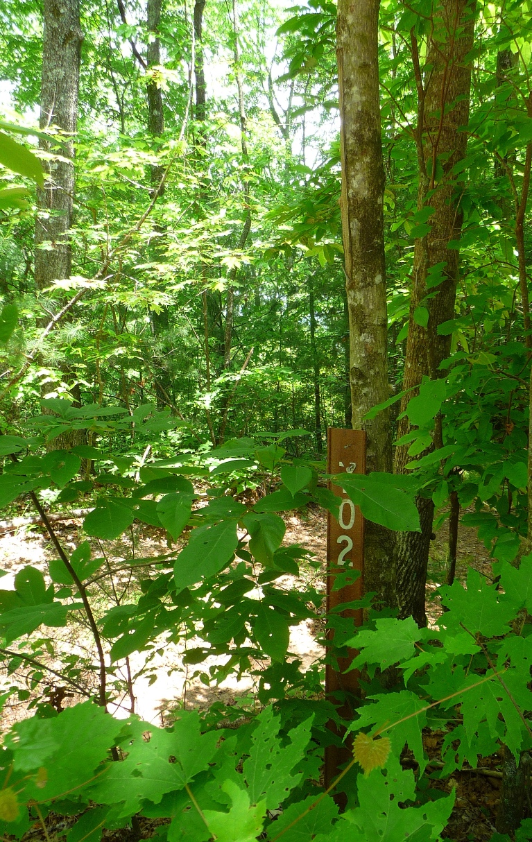
Well hidden FS road sign!
Hike down this forest service road. After 1.3 miles, the road crosses over Bee Cove Creek. Shortly after that, the road forks. Take the right fork.
At the 2.0 mile mark, you come to a "T". Go right. These first two miles are very pleasant downhill walking, losing about 500 feet elevation over the two miles. Along the way, you see the terrain to your right fall away into the valley that Bee Cove Creek forms.
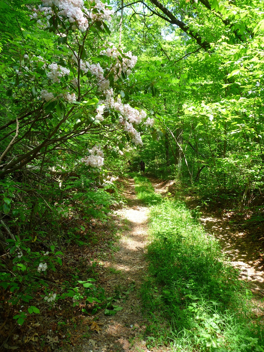
Forest Service Road 702
Once you come to the "T" and turn right, the trail you are following is now single track, as opposed to the 4 wheeled drive forest service road you had been walking along.
In about 400 feet, you'll notice a faint path that turns off this trail to the left, falling steeply downhill. This is the trail that will take you to the creek and the associated waterfalls. When we came back up the trail on this hike, we rejoined this single track trail a little further down the trail. Either way, at this point you can clearly hear the roaring creek, and you are just heading down the path of least resistance to get to the creek.
You'll note red flagging tape along the way (in some spots anyway), that leads you along a path that is generally easy to see.
On the day Jack and I did this hike, we went down to the lowest waterfall first, and then worked our way back up. The hiking upstream from waterfall to waterfall is slow going in many places. Plan on doing a lot of scrambling under rhododendron branches, over downed trees and boulders, and, if you criss cross the creek, getting your feet wet.
This is probably as good a time as any to remind the reader that waterfalls and rapids are gorgeous to view, and exciting to explore, but water + elevation drops = DANGER! Be very cautious anytime you explore around waterfalls and rapids. The day we did this hike, there were numerous places that were exceedingly slick and required very cautious maneuvering.
The photos below show each of the various waterfalls, and I have them identified A-E, according to their corresponding waypoint on the map above. For information on the bushwhack to the waterfall on Wilson Creek, see below.
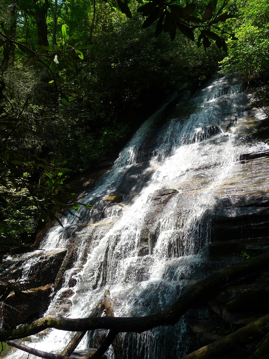
Uppermost waterfall - Waypoint "A"
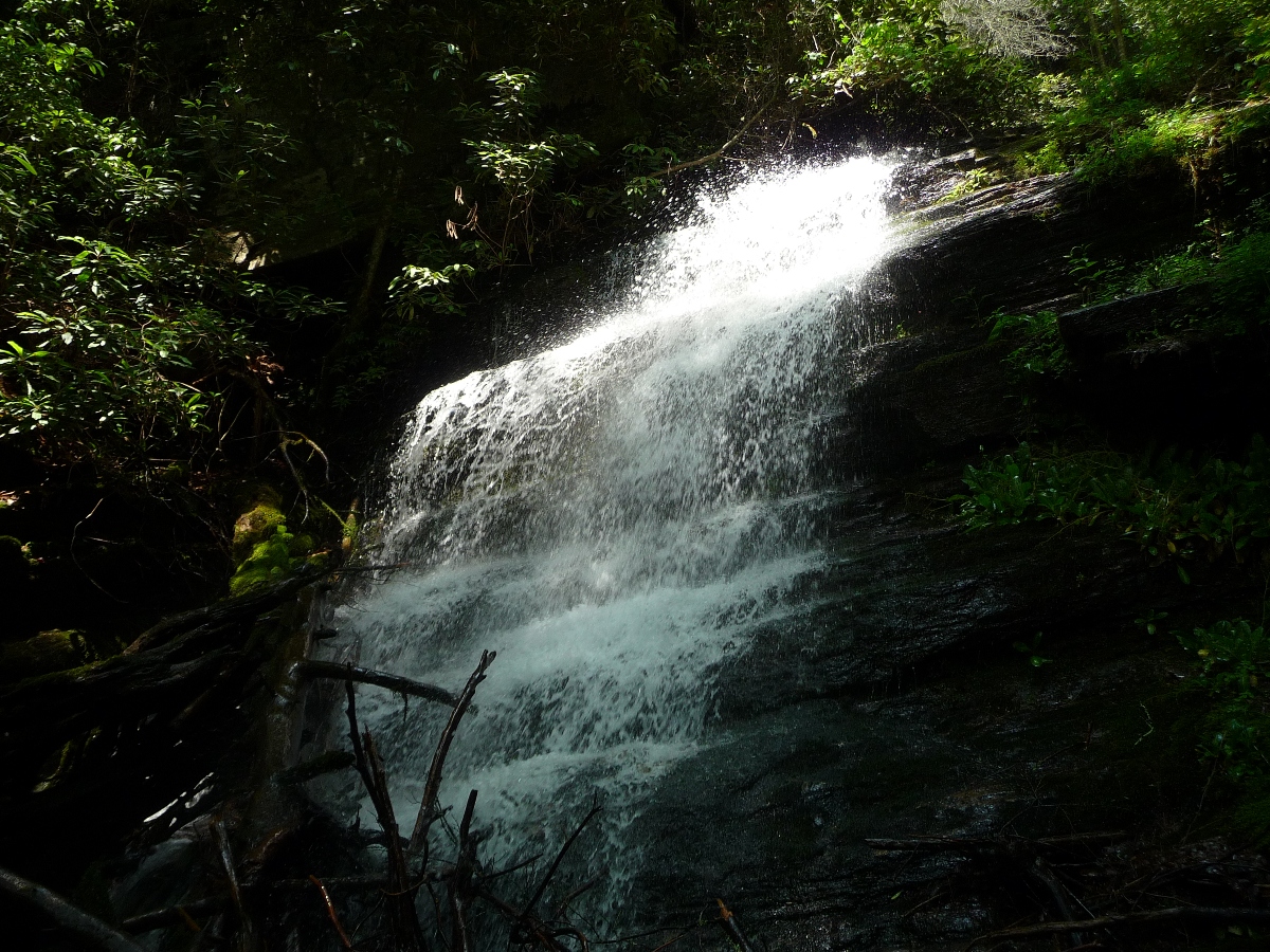
2nd waterfall - Waypoint "B"
3rd waterfall - Waypoint "C"
4th waterfall - Waypoint "D"
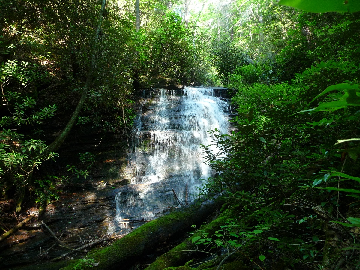
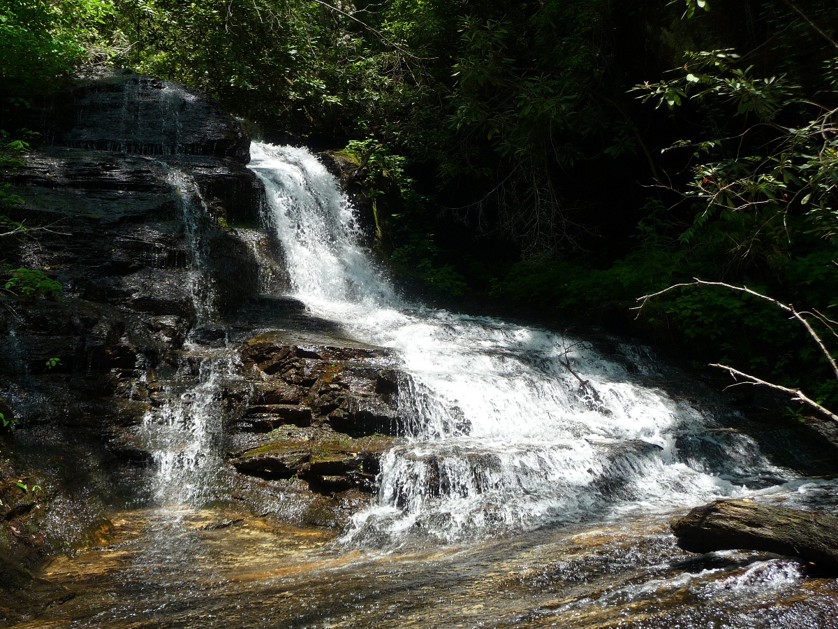
5th waterfall - Waypoint "E"
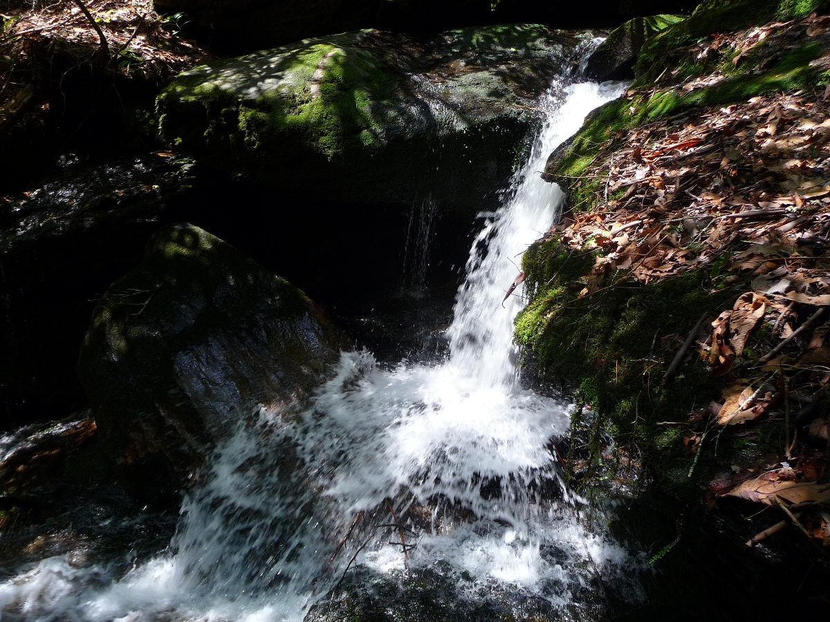
A short ways downstream from this 5th waterfall is a very pretty, small cascade.
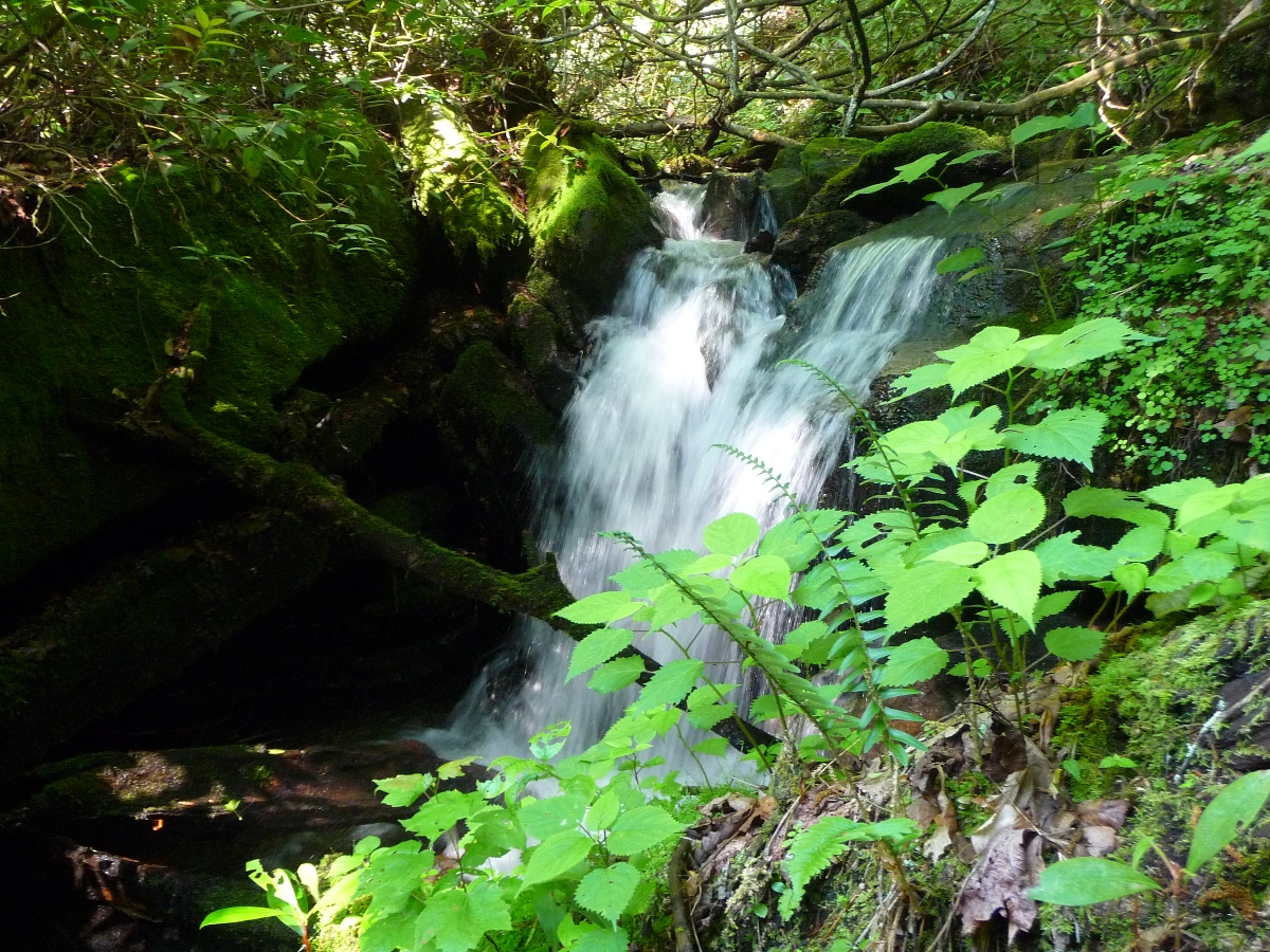
Small Cascade downstream from lower most waterfall
Bushwhack to waterfall on Wilson Creek
The day Jack and I did this hike, we went to the lowermost waterfall ("E") first, and were planning to work our way upstream from there. But after exploring this lowermost waterfall, and the small cascade downstream from it, we wondered if there were any more waterfalls on this creek, so we began bushwhacking downstream to explore.
We immediately ran into some incredibly thick rhododendron bushes, and associated undergrowth, and we finally had to head north, away from the stream in order to make any downstream progress.
As we worked our way southeast, we came to another stream, flowing from our left down towards Bee Cove Creek. Across from this stream was an incredibly steep hillside. The stream itself had quite a few downed trees in and across it.
We worked our way down into the stream, and once down there, realized walking in the stream was the easiest way to head back over to Bee Cove. But before we reached Bee Cove, we were greeted with the most amazing surprise ... the waterfall shown below:
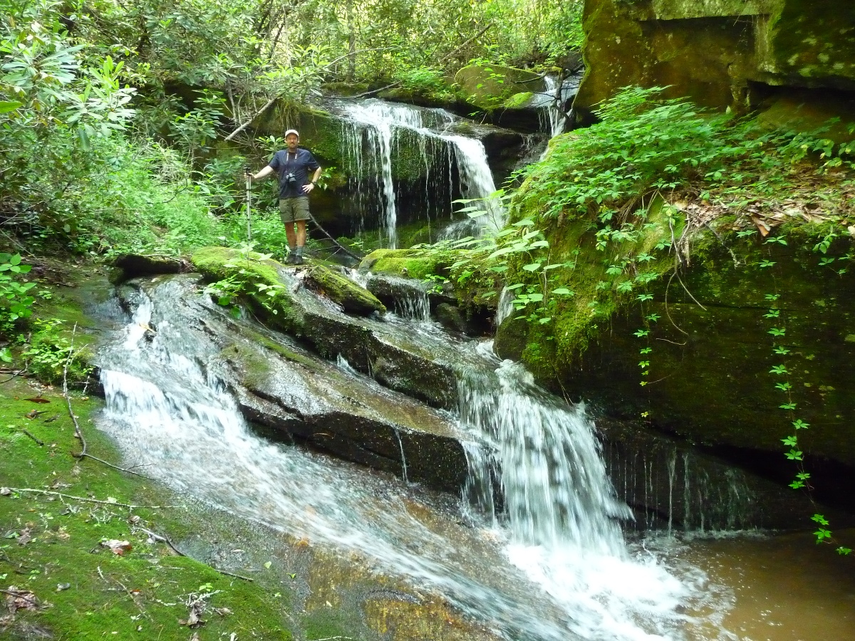
Surprise Waterfall
We were working our way downstream on the north side of Wilson Creek, and came out on the ledge to the left of where you see Jack standing in the picture above.
What was most amazing to me, were the incredible rock formations to the right (east side) of the waterfall. In fact, as we dropped down off the ledge and were standing right adjacent to the waterfall, looking across the stream you saw a large open cavern, totally surrounded by rock, with full size trees growing out of the top portion of the rock!!
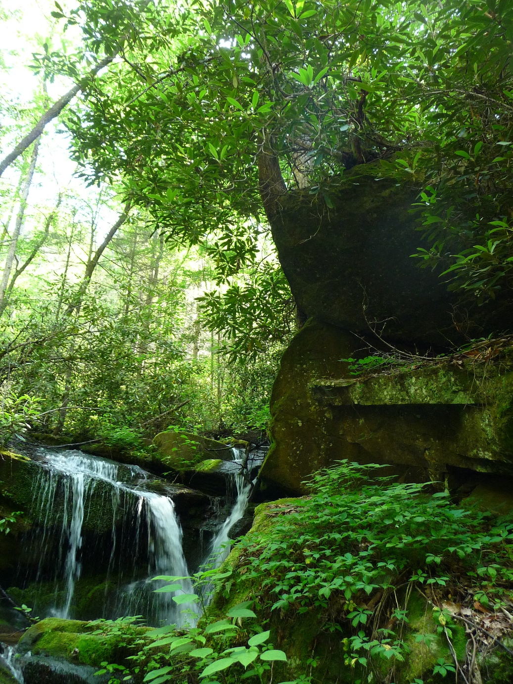
Large rock formations along the waterfall
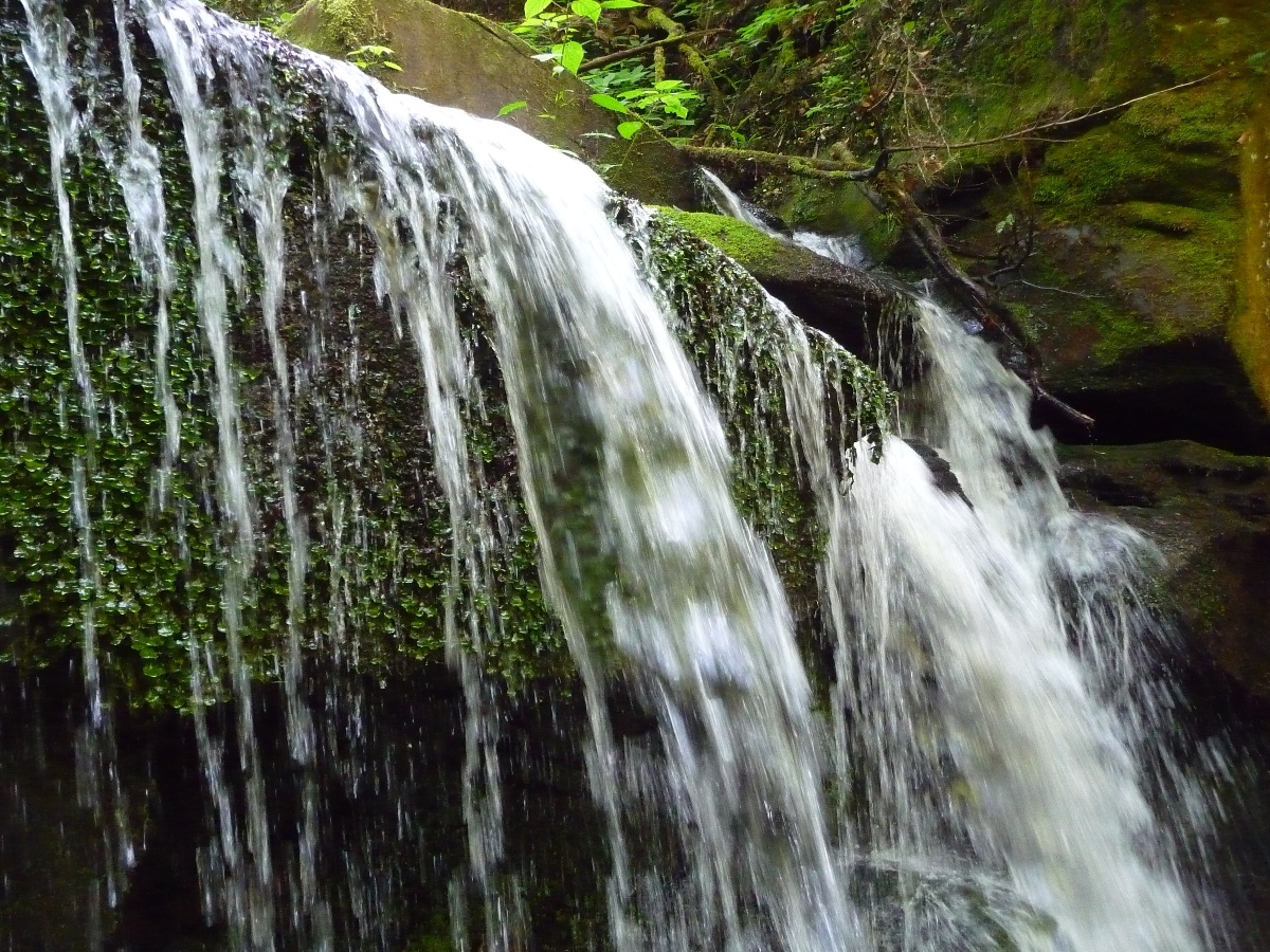
The image at the top of this page is the "up close and personal" view you get of this waterfall as you drop down off the ledge that the creek falls over to make this waterfall!! You come down immediately adjacent to the waterfall!
This waterfall is just upstream from where Wilson Creek joins Bee Cove Creek.
We attempted to work our way up Bee Cove Creek at this point, but there was no safe way to do so. After enjoying the beauty of this "surprise waterfall" we headed back upstream along Wilson Creek. We found an easier path that did not require near as much tug of war with rhododendrons, briars, and stinging nettles that we'd dealt with on the way down!!
The length of the bushwhack from the small cascade that is downstream from the lowest waterfall ("E") to this "surprise waterfall" is appriximately 0.2 to 0.3 miles. It took us 25 minutes going down and 15 minutes and coming back up.
More pictures in my flickr set from this hike.