Carvers Gap
to
Grassy Ridge Bald
Click on any of the images on this page for full size/full resolution pic.
One of the blogs I follow regularly is Mark Peacock's Appalachian Trails, and a post about this trail in May, 2010 piqued my interest in exploring this area. After my first trip there, I fell in love with the area, and have since made many, many trips back there.
The 3 mile stretch of trail which this post covers is so unique, and holds so much incredible beauty for the hiker .... no matter what the season. In winter, the vast openness of the wide open spaces, covered with snow, and biting wind all around you reminds you how exposed to the elements one is on a tree-less, 6000 foot mountain top. In spring, wildflowers from Spring Beauties, to Phacelia, to Trout Lilies await. Summer is by far the best time ... the green hills seem to go on forever, and the mountain's most magnificent display of Flame Azaleas and Rhododendrons cover the area with color.
The trailhead is easy to find ... it is right where NC highway 261 (which becomes TN highway 143) crosses the North Carolina/Tennessee line. Note that for folks coming from NC, it is probably easier to get to this trailhead from the NORTH. I live south of Asheville, NC, and took I-26 north to Unicoi, TN, and then took highway 107 towards Limestone Cove, picking up highway 173 there. Follow that to 173's juncture with 19E. Turn right onto 19E, and follow that to the community of Roan Mountain, where you will turn right onto 143, coming to the trailhead in 13 miles. Driving time from Asheville was just over 2 hours.
If one were to come from the south, you'd meander on back roads, going thru Burnsville, to Bakersville, and then north to this gap. Driving time is about the same, but the curvy mountain roads really slow you down.
Once you do arrive at Carvers Gap, you'll note that the Appalachian Trail also crosses at this point. To get to Grassy Ridge Bald, one heads north on the AT (across the highway from the parking area).
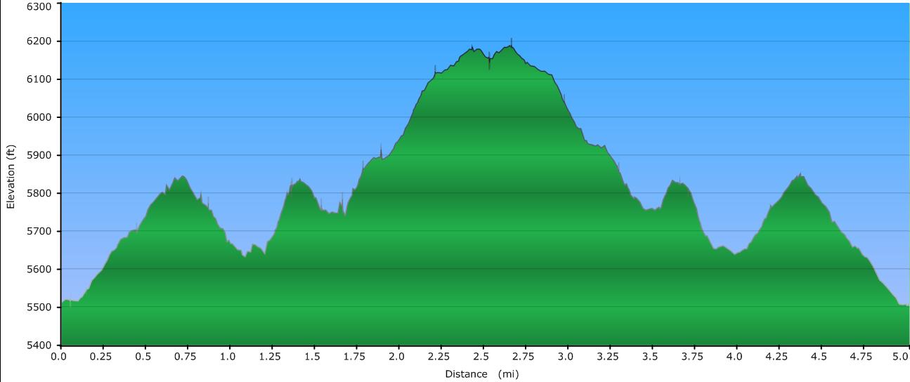
Elevation Profile
Click for larger image
Click here for a larger map
GPX data for download: Carvers Gap to Grassy Ridge Trail.
DIRECTIONS
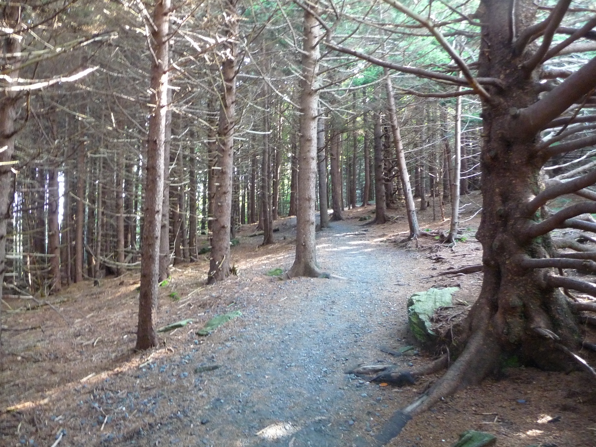
The trail begins by winding through a thick forest of conifers, which as Mark mentions on his blog, has a wonderful "other worldly" feel to it!
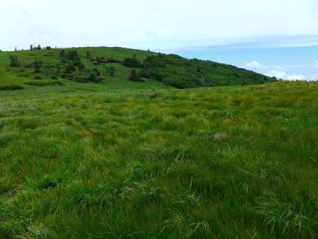
Soon enough tho, the trail leads out of the trees to the first of a long stretch of balds ... open, grass covered mountain tops, as you climb up to the summit of Round Bald.
Then, as the trail winds down off the eastern slope of Round Bald from its summit, the next bald (Jane Bald) can be seen continuously in the distance ahead of you. Just before reaching this second bald, on one August hike, I came to a section totally covered in blueberry bushes, every branch loaded with ripe berries!!
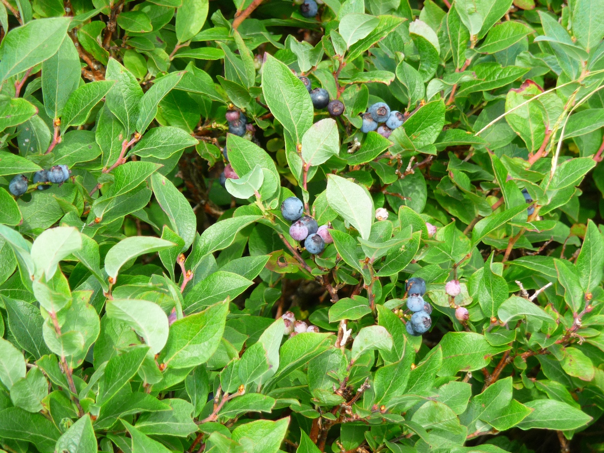
The bushes were incredibly thick, and birds were all over within the bushes! I could hear them flutter away from me to other sections of bushes, but never getting too far from all of nature's bounty!
Another unique item awaiting hikers to this area are GOATS!! For the last 6 years, from mid-June to mid-September, one will come to a group of about 2 dozen goats, their two watchdogs, and their goatherd near Jane Bald.
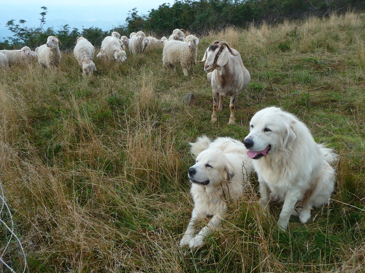
The goats are part of the "Baa-tany Goat Project" - A volunteer based project to restore grassy bald corridors on Roan's western balds using goats as an experimental management tool. Here's their website that gives lots more info on the goats and goatherd activities. Additional information on the science behind the project, as well as the various species of plants and animals found in this mountain region is available there. See my post on my experience with the project here.
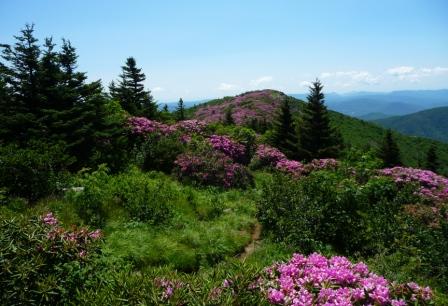
Continuing on along the trail, the AT crests Jane Bald. The trail comes up a super rocky section of trail, finally emerging out onto a wide open rock face, with views in every direction:
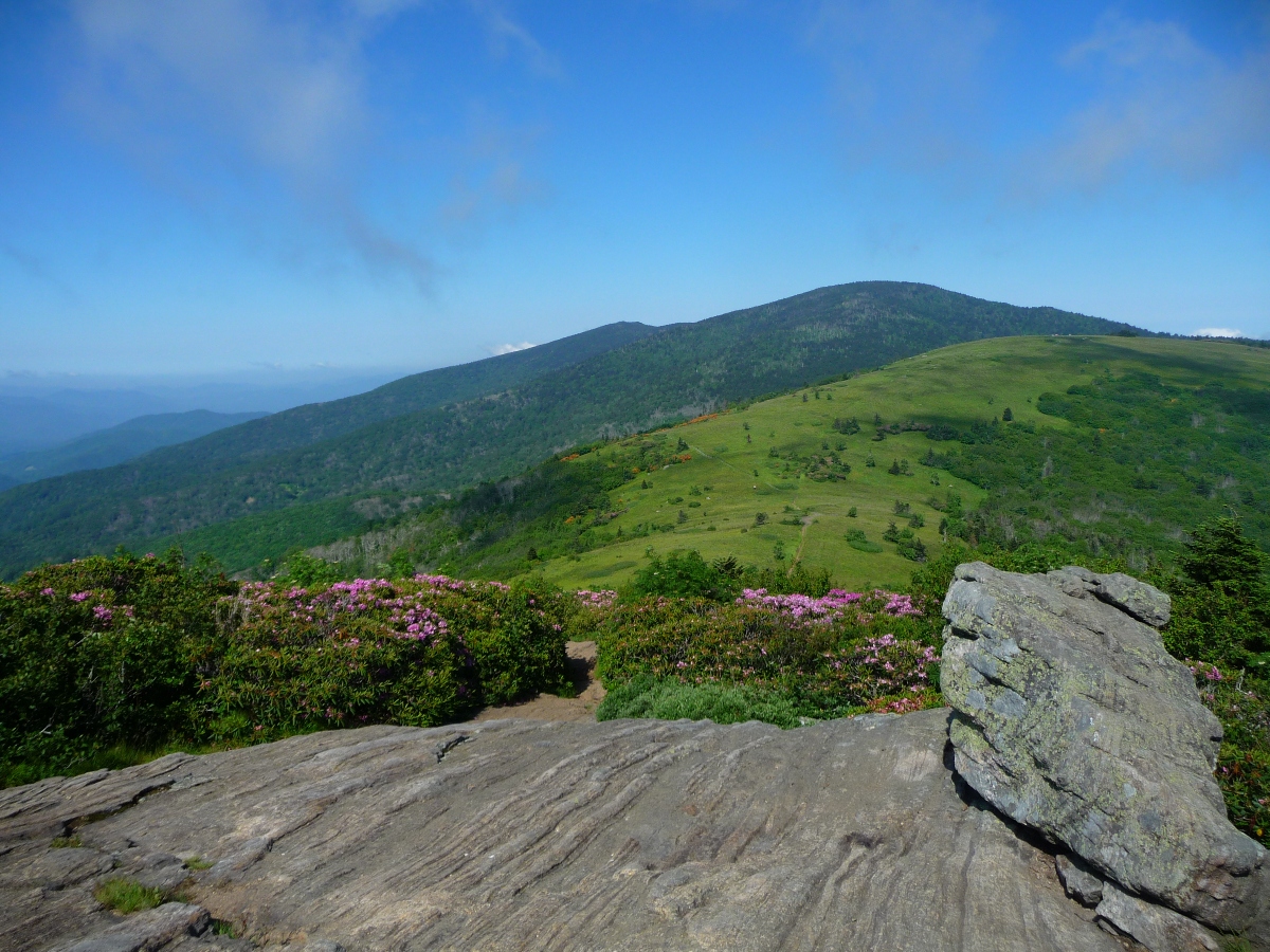
There's a great rock edge here, which makes a great spot to stop, take off your pack, and enjoy the scenery. You can see where you've come from (as shown in the photo above), as well as where you're headed: Grassy Ridge.
Once you've taken in the view here, continue on the trail, which continues its due east direction. Just shy of the 2 mile point into the hike, one comes to a well labeled intersection where the AT continues to the left, and the spur trail to Grassy Ridge Bald bears right.
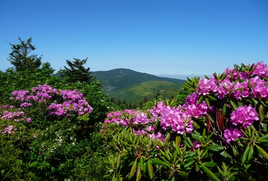
Taking the turnoff to the right, the trail once again begins heading uphill. Along this stretch, you will reach your highest elevation, just shy of 6200 feet. The trail becomes very narrow and rocky, and for the first part, goes through a thick section of rhododendrons. In late June, this area is nothing but gorgeous blossoms!
The trail eventually emerges from the thick rhododendrons, and opens up into another grassy bald. 0.7 mile from your turn off from the AT, one reaches a sections of rocks, with a tremendous drop off and view to the south.
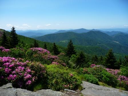
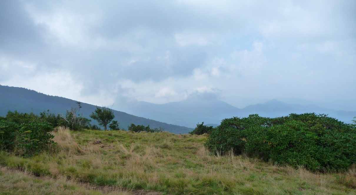
The views from here are tremendous, and depending upon cloud cover (or not), one can see nearby Yellow Mountain, Grandfather Mountain, and areas around Boone (to your left) and the non-stop mountain ranges of North Carolina to your right. This area tends to "make its own weather", and it is not uncommon over the course of a day hike to see clouds form, dissipate, and form again, sometimes moving in and completely covering the mountain in fog.
The trail continues another 1/2 mile or so beyond this point to the peak shown in the photo below, but actually the best views are from this first rocky outcropping.
The return trip on this out and back hike provides some wonderful long range views of the Appalachian Trail back to the trailhead at Carvers Gap. The photo at the top of this page is a shot taken from Grassy Ridge Bald; one can see the AT thread itself over the top of Jane Bald, and then around the south side of Round Bald.
A collection of some of my favorite photos from my various hikes over the last 4 years to this special place can be found in this SmugMug Gallery.