
High Bethel
on
Cold Mountain
in
Panthertown
Click on any of the images on this page for full size/full resolution pic.
Panthertown is located within the Nantahala National Forest in Jackson County, North Carolina. Comprised of over 10,000 acres, Panthertown offers a wide variety of terrain, including flat, high elevation valleys, two monoliths rising out of those valleys, over a dozen waterfalls, and numerous creeks and rivers.
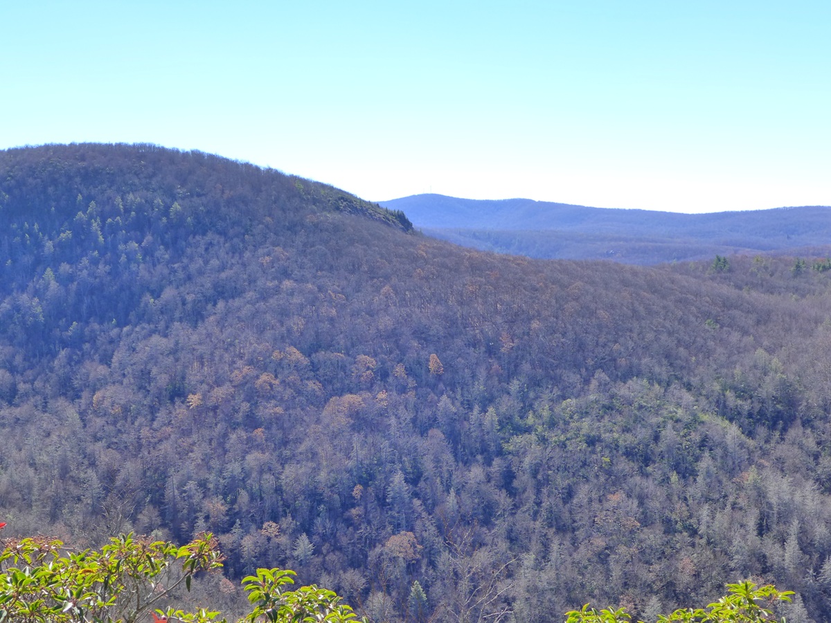
One of the mountains within this area is Cold Mountain (not the one of more well known fame in Shining Rock Wilderness). This Cold Mountain has a peak of just over 4600 feet. Its south surface has an area of open cliffs and bare rock, visible from the road you drive in on.
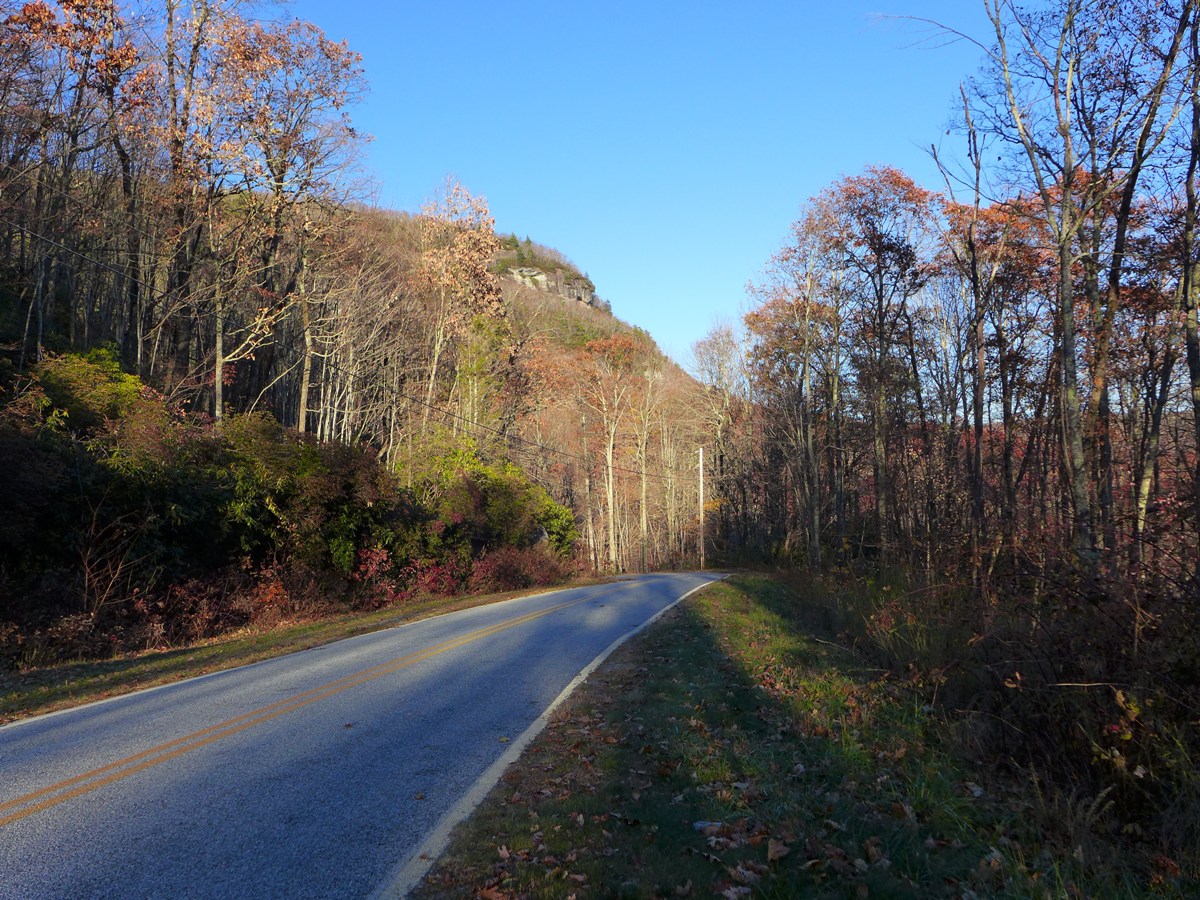
You can see your destination as you drive up to Panthertown
My destination for the day was to get to the open rock face visible in the above photo. There are two routes you can take to get here: a 3.7 mile (one way) route takes you up Devil's Elbow Trail to Little Green Creek, then following the creek upstream to pick up an unlabeled, unnamed trail that winds around the northwest face of Cold Mountain to the short trail that climbs up to the rock face.
The second route is 5.2 miles one way. It follows Devil's Elbow Trail on past Little Green Creek, up and around the "elbow", then climbs up to the top of Shelton Pisgah Mountain, then back down via its southeast facing ridgeline. At the bottom of the ridgeline, you wind around to the west and come to the upper end of the trail that comes up from Little Green Creek, and pick up the trail mentioned above that winds around Cold Mountain.
All the trip reports I'd read about the route up Little Green Creek was that it was pretty much a tough bushwhack, fighting a lot of rhodos and other undergrowth. I decided to take the longer of the two routes going, and return by way of Little Green Creek.
This trip reports follows that route. Total mileage for the day was just over 9 miles, and that included a couple wrong turns. Along the way, you are treated to a wide variety of terrain: Devil's Elbow trail follows the Tuckasegee River, and although you never see it, you hear it for much of the way. 6 waterfalls are along this section of the creek.
The section up and over Shelton Pisgah Mountain gives you wide open forest with lots of long range views. Your destination of Cold Mountain gives you a clear 180 degree view of most of the southern half of Panthertown, as well as the areas south and west of there. And Little Green Creek gives you a delightful rocky, creek valley to traverse.
NOTE: My initial trip along this route, described here was done in November, 2014. I did the loop a second time in October, 2015. Only update of note is that the trail that leaves Devil's Elbow Trail to head up and over Shelton Pisgah Mountain is much more evident and clear than it was on my first trip. There's still a couple places where it sort of disappears and comes and goes, but over all that section now has a pretty clear, evident trail. Note that it still is not labeled or blazed, and you will still definitely want to have backcountry wayfinding skills if you attempt this route.
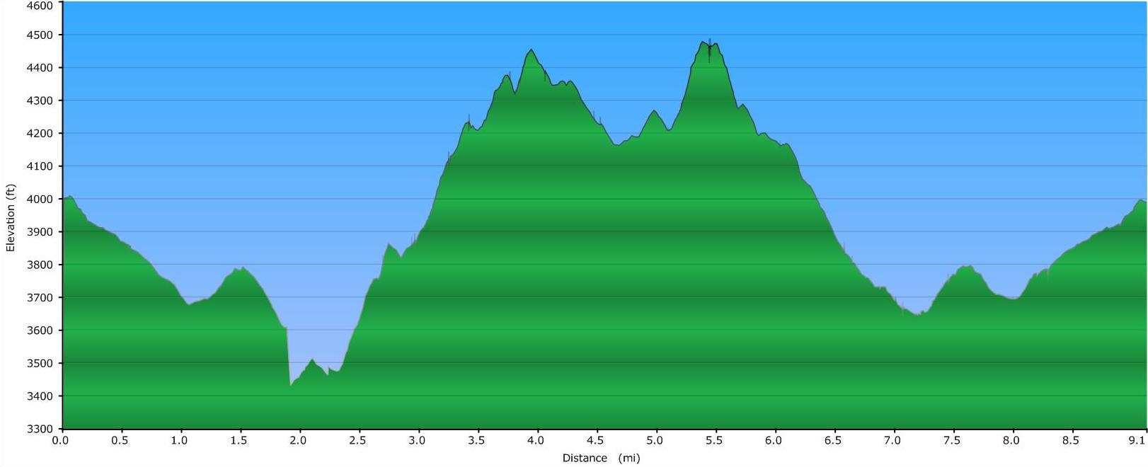
Elevation Profile
Click for larger image
Click here for a larger map
GPX data for download: GPS track for hike to High Bethel, including trek over Shelton Pisgah Mountain, as well as the trail which follows Little Green Creek. *.gdb format for Garmin users, as well as *.gpx format included.
DIRECTIONS
First and foremost, this trek should only be attempted by folks who are skilled at navigating through areas where trails are "sort of there" and often "not there". Most of the area up and over Shelton Pisgah Mountain is done purely by navigating along landmarks .... basically keeping yourself on a ridgeline that heads up to this mountain's peak. Occasionally I would find myself on a "pseudo" trail, that may have been nothing more than just an animal trail.
Even where there were clear trails, none are labeled or blazed. There is occasional flagging along the route up and over Shelton Pisgah Mountain, but occasional is the operative word. Certainly not frequent enough flagging to try and follow.
The hike begins at the Cold Mountain trailhead in Panthertown. If coming from the east (Brevard/Asheville), follow US64 west to Hwy 281 North. Turn right onto Hwy 281, and in 0.8 mile, turn left onto Cold Mountain Road. A fire station is on your right at this turn.
Cold Mountain road will twist and turn as it makes its way along the north shore of Toxaway Lake. At 5.7 miles, the road will make a 90 degree left turn and become gravel. Straight ahead of you is a private community called Canaan Land. Turn left following the gravel road, and in another 600 feet, turn right following signs for Panthertown. Straight ahead of you is a road into another private community.
Once you make this final right turn, you are at the Cold Mountain Trailhead for Panthertown, and parking is where ever you can find a spot along the side of the road. The trail begins behind the informational board on the right at the end of the road.
The first 2.7 miles of this hike are along easy to follow, well labeled trails. The first mile heads downhill along an old (now gated) road, making a couple switchbacks enroute down.
At 1.1 mile, the well labeled Devil's Creek trail turns off to the right. Take this right turn.
Devil's Creek heads through the open electric line right of way that transects all of Panthertown.
Soon after passing through this right of way, you begin to hear the roaring Tuckasegee River, even though you are about 200 feet above it (and never get to see it).
0.8 mile after turning onto Devil's Elbow Trail, you cross Little Green Creek. I stopped and looked around at this point, to see what, if any semblence of a trail there might be, and nothing really jumped out at me, making me think this route was indeed pretty much of a bushwhack (see more on this below!!)
The Fun Begins!
1.6 miles from the beginning of Devil's Elbow trail (2.7 miles from the hike's start), you come to a place where the trail passes a sandy, eroded area on a wide area of the hillside to your right. The trail continues it's delightful trek off to the left of this, wide and lined with rhododendrons.
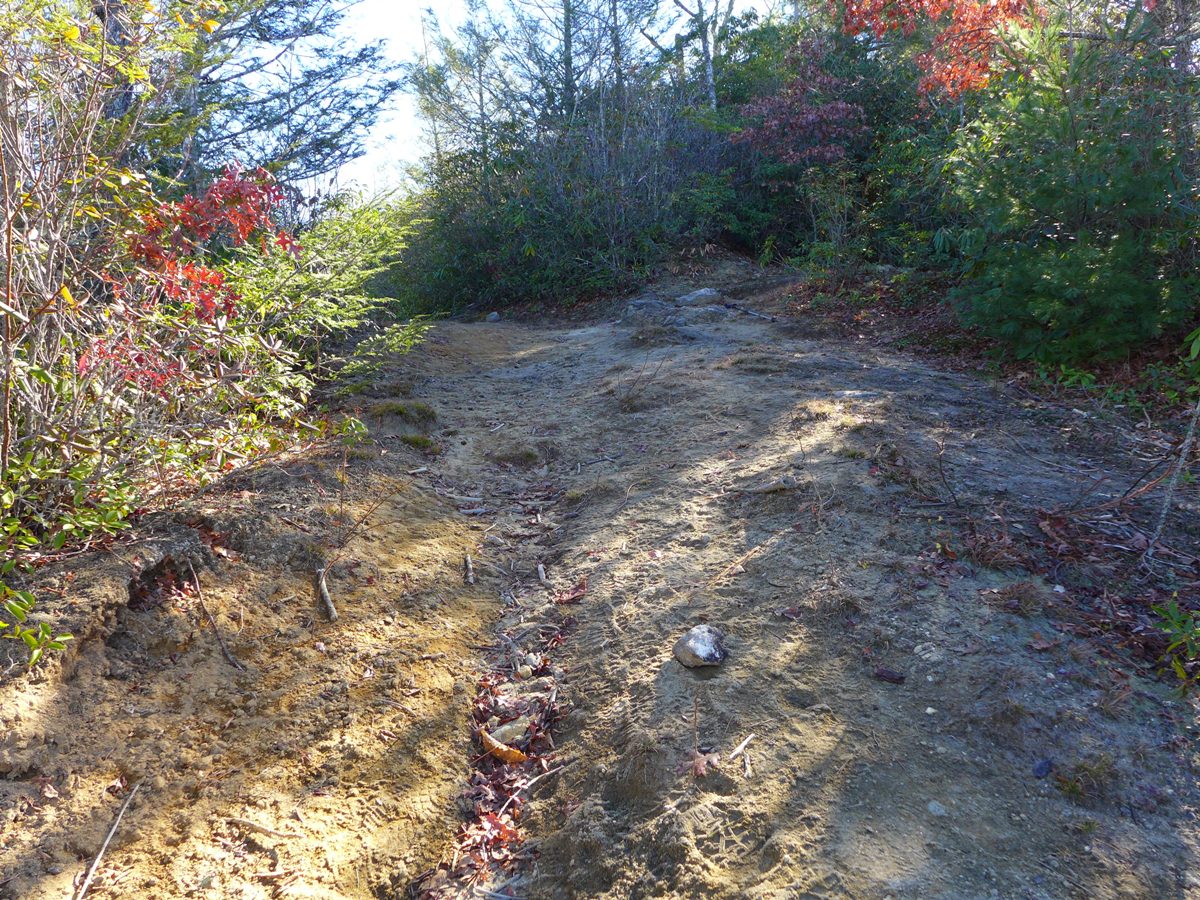
Eroded, sandy area (above) and Trail (below)
This is where I made my first wrong turn of the day. I went up the hillside to check out this sandy area, more of out curiosity than anything .... it offered no views, and was just this open, eroded area in the middle of nowhere.
My curiosity satisfied, I then continued along the trail shown above.
However, soon I found myself going steadily downhill, and I knew there wasn't going to be any downhill till after I crested Shelton Pisgah Mountain. I hadn't noticed any other trails off of this one, but that eroded sandy area HAD been on the crest of a ridgeline, and this trail was dropping down off the ridgeline, heading northeast. Shelton Pisgah Mountain was to the southeast.
So, I headed back up to that open, eroded area, and checked out things more closely. Right at the upper edge of this area, was a small indentation into the surrounding rhodos.
See the trail??? Sort of??
Heading into the rhodos at this point, I found the semblence of a trail.
A little further in
Following this faint trail had me head uphill, as well as heading southeast. So, I figured I was heading in the right direction.
After a short ways, the thick rhodos gave way to open forest. It was at this point the "sort of" trail basically disappeared. From here on, until I'd crested Shelton Pisgah Mountain, I never really did find much of a trail. Every now and then I "thought" I saw one, but it would disappear as quickly as it appeared. I'm curious if there is a more visible trail at other times of the year ... I did this hike in mid-November, and the ground was covered with several inches of thick, dry leaves, which may have been obscuring a trail that may be more evident when there aren't so many leaves. (As per my NOTE above, in October of 2015, I found this trail to be fairly clear the whole way. It faded out around the 4100' elevation point and was sort of hit or miss until another 100 vertical feet were climbed when I again found a clear trail.)
At any rate, with all the leaves OFF the trees, it made it very easy to see the crest of Shelton Pisgah Mountain ahead of me, as well as Cold Mountain further to the south.
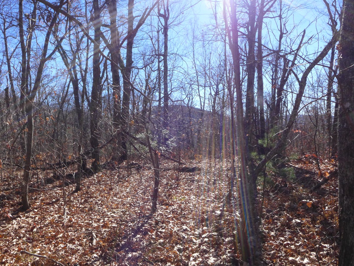
Cold Mountain's outline in the distance
As you're heading up to the mountain's crest, you get great views to both the north and south. And, every now and then, I saw a bit of flagging on a tree, letting me know that I was on the right trail.
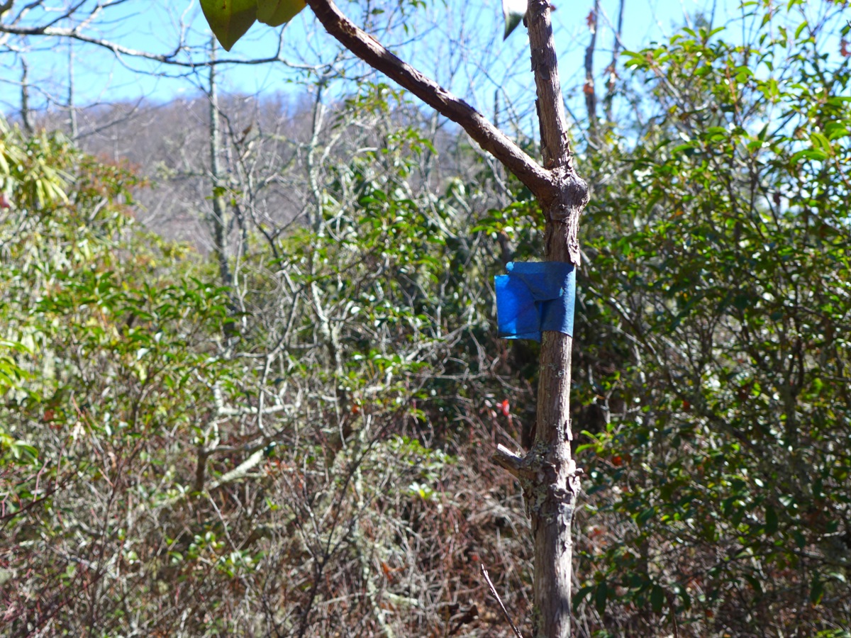
The occasional flagging found on a tree
Just before the crest of Shelton Pisgah mountain, the trail (at this point, there actually WAS a visible trail) opened up onto the top of a bare rocky cliff, giving a tremendous view to the south. Cold Mountain was right in front of me, with Little Green Creek's valley between me and it.
View from an open cliff along Shelton Pisgah Mountain (above)
Panorama shot (below)
Click for larger image
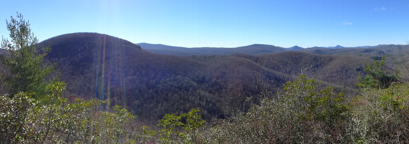
I can only imagine what this view looks like in the height of summer, when everything would be a deep, rich green, or in the middle of fall, all decked out in autumn's colors!!
From here, up and over, and then down Shelton Pisgah Mountain on the southeast side, there was actually a very clear trail to follow.
At the base of Shelton Pisgah Mountain, I knew the trail made a sharp, almost 360° turn to the right, and I was curious if I would be able to find this. While the vegetation was slightly over grown here, it was fairly easy to find this big turn. The topo map shows that landmarks to look for include the terrain flattening out straight ahead of you, and so I knew to be looking for the trail to bear off to the right when I hit that.
Once I'd made "the big turn", I came to the beginnings of Little Green Creek. I was surprised to see that there was water flowing even here, near the creek's beginnings, since we hadn't had significant rain for several weeks. So apparently a good sized spring must feed this creek, and I would suspect it always has water in it.
Also very evident here was a trail heading downhill along Little Green Creek.
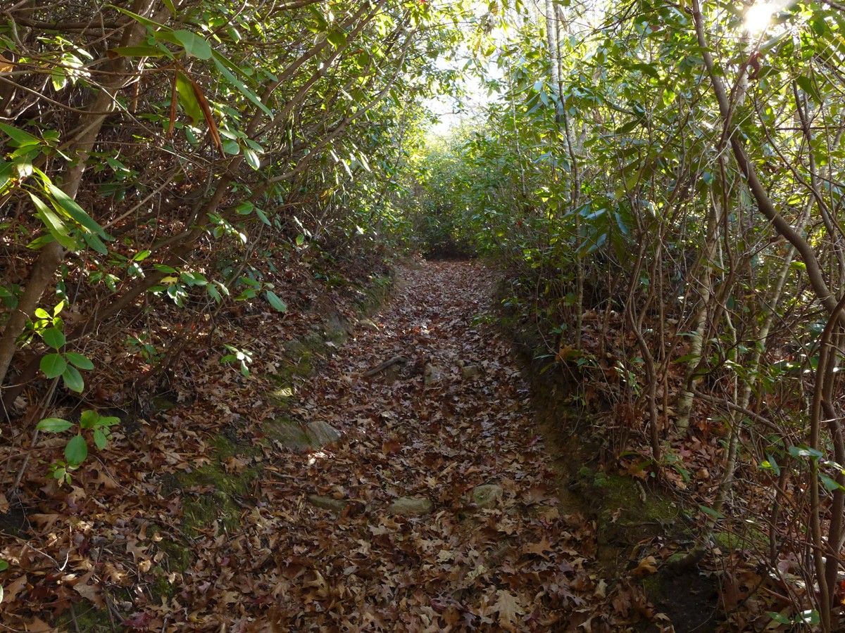
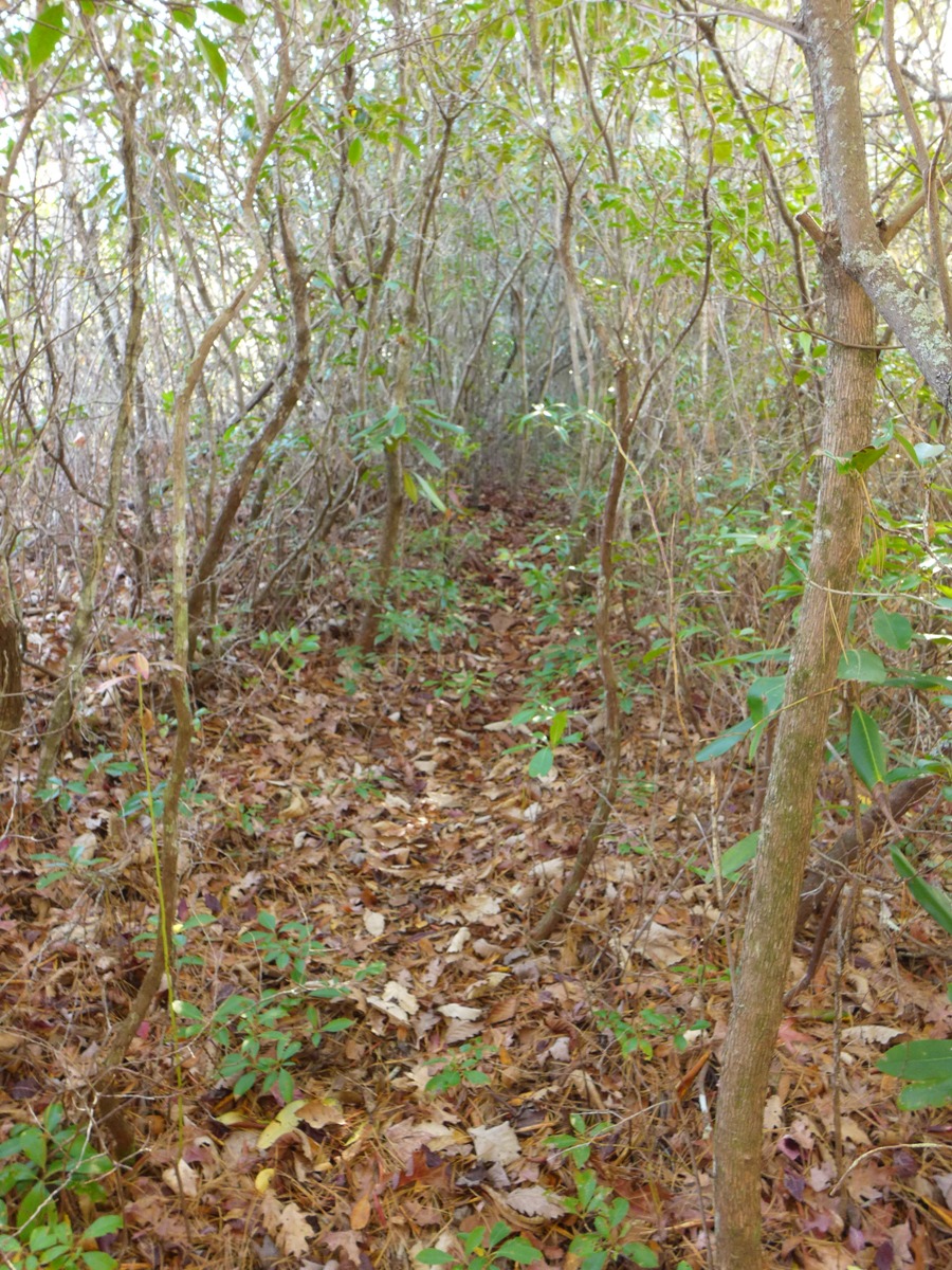
After traversing the last couple miles with only the hints of a trail here and there, once I hit the creek, there was a very clear (although still unlabeled and unblazed) trail heading southwest towards Cold Mountain. In fact, at this point, Cold Mountain is RIGHT in front of you, and the trail winds along its northern face, following a rocky path that has been cut through thick rhododendrons.
After about 0.4 mile, this rocky trail through rhodos opened out into a wide, old logging road, going through open forest, and made for some of the easiest hiking I'd had since the first mile of the hike.
Except ... this delightful road/trail was heading downhill. I was supposed to be heading UPHILL.
So, once again I retraced my steps, looking for a trail I must have missed.
What I found were two, very clear signs on two adjacent trees, which, in big letters said "HIGH BETHEL", with an arrow pointing to the right. Trouble was these signs are visible ONLY when coming from the south. From the north, you never see them!
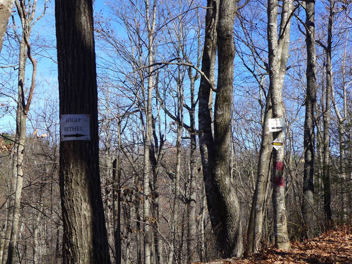
Very clear signs (IF you are coming from the other direction!!)
I suspect this wide old logging road heads down to Canaan Land, a section of private property that borders Panthertown. Labeled as "Camp Toxaway" on many maps, Canaan Land is (quoting from their webpage) a retreat for "full time Christian workers of the Baptist faith (conservative) and their immediate families".
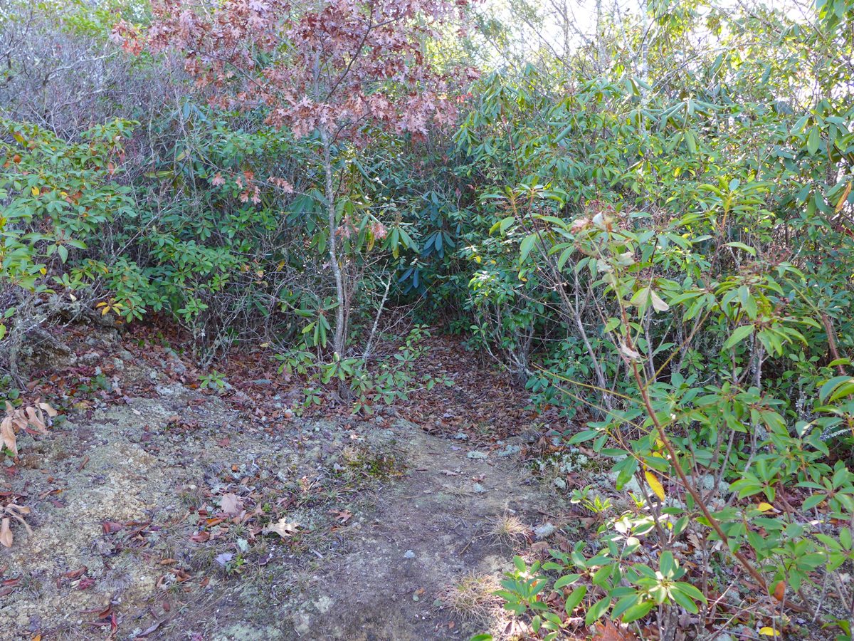
The turnoff I'd missed was a rocky path that headed steeply uphill from this wide logging road. Following it for 0.2 mile (in which distance it gains 200 feet of elevation), you come out very suddenly from a very thick, mountain laurel lined trail, out onto a bare open rock face at the top of a rocky cliff, which drops off steeply below you.
Ahead of you, for a full 180 degree view, you have a grand view of all of Panthertown to the south, as well as areas south and west of Panthertown.
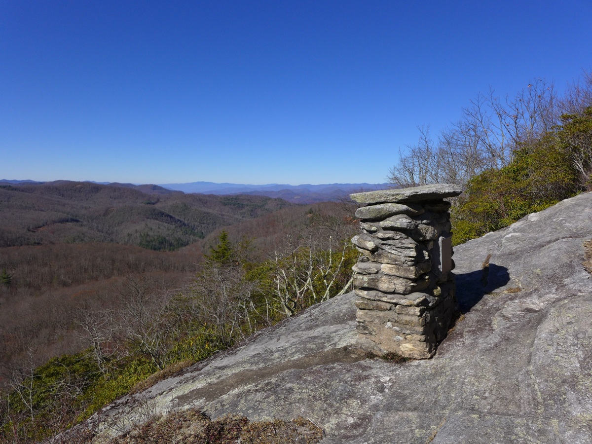
And, you come to an altar.
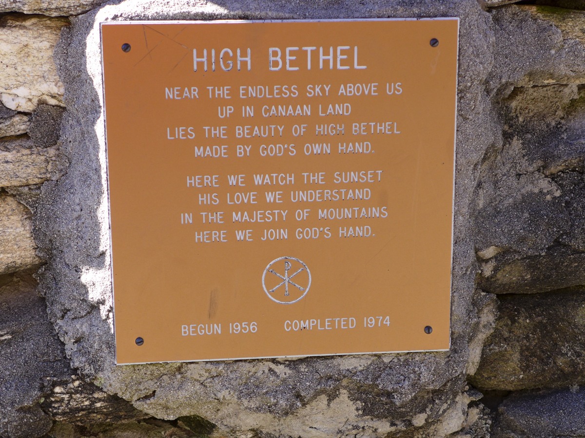
Yup, an altar. I'd read about the altar in my research of this hike, but nothing ever mentions who built it, or why. In fact, the name of this particular spot, "High Bethel" does not appear on any maps. I suspect the name and the altar are both connected with the Canaan Land Christian Retreat, given that both those names (Cana and Bethel) are Old Testament references. And, if you check the date that is on the plaque on the altar, it coincides within a year of when the Canaan Land property was purchased and set up as a retreat (see this property's history here).
Anyway, after a curious inspection of the altar and its plaque, I turned my attention to the grand view before me, had lunch, and relaxed in the sun. (Actually, it was the otherway around ... once I stepped out onto the rock face, you couldn't help but be immediately taken in by the grand view, THEN you notice the altar!!)
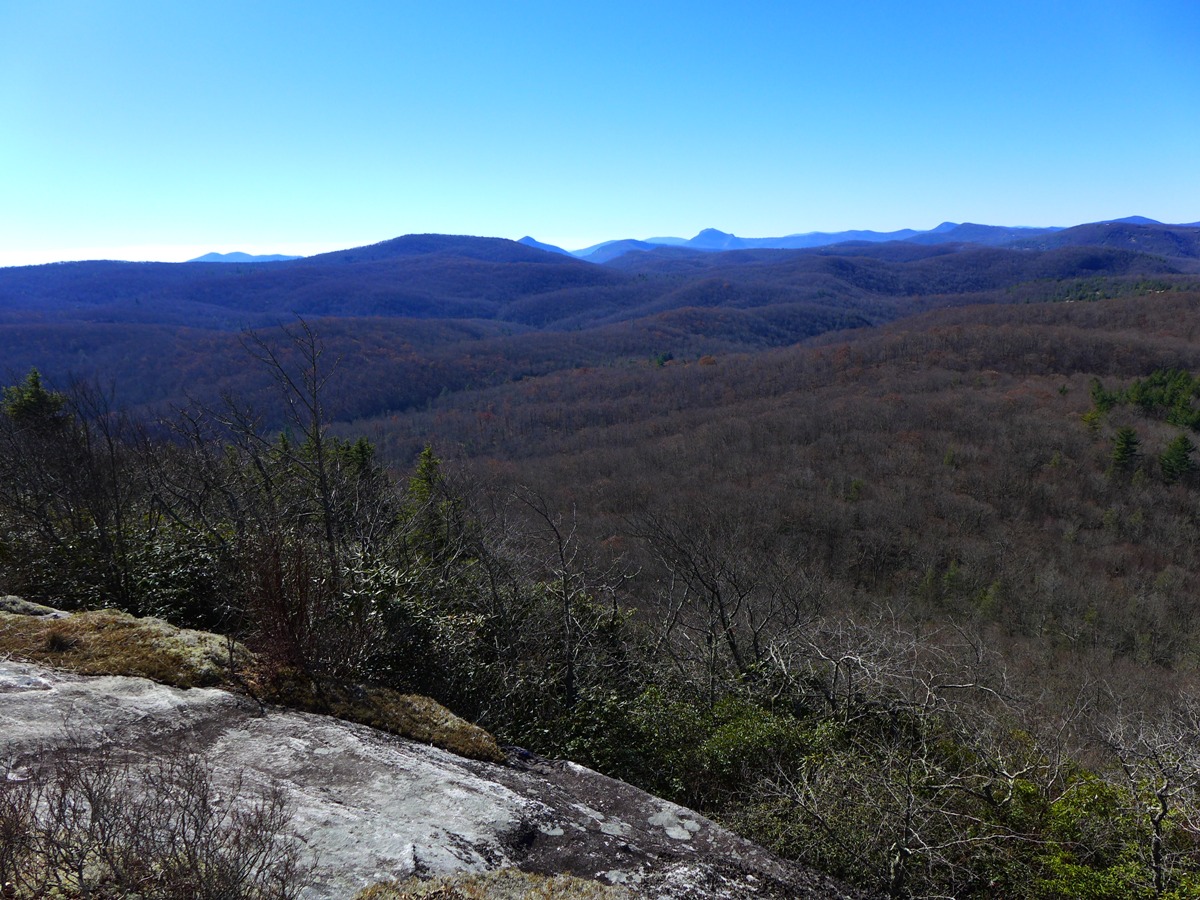
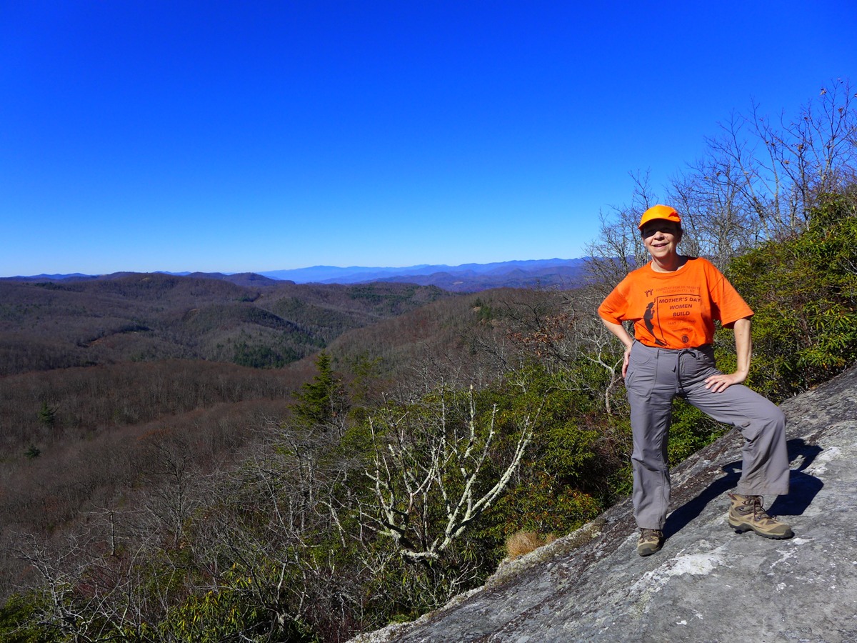
View from High Bethel (above)
Altar and its plaque (below)
View from High Bethel in full autumn color (below)
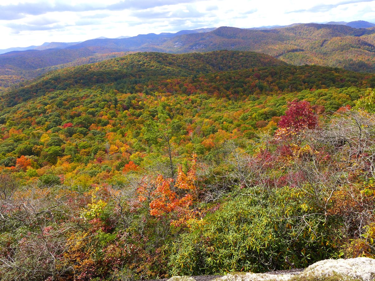
The photo at the top of this page was also taken from this spot.
The Return Route
It had taken me 4 hours of hiking to reach High Bethel, and I'd spent an hour here on the rockface having lunch and relaxing.
I was trying to decide whether to head home via the same route, or take the trail that was supposed to follow Little Green Creek back down to Devil's Elbow Trail. That would be shorter in terms of distance, but if it involved as much bushwhacking as I'd read others had run into, it might very well take as long in terms of time.
However, I was curious about this trail, and figured heading downhill along a creek should be doable, even it if was thick bushwhacking.
So, I followed the trail back to the beginnings of Little Green Creek, and made the turn onto the wide trail evident at that point.
What I found for the rest of the way, was a delightful trail that had very recently had A LOT of trail maintenance done. Evidence of thick rhododendron limbs that one would have had to crawl over or under had been sawn away. Smaller limbs had been snipped to clear the trail. There were several crossings of Little Green Creek, and each ocurred where there were plentiful rocks to rock hop on.
Flagging was done all along the trail, not too much to be excessive, but just enough so you could see where the trail went next.
A BIG thank you to which ever trail maintenance team did all this work!! I was expecting a tough, long bushwhack, and instead was treated to a delightful creek walk.
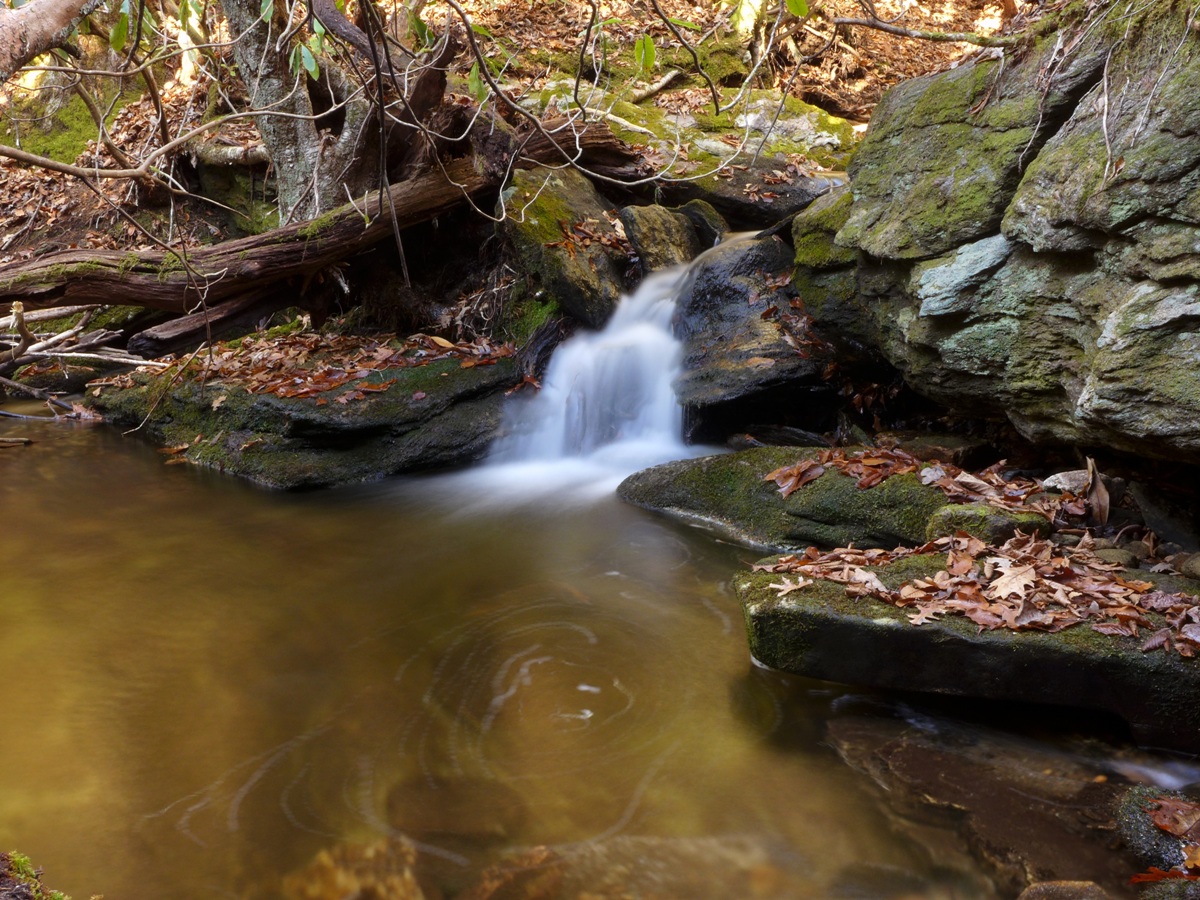
The first 0.4 mile heads downhill, above the creek. After a short switchback, the trail descends to creek level, where it stays for the remainder of its route down to Devil's Elbow Trail. You are treated to some impressive rock formations all along the way, as well as lots of boulders in and around the creek, and a few small cascades. All in all, a very delightful hike. Total distance from the top where you first pick up the trail, down to Devil's Elbow Trail is 1.2 miles.
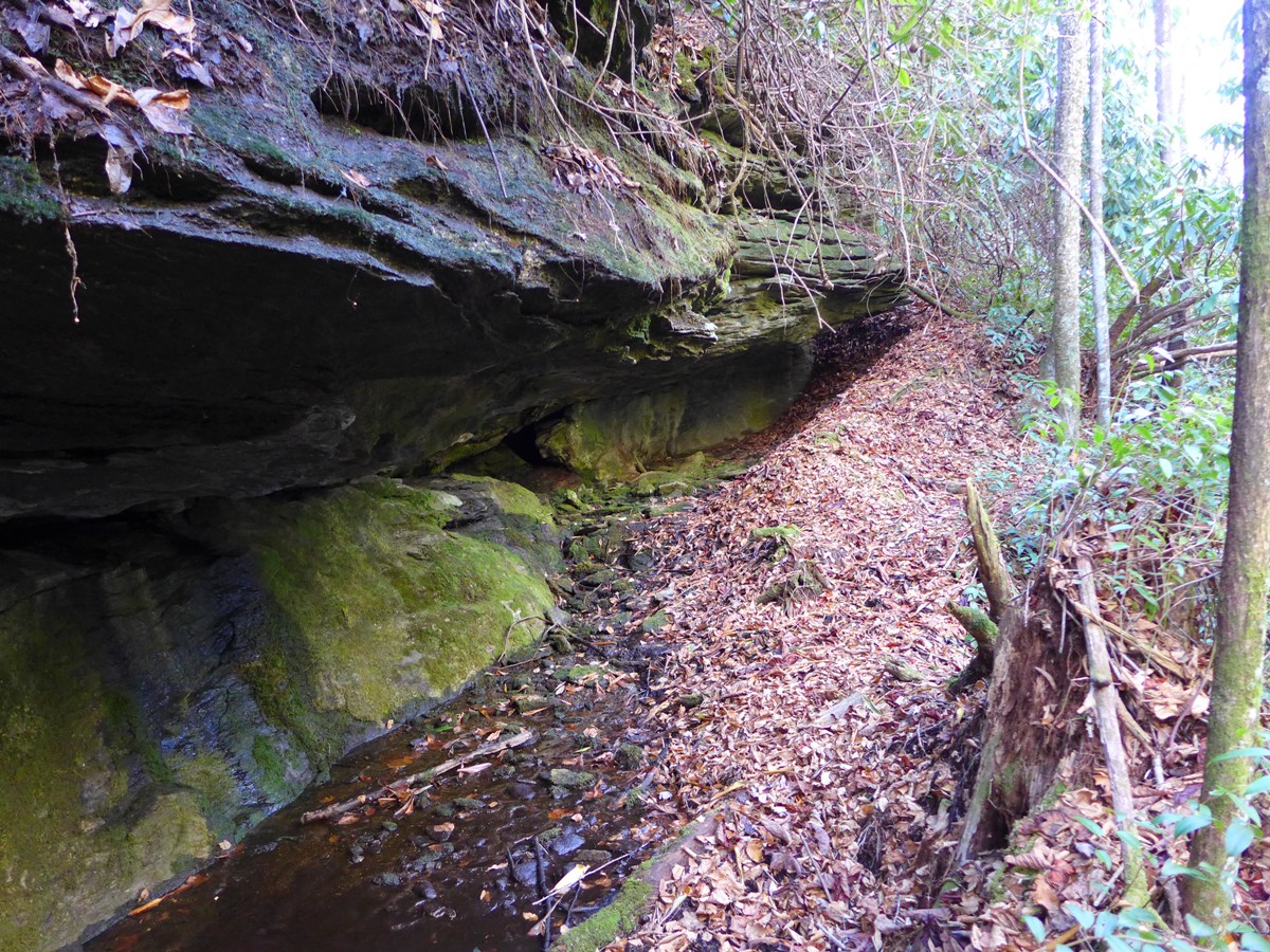
Rock Formations along Little Green Creek (above)
Small Cascade (below)
And remember at the beginning of the hike, where I stopped and looked for a trail in this area when I was down at Devil's Elbow and couldn't really see any?? I had to laugh when I came out onto Devil's Elbow Trail from the Little Green Creek Trail!! While the trail itself was very clear all the way down Little Green Creek, looking at this area from Devil's Elbow the trail doesn't really jump right out at you. It comes immediately before crossing the creek (if coming from the Cold Mountain Trailhead). Click the photo below to enlarge it, and look where my hiking pole is .... that's where you turn to get onto Little Green Creek Trail.
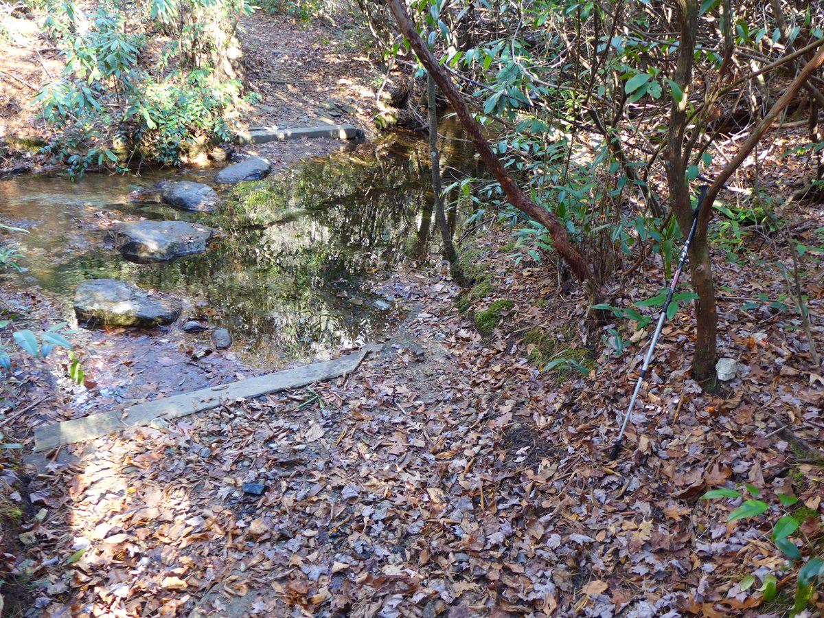
Turnoff for Little Green Creek Trail
Once back on to Devil's Elbow Trail, I turned left and was back at the trailhead in another 1.9 miles.
More photos from my initial hike in November, 2014 hike are in my SmugMug gallery. Photos from the October, 2015 hike (which hit the area at PEAK fall color) are in this gallery.