Palmetto Trail
from
Table Rock State Park to US178
Click on any of the images on this page for full size/full resolution pic.
The Palmetto Trail is a hiking/mountain biking trail that, when completed, will provide over 425 miles of trail across the state of South Carolina.
The trail’s southeastern end starts just northeast of Charleston, in Francis Marion National Forest. From there, it extends northwest across the state to Oconee State Park.
This trip report covers the 12+ mile section that goes from Table Rock State Park west to US178.
Hiking this segment works well for a shuttle type of hike … the driving distance between the two trailheads is only 8.5 miles.
I’ve done this hike once so far, going from east to west. Note that the mileage references on this page refer to a hike done in that direction, as do the mileage waypoints on the GPS track (see below).
The first section takes you through a portion of Table Rock State Park, near the border with the nearby Wesleyan Camp (a year round camp and conference center). In fact, in the first mile you can see the camp’s buildings and road.
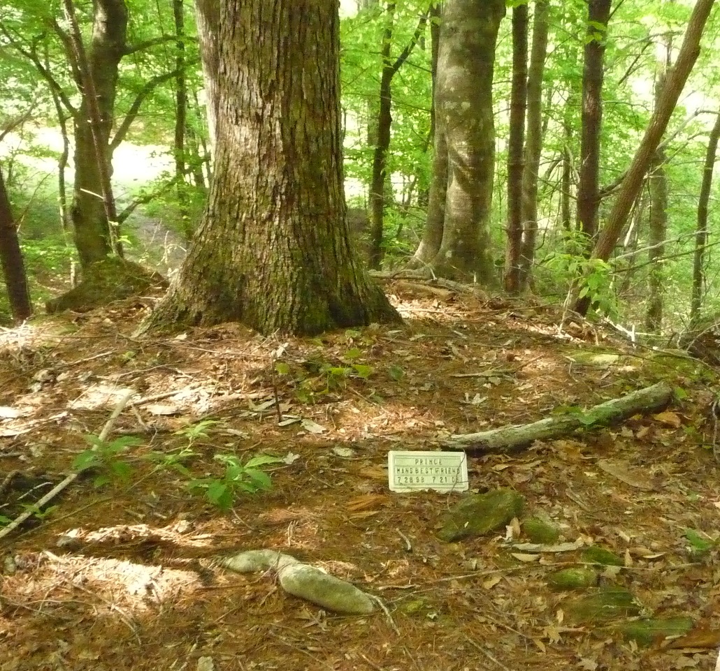
Also in this first section is a touching grave site at the base of a tree of, apparently, a dog named Prince. I’d love to know the story behind him and his special gravesite.
The inscription on the small grave marker reads:
PRINCE, A Man’s Best Friend.
7-28-93 to 7-21-05
Heading on to mile point 1, you cross Mill Creek. This is the same creek where, further upstream, you pass Mill Creek Falls on the Pinnacle Mountain Trail in Table Rock State Park.
Additionally, there is at least one other waterfall on this stream, about a half mile upstream from where the Palmetto Trail crosses. Here’s a shot of that waterfall as photographed by fellow hiker Johnny Corn.
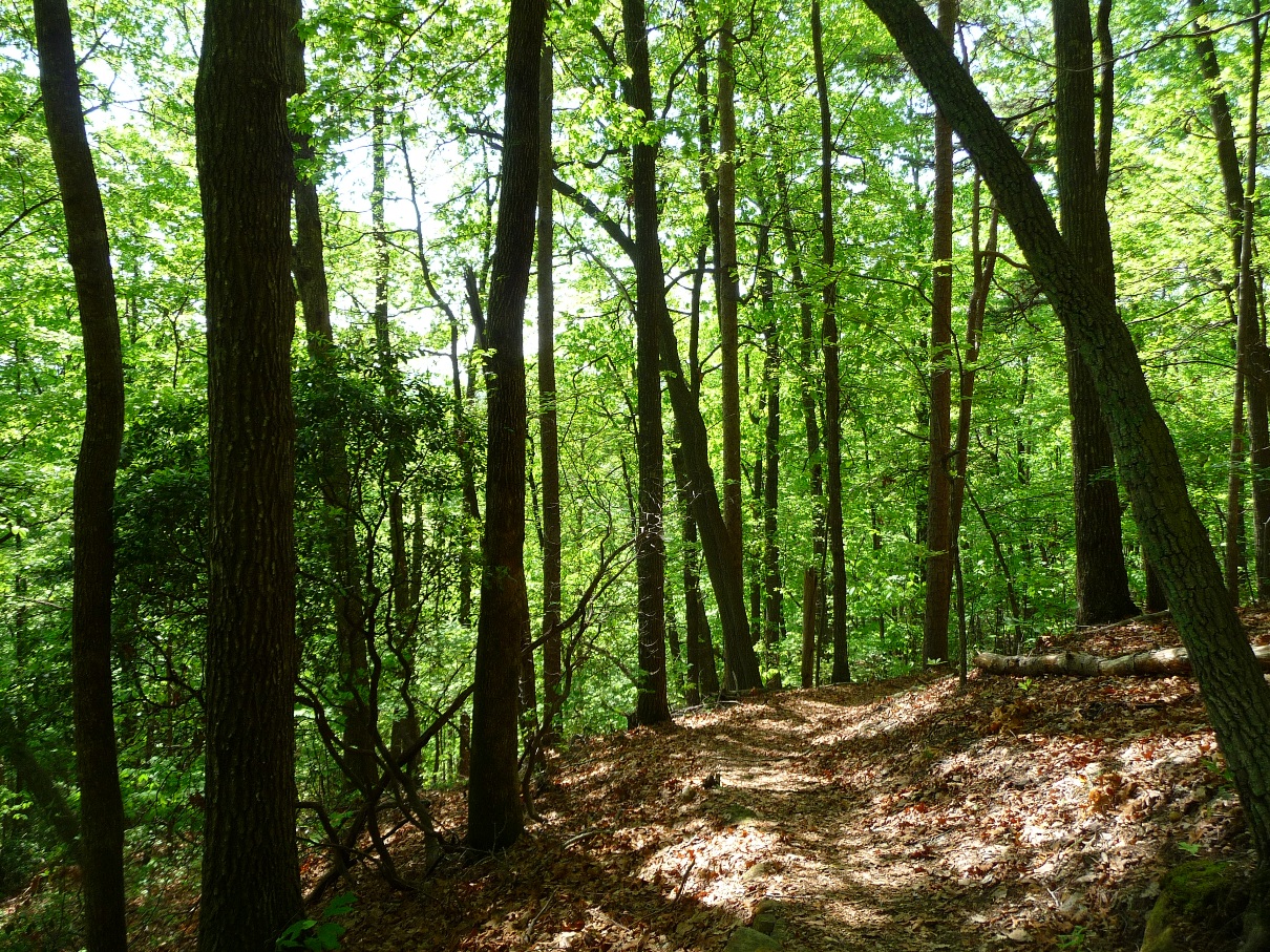
The first half or so of the 12 mile route mostly follows single track trail that winds in and out around the shallow coves of the lower portion of the southeast face of Pinnacle Mountain.
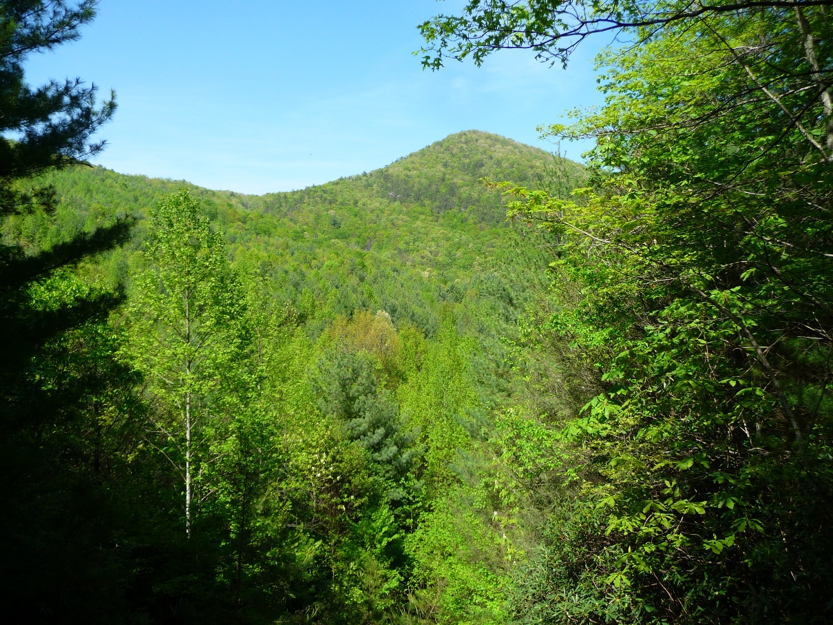
A view of Palmetto Trail 1.5 miles west of Table Rock State Park
Around the 3.5 mile point, there is a small cascade right off the trail. The map provided by the Palmetto Conservation group has this labeled as a waterfall! Given the other "real" waterfalls one goes near on this trail, the labeling of this one was a bit humorous! It does make for a nice lunch spot, however!
Small Cascade on an unnamed tributary
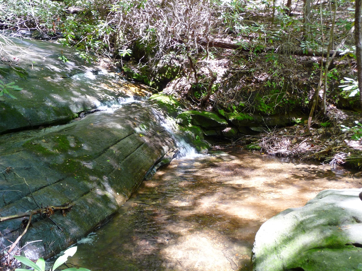
The nicest surprise of the entire hike was an impressively tall cascade/waterfall which comes very close to the trail at the 7 mile point. One can easily hear and see the waterfall at this point, and hiking a short distance off the trail brings you to the top of the waterfall. It is an easy bushwhack down to the base of the cascade …. the day I did this hike, I opted for a 30 minute nap in the shade while my two hiking partners explored the waterfall …. it is definitely on my list to explore on a future visit.
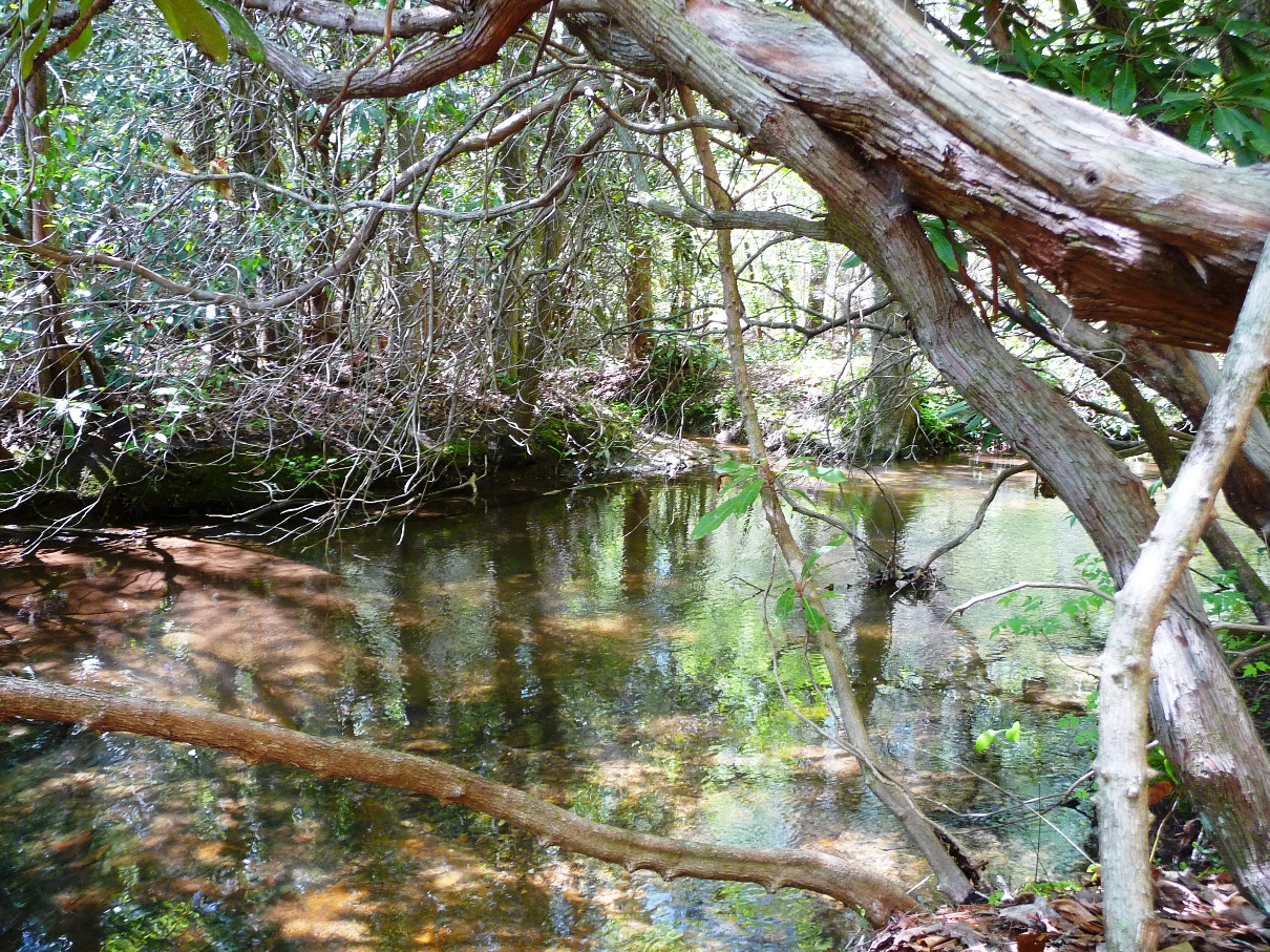
A still, quiet section of Emory Creek just above the waterfall
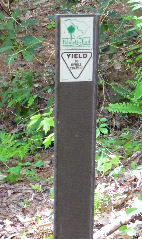
From around the 8 to the 11 mile point, the hiking trail changes from the narrower single track to wider, 4 wheel drive roads, and you’ll note other 4-wheel drive roads criss-crossing the Palmetto Trail (although no motor vehicles are allowed on the Palmetto Trail itself). It was along this area that I noticed a rather silly sign:
The trail is wide enough to drive a vehicle on, and in 8 miles we had not seen another person, but if we should, we certainly were prepared to yield to that uphill traffic!!
Just before the 9 mile marker is the opening that gives the view of Pinnacle Mountain shown at the top of this page. A side trail to a designated campsite located on Emory Creek upstream from the waterfall is also in this area. And, at the 9 mile point, the trail makes a sharp turn to the southwest, taking you on your final climb up to the ridge of Horse Mountain.
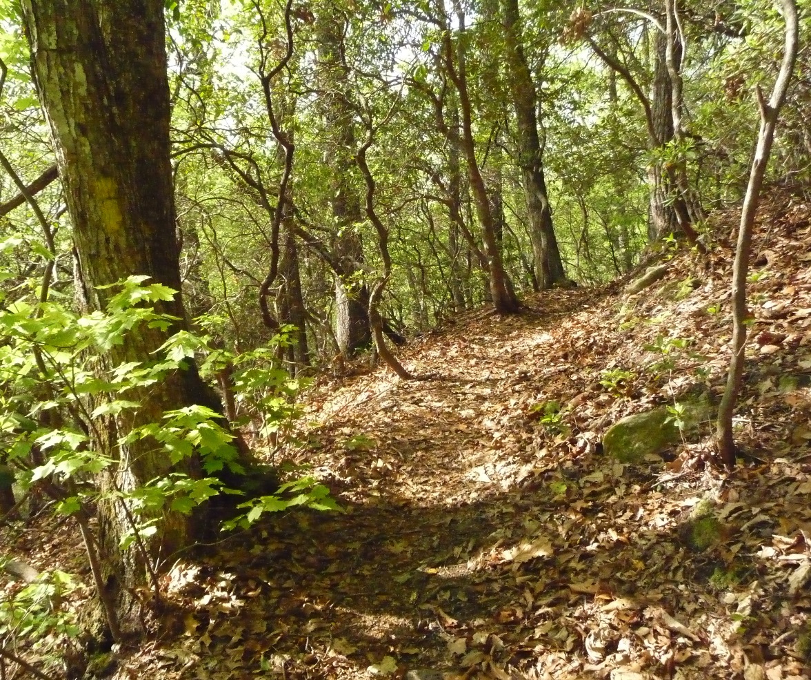
Palmetto Trail along Horse Mountain's ridge
I was worried that the last mile or so was going to be steeply downhill, but this section returns you to the beautiful, narrow, single track trail and the grade is very pleasant – not at all overly steep. This segment of the trail ends at US178.
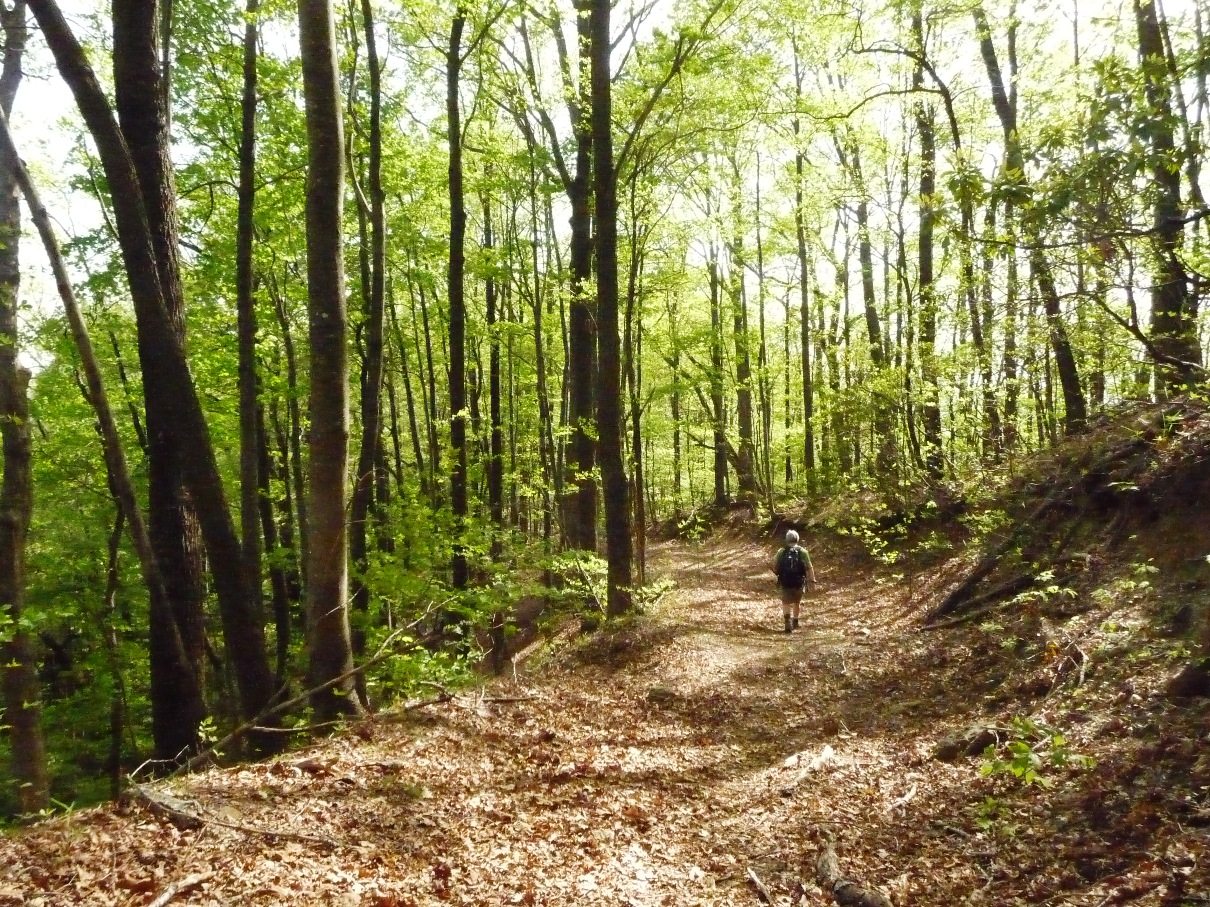
Above: Palmetto Trail, just past the 11 mile point.
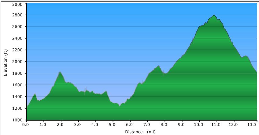
Below: Elevation Profile of the trail

GPX data for download:
Palmetto Trail from Table Rock State Park to US178.
DIRECTIONS
The eastern trailhead is located in Table Rock State Park. Enter at the west entrance, located off West Gate Road. This road is a semi-circle half loop, with both "ends" of the loop joining Highway 11. Once you've entered the park ($2.00 per person fee), take the next left to the campground and park near the "barn". Table Rock State Park's signs include directions to the Palmetto Trail.
The western trailhead is located on US178, approximately 2.6 miles south of Rocky Bottom (where the road to the top of Sassafras Mountain joins US178). The trail comes out onto the highway about 0.35 mile past Sugar Licker Road, which comes immediately after Reedy Cove Road.
There is no parking at this trailhead (in fact, there is a NO PARKING sign right at the trailhead ... another landmark to look for). Drive another 0.1 mile further, and there is a pull off on the left for several vehicles.
The trail is well labeled its entire way with both yellow blazes, as well as signs. However, in half a dozen places or so over the course of the 12 miles, the Palmetto Trail will be following a logging road and then turn sharply off, while the logging road continues straight. The day our group did it, we missed one of those turns. We stayed on the logging road, ending up on the edge of residential area. So do watch for the turns ... if you haven't seen a yellow blaze in a while, double check that you haven't missed a turn.
There is additional signage you will see along the trail: This 12 mile segment of the Palmetto Trail is labeled as the Blue Ridge Electric Co-op Passage. The company reminds you frequently of their presence on this trail via rather tacky signs located in numerous places along the route. Reminds me of those plastic little trays a restaurant puts your bill on at the end of a meal! I couldn't bring myself to photograph one, but myke on flickr has a shot of one.
|