
Sidepocket Falls
Side Pocket Falls
Click on any of the images on this page for full size/full resolution pic.
I'm just beginning to discover the vast options for hiking and exploring that are contained in the Gorges State Park and the surrounding remote and rugged areas that are part of Pisgah National Forest. Two major rivers run through this area: Horsepasture River and the Thompson River, and both contain some incredible waterfalls --- Big Falls, Rainbow Falls (both over 100' high) and the massive Windy Falls, along with dozens more that are in the "under 100 foot" range.
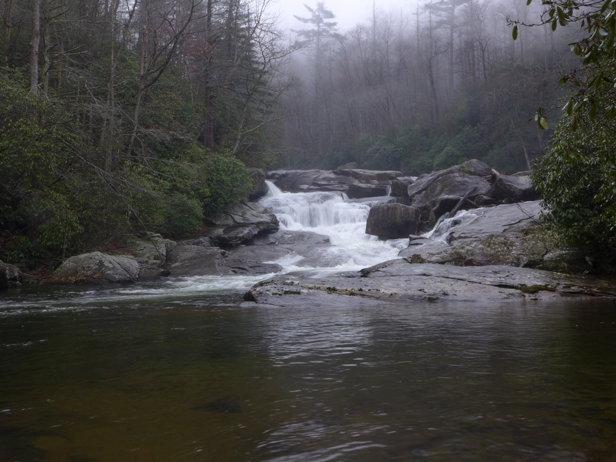
This trip report highlights one of these many smaller falls along the Horsepasture River: Sidepocket Falls (or Side Pocket ... I've seen it referenced both ways).
These falls are located between Rainbow Falls and Windy Falls on the river, around the 2300 foot contour line.
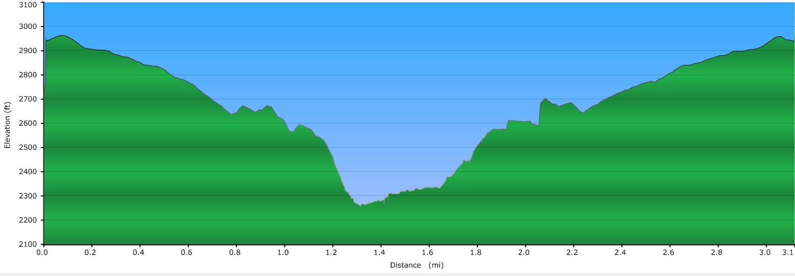
There is no trail to these falls, but recently, trail wizard Bernie researched and marked out an excellent way to get to these falls. The trek is 3 miles round trip with 700 feet of elevation change, and includes some mild bushwhacking. He took Rich and me down this route on a recent December day.
Elevation Profile
Click for larger image
Click here for a larger map
GPX data for download (zip file which includes both GPX format, as well as GDB format for Garmin users):
Side Pocket Falls.
DIRECTIONS
The hike to these falls begins at the parking area for Rainbow Falls, accessed from the Grassy Ridge entrance to Gorges State Park off Highway 281. Turn into the park's entrance, and follow the road down to the parking area, located 1.6 miles from the highway (at mile 1.0 you'll come to the entrance for the Park's visitor center. Do stop in if this is your first visit to the park ... it is a beautifully designed building, with maps and other park information available there.)
Once at the Grassy Ridge parking area, you'll note a sign board which marks the beginning of the trail to Rainbow Falls. Just to the left of that you'll see a gravel 4WD road (Chestnut Mountain Road). Park at the lot, and begin your hike down this 4WD road.
0.5 mile down this road, you'll come to an old, overgrown forest road to your right. Turn here (there is another old forest road that bears to the right another 300 feet down this road ... these two old roads merge in about 0.3 mile. If you note my GPS track above, you'll see we went down one road going, and returned via the other road).
Soon after these two roads merge (about 0.3 mile from where you turned off Chestnut Mountain Road), you'll notice a rock cairn in the middle of the trail. This is your signal to start looking for Bernie's Trail that he made down to the river.
The route bears off the old forest road to the right, and is marked with orange ribbons. It initially winds through a relatively flat area. After about 0.3 mile from where you turn off the old forest road, you begin your final descent to the river. You drop about 300 feet in about 0.2 mile, but even with this steep grade, Bernie's skill with route finding shows its finesse: the GPS track makes it appear as if you're going straight down the ridge, but you're not. His route zig-zags back and forth, around this rock or that outcropping and is a very hike-able.
Once you reach the stream, bear to the right. You will see Bernie's trail continues upstream for a short ways to this first view of the falls.
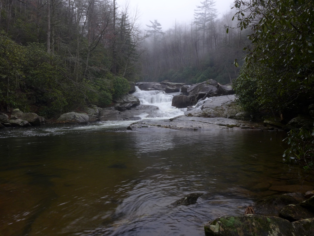
Lower section of Sidepocket Falls
From here, if you make your way upstream by staying on the right side of the stream (right side as you're heading upstream), you can make your way along the rocks to the other part of Sidepocket .... a series of drops that end with a pool at the base, just upstream from the shot above.
However, on the day I did this hike with Bernie, it had been raining most of the morning, the rocks were wet, and the water level in the river was up considerably, making the upstream route totally unsafe.
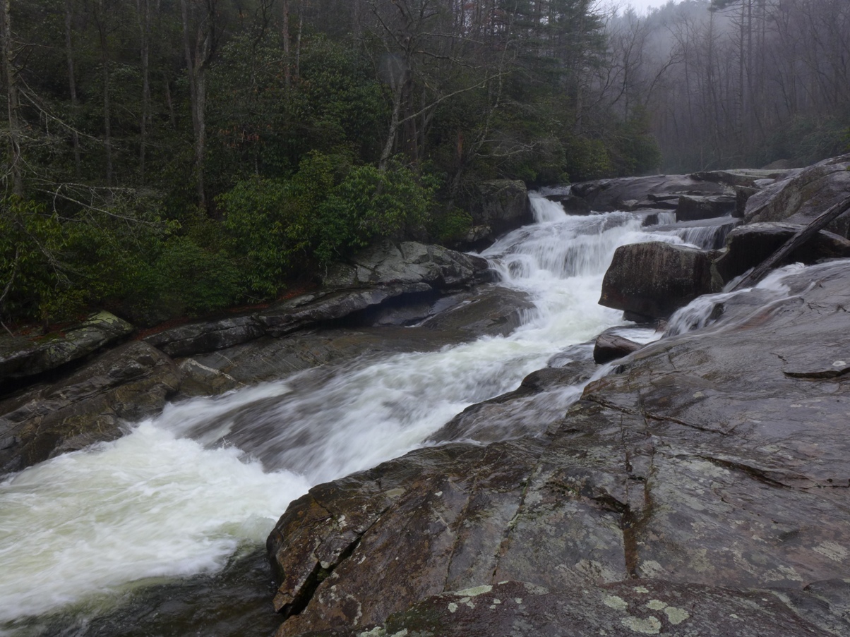
We had planned to keep hiking upstream along the rocks to the right, but there was so much water flow that we could not safely do so.
You can just barely see some of that water flow on the far right center of the photo above, where what looks like a thin stream of water is coming into the frame. This actually was a very large volume of fast flowing water, with no dry rocks to maneuver along upstream. Additionally, it had been raining all morning (and still was), so all the rocks were very wet, and quite slick.
So, we did not proceed any further. We took a few more photos and then turned around and retraced our route back to the car.
This brings up the always important safety aspect when you're hiking around waterfalls ... wet rocks = slick rocks. Add in a fast flowing river, and you've got the ever present danger of one slip plunging into the fast flowing stream. NEVER take chances around waterfalls ... safety FIRST. That waterfall will still be there to see next time I make the trip down!
More photos in my SmugMug gallery.