
Hike to Table Rock
via
Pinnacle Mountain Trail
including Mill Creek Falls
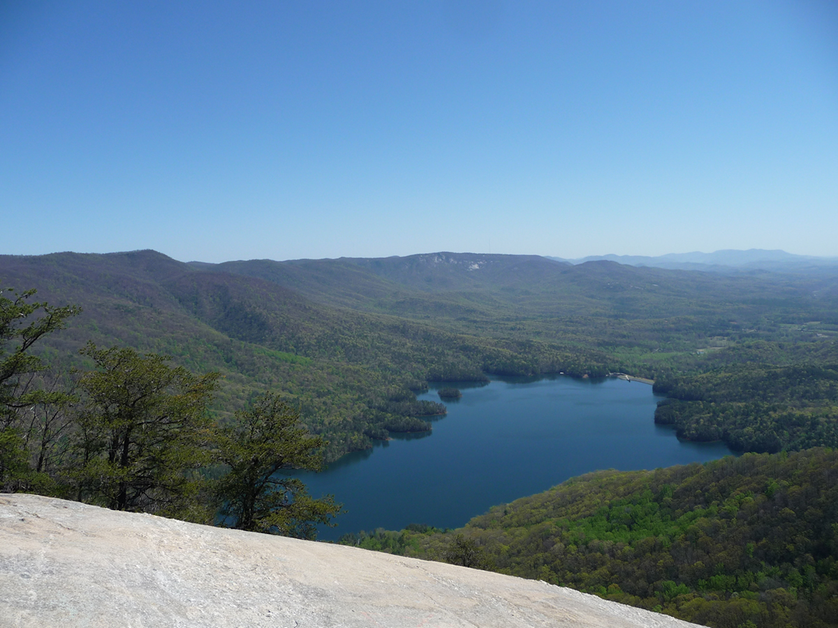
Table Rock State Park is located in northern South Carolina and offers many options for outdoor activities. By far the most challenging, is the hike to the top of "Table Rock", the large rock formation that rises up from the landscape, looking very much like a table. As challenging as the hike to the top of this geological formation is, it is equally rewarding (maybe more so!) with the view one is treated to at the top.
The above picture is what awaits you after hours of almost continuous uphill hiking .... a view of Table Rock Reservoir, and the protected Greenville watershed surrounding it.
The shortest route to the top and to this view is via the 3.7 mile Table Rock Trail. However, when I do this hike, I generally start out going up Pinnacle Mountain Trail to the west, make a stop at Mill Creek waterfall, and cut over on Mill Creek Pass Trail to Panther Gap, and then on to Table Rock's summit.
That makes the total hike 10.7 miles, instead of 7.4 miles, but I find that this route, despite the longer mileage, actually makes the entire hike a bit easier, since the elevation gain is more gradual, and you get the refreshing enjoyment of a waterfall stop along the way.
Note that if you do choose to do this longer hike, it is MUCH easier to go to the waterfall first, then over to Table Rock. Doing it in the opposite direction gives you two very steep climbs that you otherwise get to avoid ... the main Table Rock Trail to Panther Gap (this is the long steep uphill you get to avoid by going to the falls first), as well as the very steep grade that goes from Panther Gap up to the ridge line that allows you to pick up Mill Creek Pass trail (going to the waterfall first lets you go DOWN this section).
If you are interested in the shorter, 7.4 mile hike that goes up Table Rock Trail, and then back the same way, please see my trip report on that hike here.
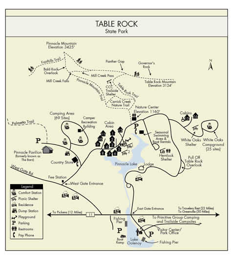
Click on the above map for a pdf version
Map provided by www.SouthCarolinaParks.com
The map above is probably as good of a map for hiking in the park as any. The trails in the park are very well labeled, as well as heavily used, so you will not have any problem finding trails and/or turn offs.
Most of the topo maps I've found are very, very old, not even showing the main highway (Highway 11) that leads to the park. If you want to check elevation gains and such, check any of the on-line topo maps available such as the one below.
For GPS users, below is my track from my hike. On this particular hike, my GPS's batteries died mid-hike. Thankfully, I noticed it fairly soon after they died (only went 0.3 mile without tracking), and replaced them with fresh (I always carry GPS and camera batteries with me!) The short blue track called EXTRAPOLATED is the section where the batteries had died, and therefore I was NOT tracking. I extrapolated this section from the beginning/end of the actual hiked track.
Click here for the map
GPX data for download: Table Rock Hike, Long Version.
DIRECTIONS
Enter the park at the West Gate Entrance. (Even if you are coming from the east this is the easiest route to the parking area and trailhead). South Carolina charges a $2.00 per person day use fee ($1.25 for SC residents 65 and older, disabled residents, and National Guard members), paid at the park entrance.
The parking area is easily located on the right (if coming from the West Gate Entrance). It is adjacent to Pinnacle Lake, which offers a beach and swimming during the summer months.
The trail to the top of Table Rock starts from the Nature Center, located across the road from the parking area. Restrooms are also located here.
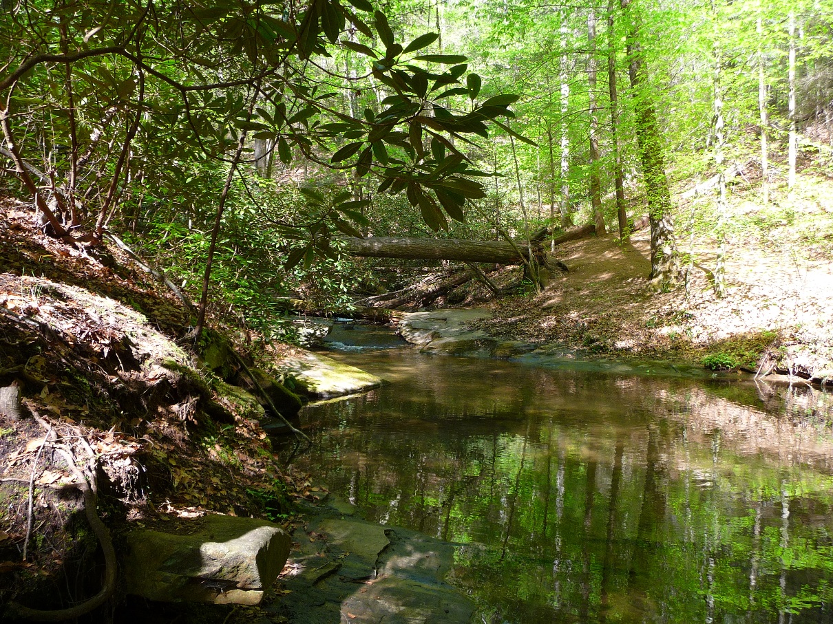
The first 100 yards or so are a delightfully landscaped, PAVED (!) trail running along Carrick Creek. This area of the park offers a lot of options for families and individuals who do not want a 3 hour uphill hike, but rather just a fun place to play by water.
Pinnacle Mountain Trail
Begin at the Nature Center, and follow the main, paved trail. You soon come to the first of several junctures --- the lower portion of the 2 mile Carrick Creek loop bears left. The main Table Rock Trail goes straight. Turn left here, onto Pinnacle Mountain Trail.
The two photos (above and below) show the views you have along Carrick Creek.
Click either photo for full size
The next juncture you come to is the turn off to the upper loop of the Carrick Creek Loop, which would take you back to the Nature Center. This loop makes a very nice 2 mile hike, most of which is along the creek and its rapids.
However, for the loop to Table Rock, you want to go straight here, staying on Pinnacle Mountain Trail.
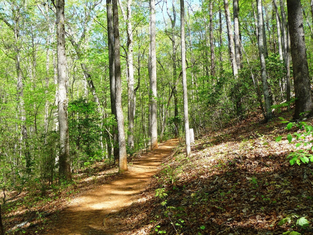
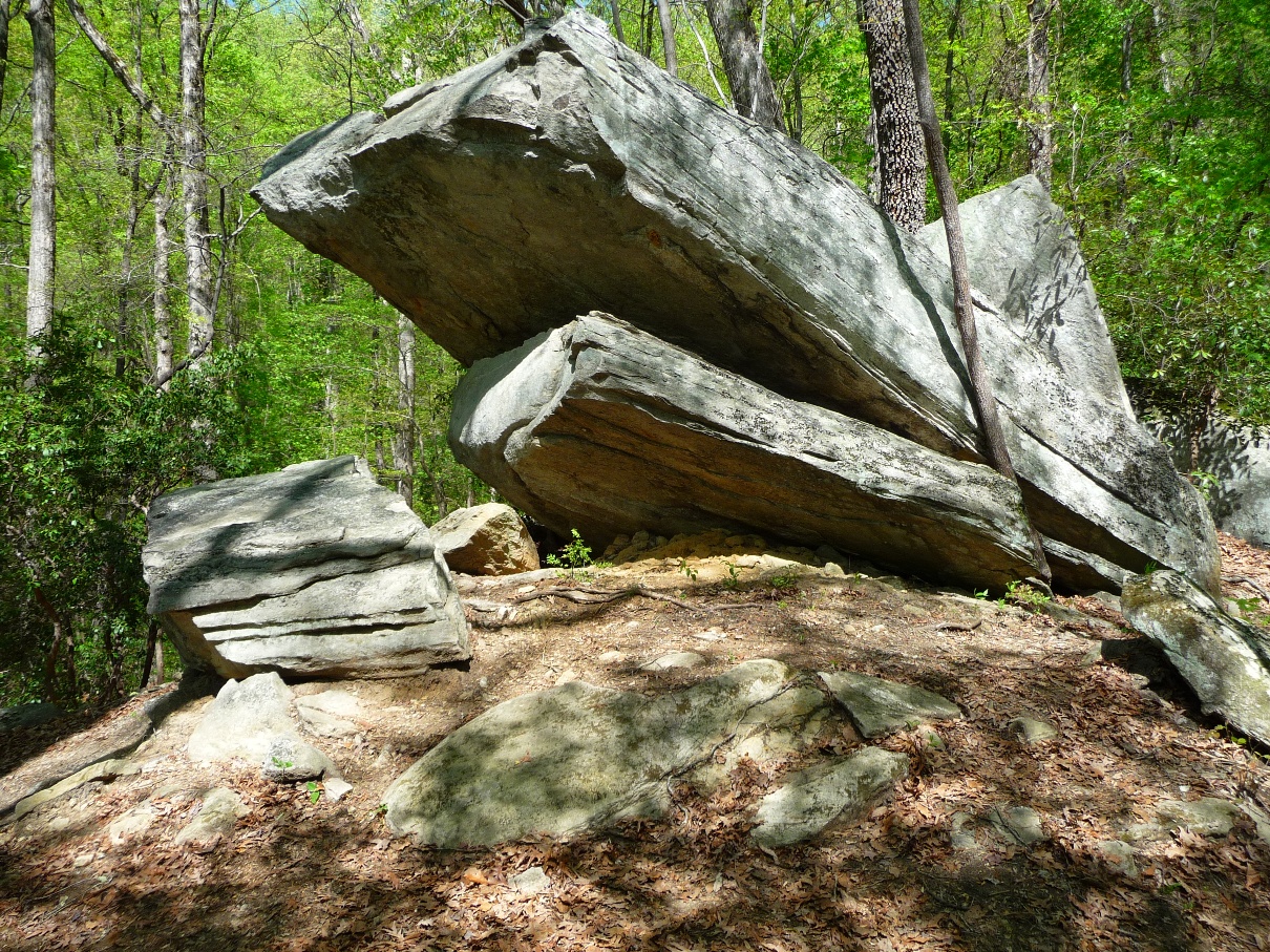
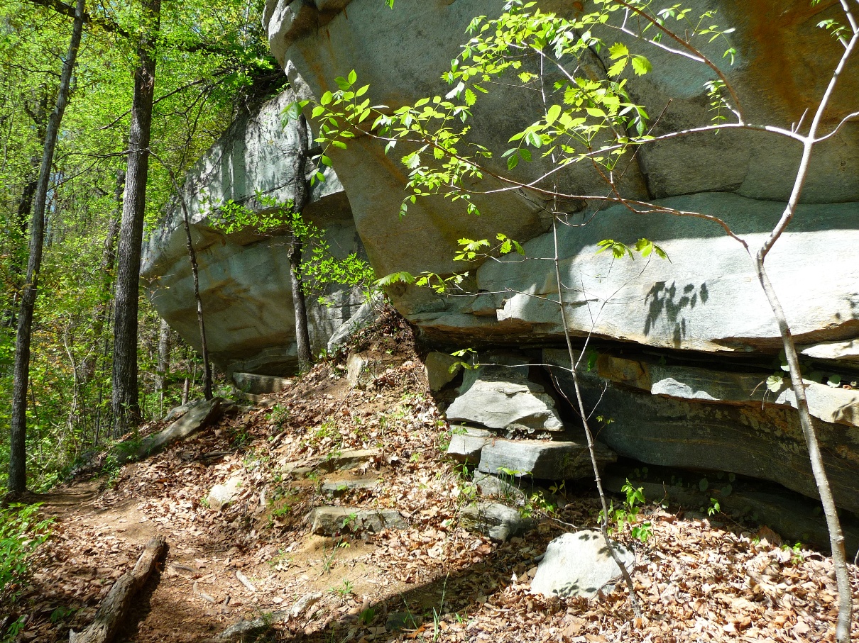
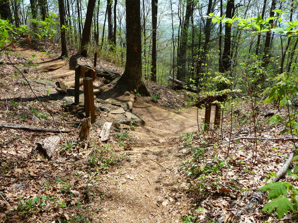
Pinnacle Mountain Trail's grade is very pleasant, much less steep than Table Rock's. It is also has more trees, and visually is more interesting. You pass some impressive stone formations, including one that has water dripping off year round.
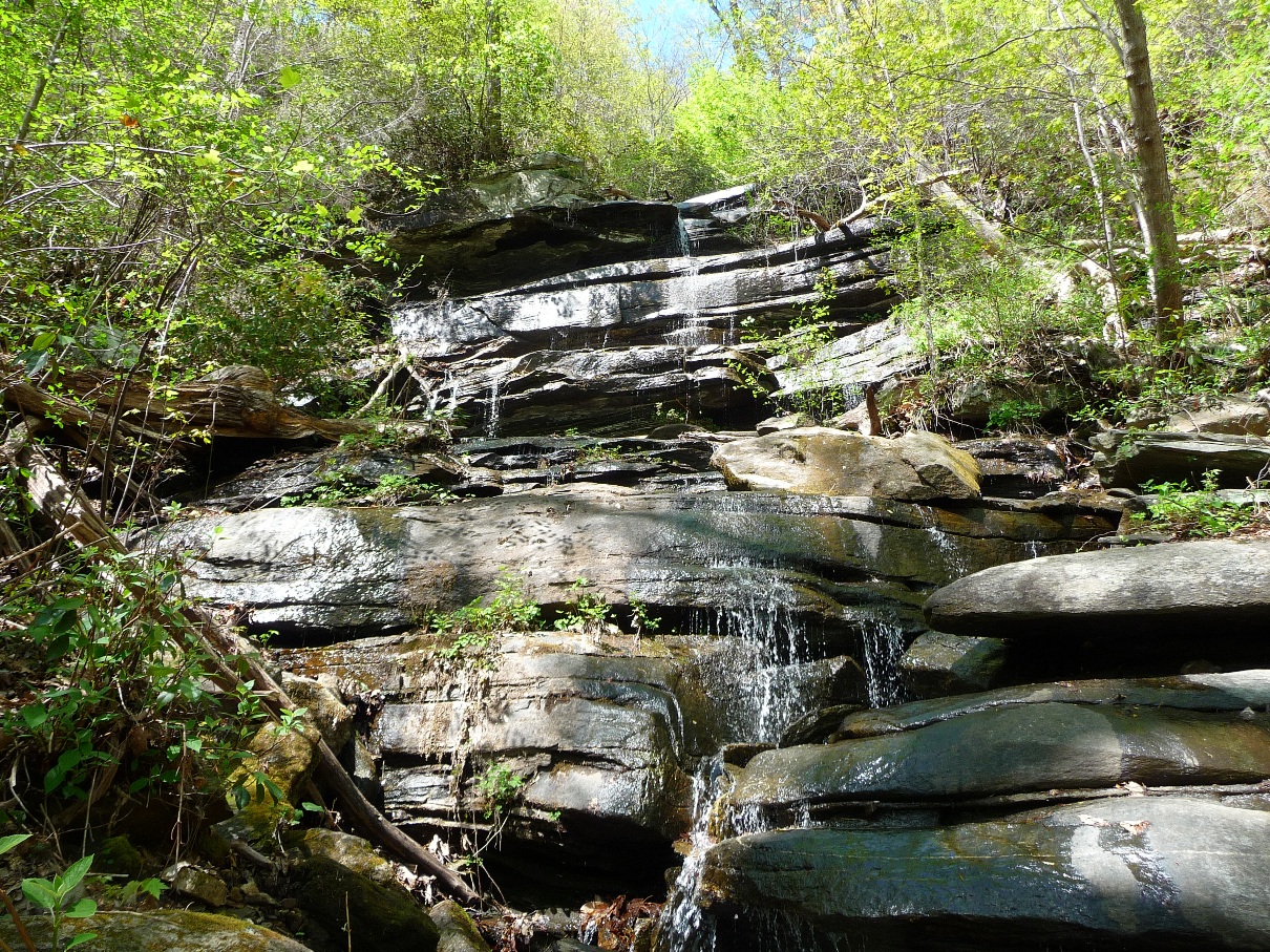
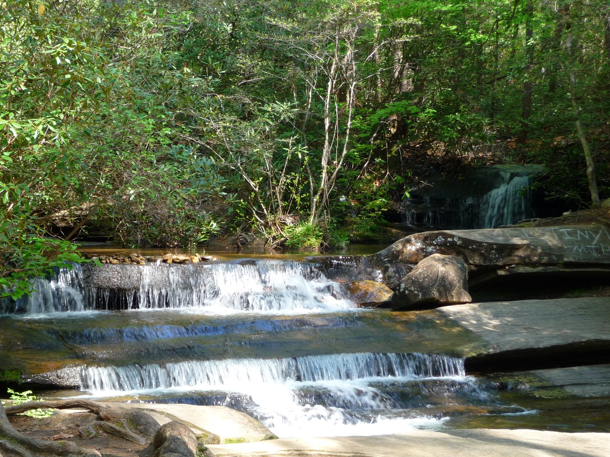
After approximately 2.6 miles, you come to the turn off to the 0.4 mile spur trail (out and back) that goes to Mill Creek Falls.
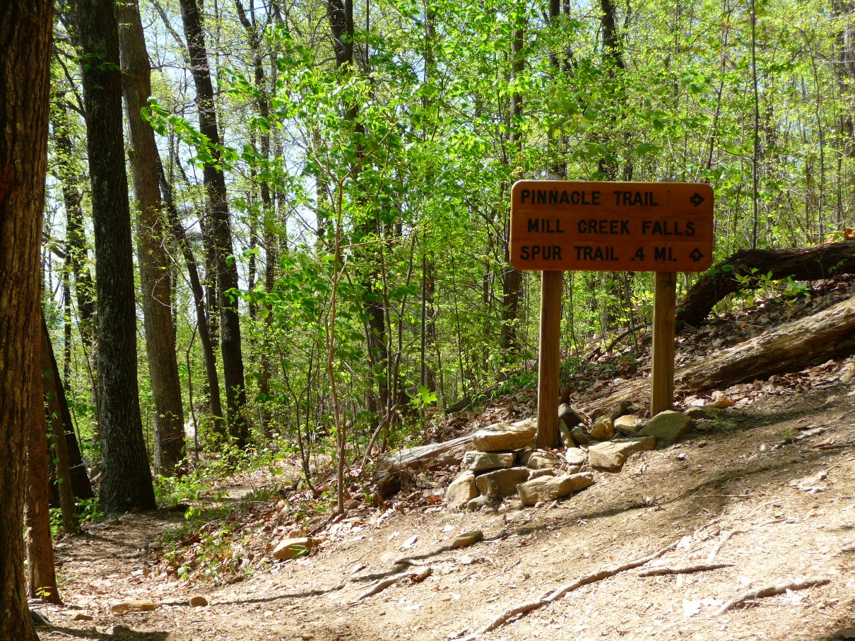
Several years ago the trail to Mill Creek Falls was re-routed. One previously had gone by the falls on the Pinnacle Mountain Trail. Now, you have to leave Pinnacle Mountain Trail, and go down an out and back 0.4 mile spur to reach the falls.
Severe erosion and tree falls on the trail past the falls following severe storms necessitated this re-routing.
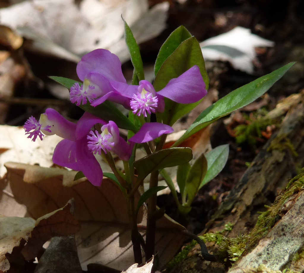
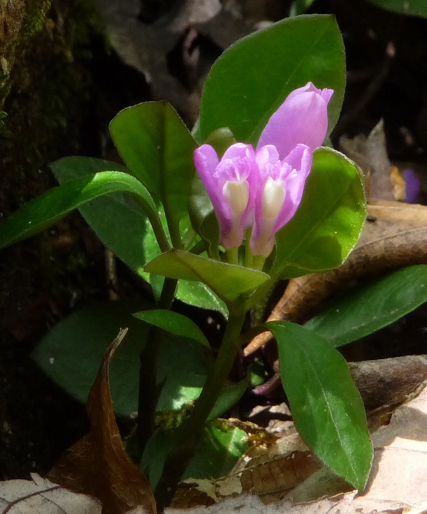
Along this 0.4 mile spur trail, one gets some great views of Oolenoy Lake and the South Carolina Piedmont south of highway 11. As you get close to the waterfall, you follow Mill Creek and its rapids. In the spring, some great wildflowers are also along this way, including the relatively infrequently seen polygala.
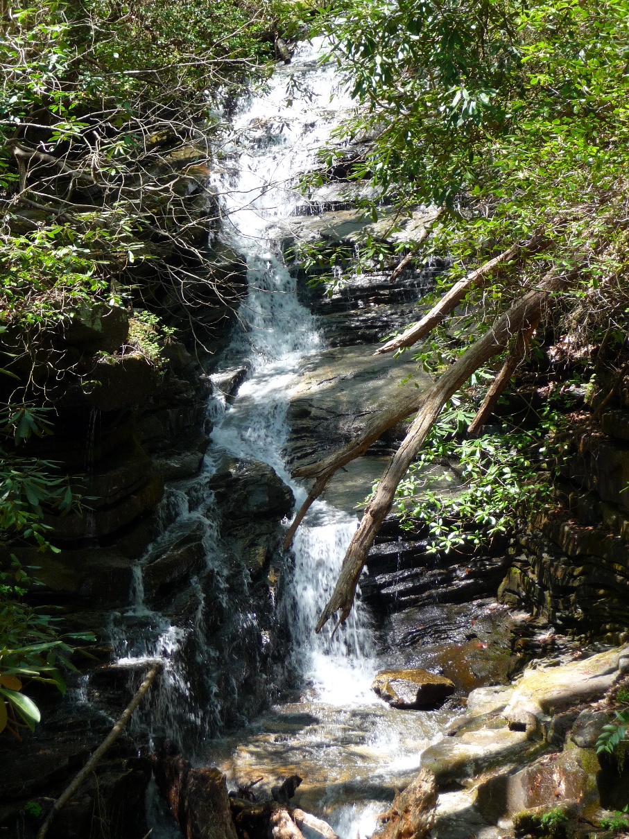
I am hesitant to share a picture of Mill Creek Falls, since this waterfall is so darn hard to photograph well!! All my pictures just look like .... ehhhh. There are a lot of downed trees along the water's path, lots of greenery on either side, and the few places available to stand for photographing are not the places you get a great shot. But for me, the falls, combined with the hike up along Mill Creek ARE worth this extra 0.8 mile detour.
Once you get to the falls, the trail dead ends, and you need to retrace your steps back down the 0.4 mile spur trail and resume following Pinnacle Mountain Trail.
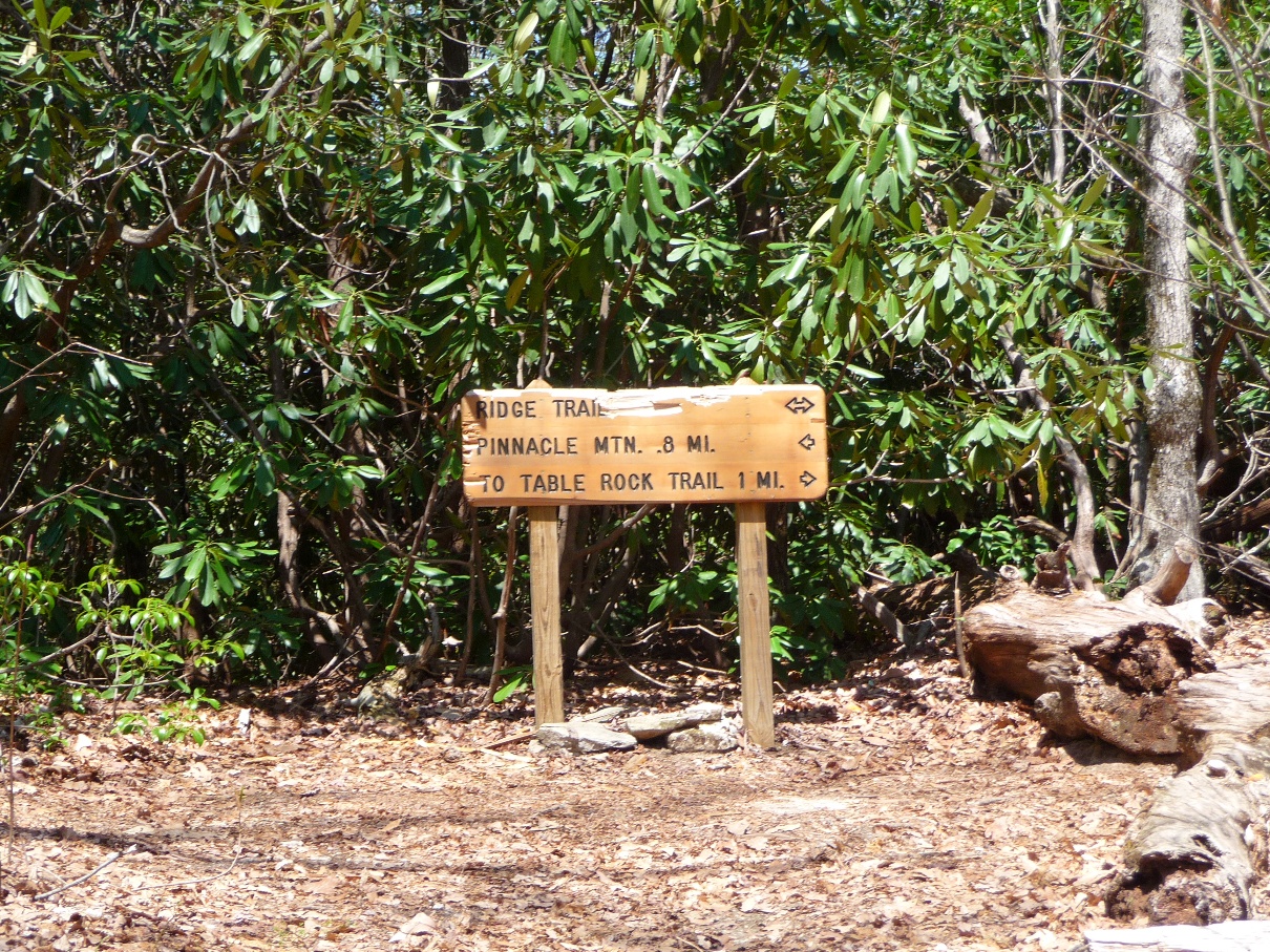
About one half mile from the intersection of Pinnacle Mountain Trail and the Mill Creek Falls spur trail, is your turn off onto Mill Creek Pass Trail. This will take you east towards Table Rock. Pinnacle Mountain Trail continues west to Pinnacle Mountain's peak, as well as to the Foothills Trail turn off.
Turn right onto Mill Creek Pass Trail; this section is approximately 0.6 miles long, and climbs steadily through thick rhododendrons to the ridge line.
At the ridgeline, you come to a "T"; turn right, heading over to Panther Gap. This intersection, like all in Table Rock Park, is well labeled.
In approximately one mile, you will come to Panther Gap (and along the way, get some great views of Table Rock), and join the "main" Table Rock Trail. From here, it is 1.5 miles to the summit. Bear left at the Panther Gap intersection, shown below. This is the one location in the park that is not labeled. There is a sign board here, however, the map is missing!!
For the next little stretch, you actually get to hike on level ground, even going slightly downhill. All this does is make the next section seem even more steep than it already is!! However, your legs will greatly appreciate this stretch! Just remember, more uphill to come!!
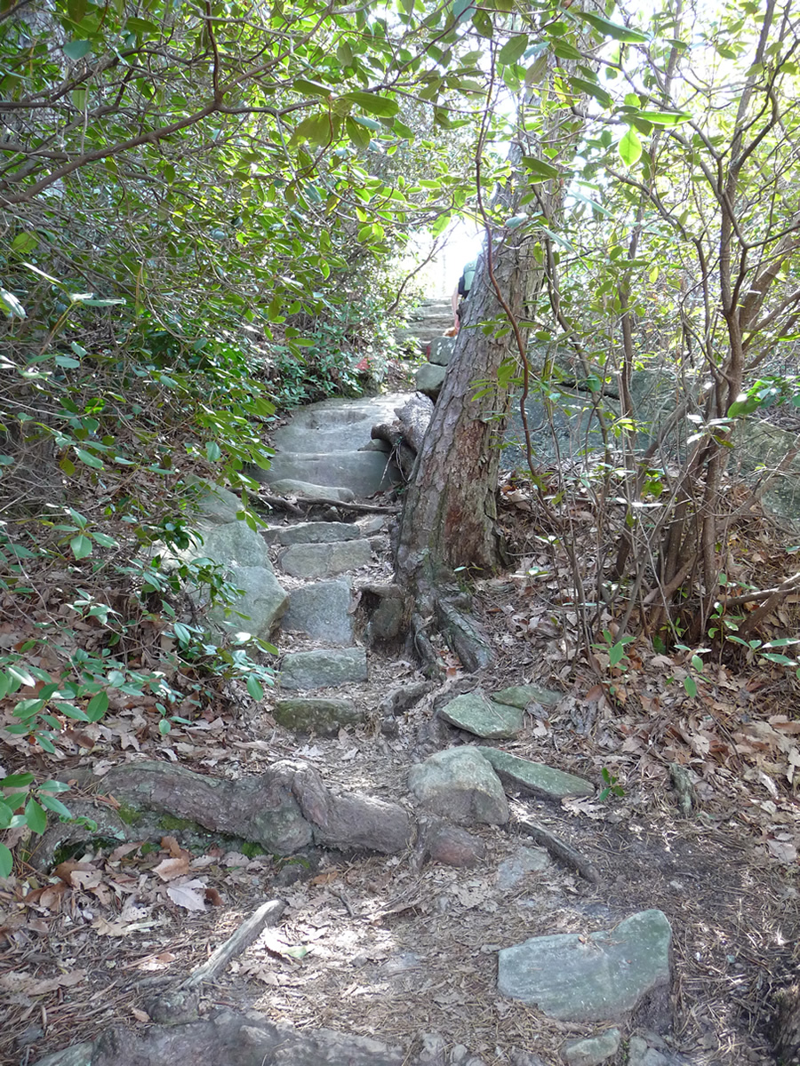
After a very pleasant half mile or so walk along this more or less level stretch, you hit the steepest climb of the entire hike, as you head for Governor's Rock.
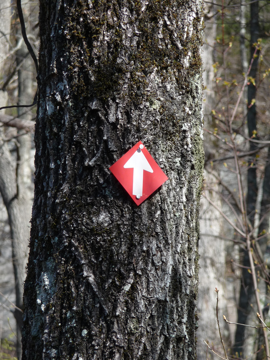
The lower left photo shows the beginning of the climb that eventually brings you out at Governor's Rock Partway up this trail one sees one of the many "trail goes straight ahead" arrows located along the trail, but at this point, all I could thing was, |
 |
 |
 |
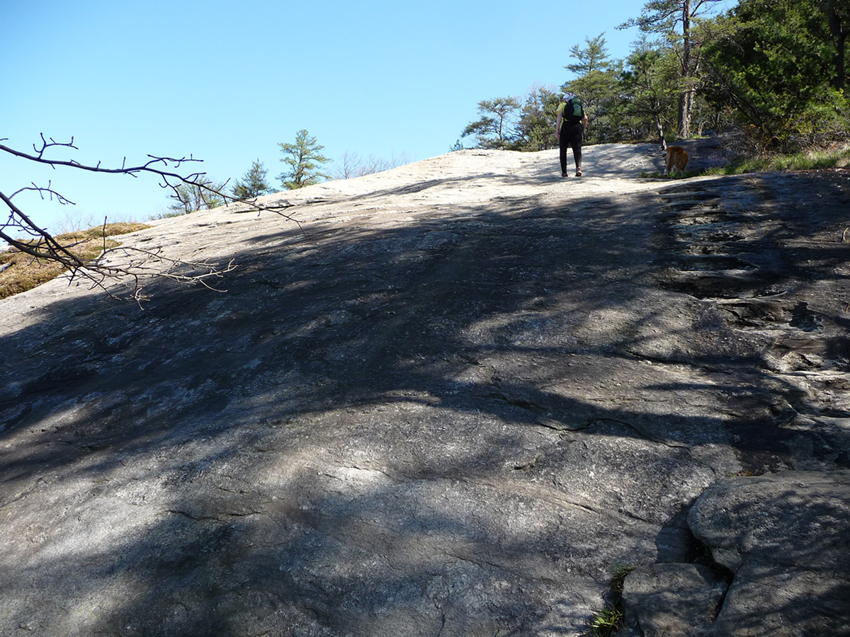
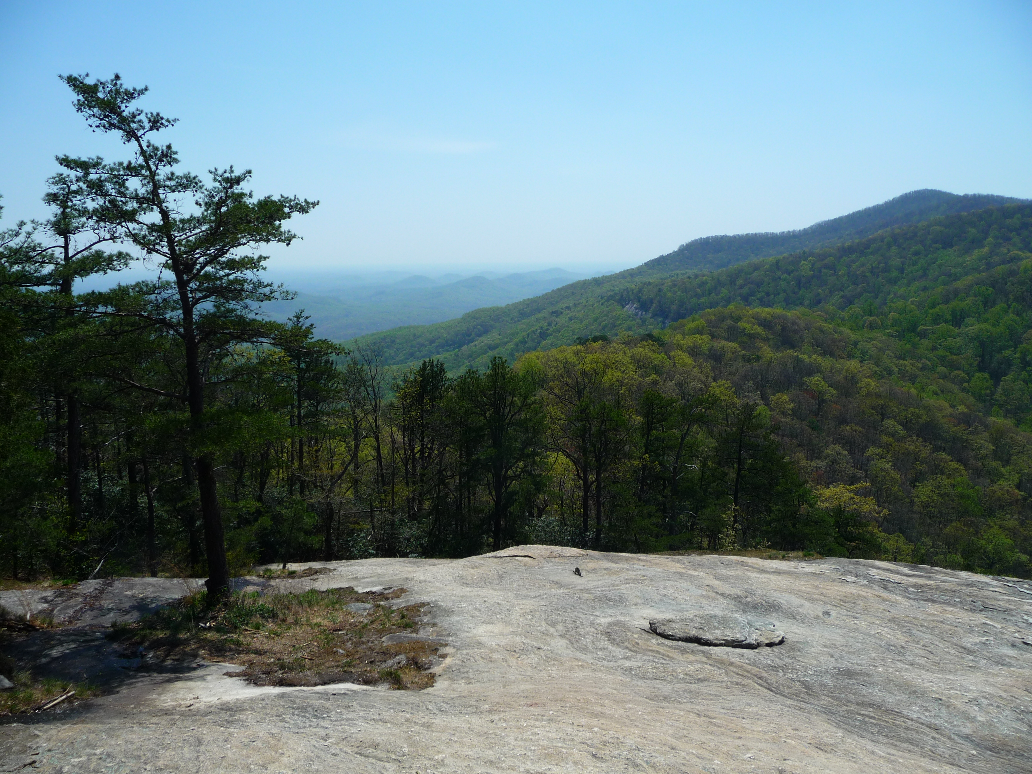
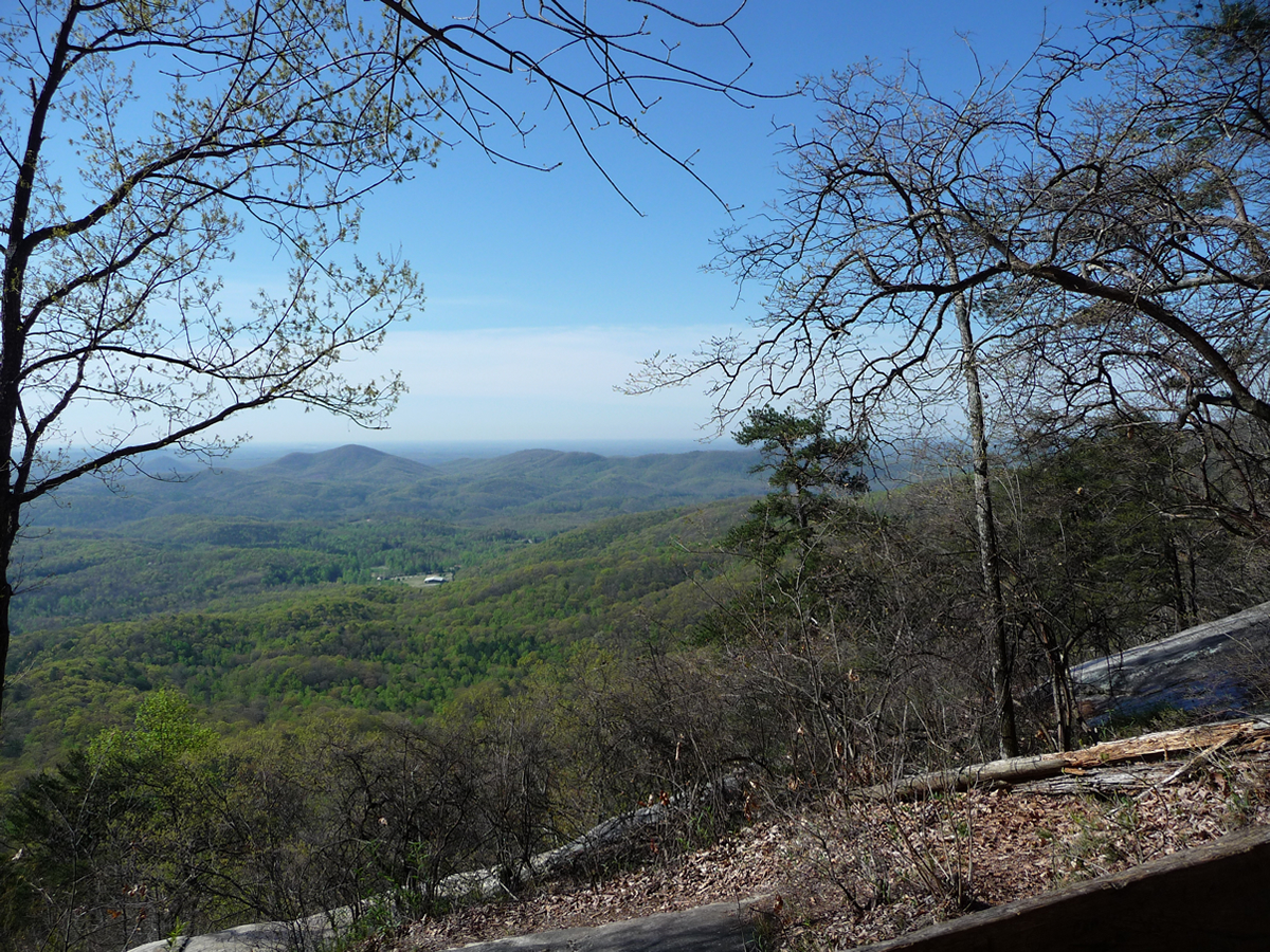
Once you ascend to the top of Governor's Rock, you are well rewarded for this latest bit of climbing:
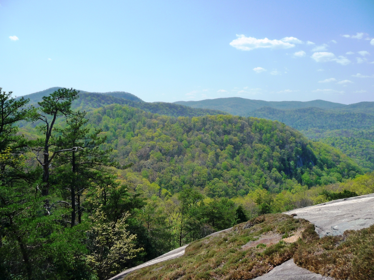
Views from Governor's Rock to the northwest (above) and to the west (below).
Click either image for full size pic.
Many hikers, especially those coming up the shorter, main trail, make this their turn around point. Just remind yourself you've already climbed over 90% of the elevation gain needed to get to the summit ... less than 200 feet in elevation to go!!
The next portion of the hike takes you into a pine forest, a nice break from the sun if you do this on a sunny day. In a quarter mile or so, you finally reach the Table Rock Summit at 3,124 feet in elevation (952 meters):
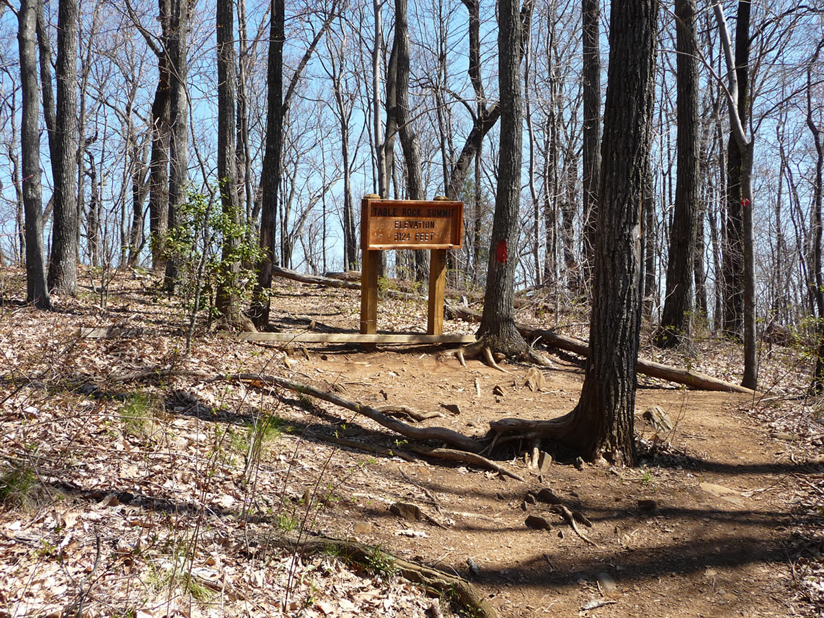 |
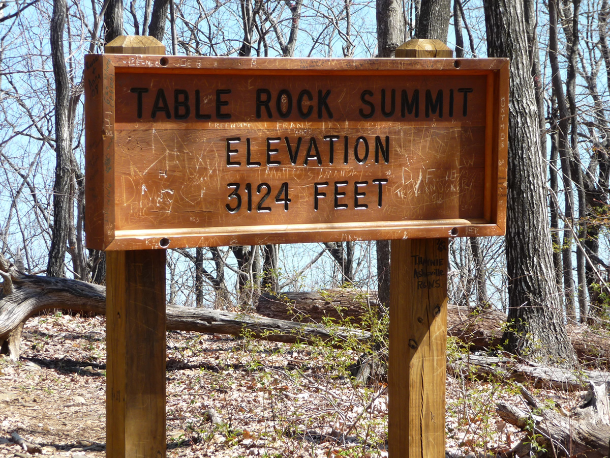 |
Whatever you do, don't stop here, thinking this is the end of the hike!! (I have heard horror stories of folks who've climbed to this point, and thinking this is the end, turned around!!) This happens to be the SUMMIT, but definitely NOT the high point of the hike!!
On my most recent hike, I noticed more of the red arrows signaling the trail continues onward just past this sign, to indicate to hikers NOT to turn around here!
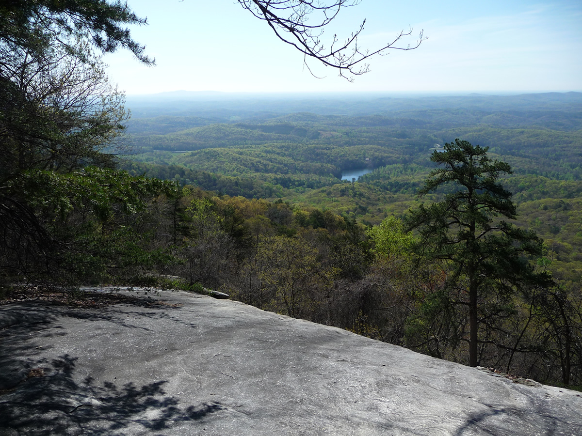
Continue on about another half a mile, to the visual grandeur that awaits you for all your hours of climbing:
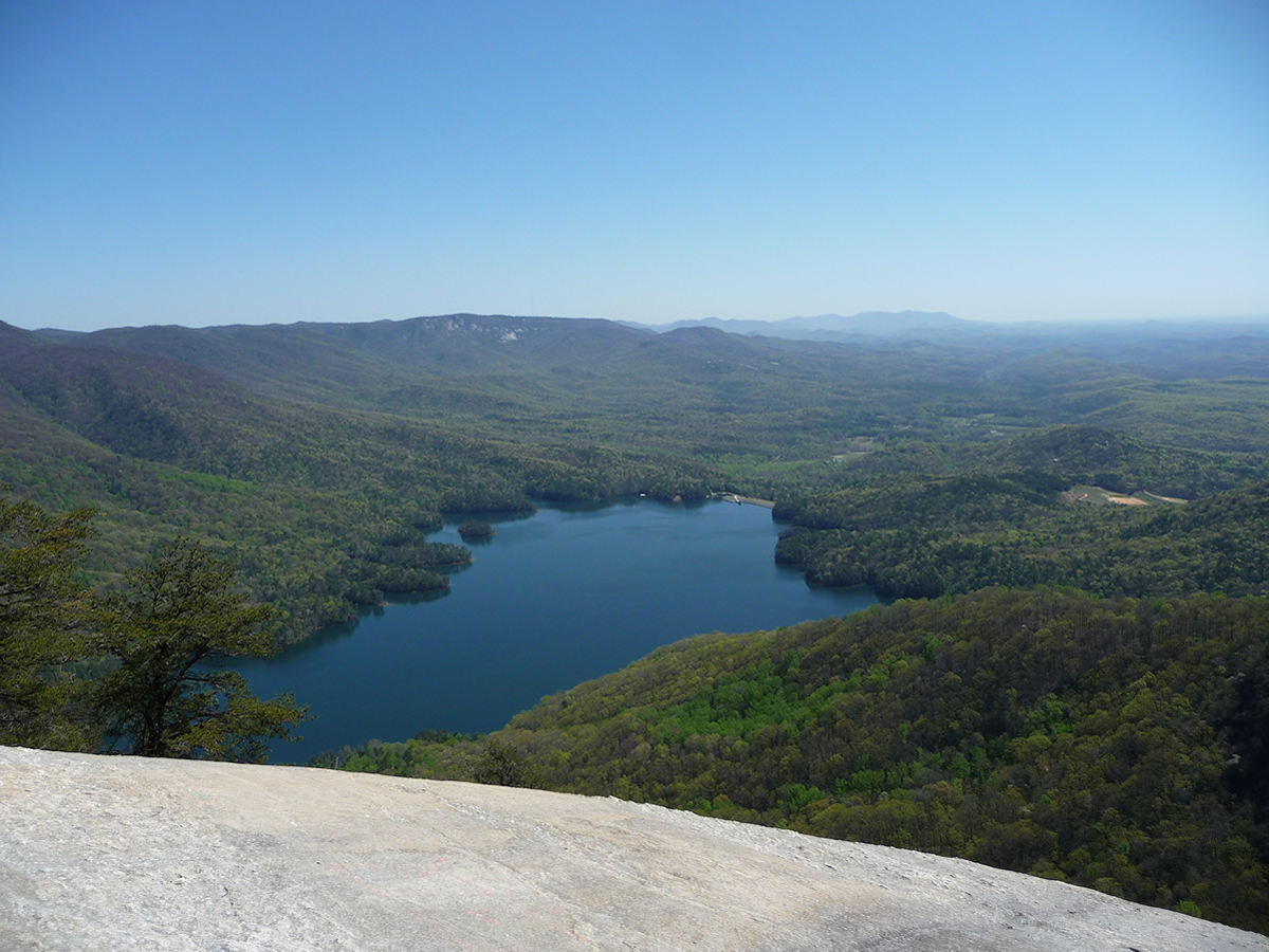
The lake you are looking down on is approximately
1600 feet in elevation lower.
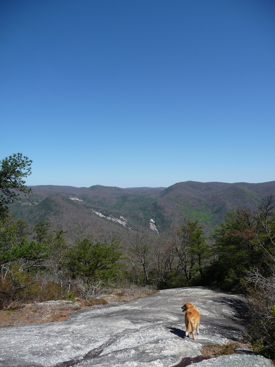
Looking a little further north,
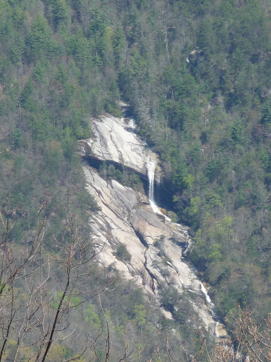
you see Slicking Falls, seen below.
The photo on the right is zoomed in from the one on the left.
 |
 |
Be sure to allow plenty of time to rest, lunch, and enjoy the view here!!
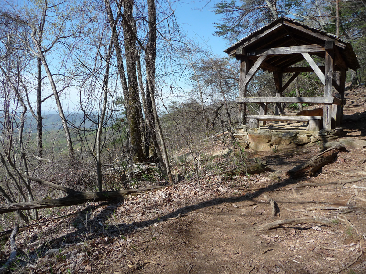
To return, head back to Panther Gap, and then turn left, heading down the main Table Rock Trail (or, if you're a glutton for punishment, return the way you came via Pinnacle Mountain Trail !! )
In a short distance (if following the main Table Rock Trail) you come to a trail shelter, built in the 1930's by the CCC. (An informational poster at the Nature Center states that most of this park's trail system was built by the CCC workers).
 |
 |
 |
Click on any of the thumbnail pictures for a full size view |
From the CCC Shelter, it is approximately 2 miles back to the Nature Center and parking area.
Please also see my flickr set for more photos, including various wildflowers and flowering trees seen along this hike.
NOTE FOR HIKERS WITH DOGS: You'll notice from a couple of the pictures that my dog accompanied me on this hike. This hike is suitable ONLY for dogs well conditioned and used to long, uphill climbing. Also, you WILL need to bring water for your dog ... even in the relatively cool days of spring, this hike is HOT ... much of the trail goes through open, exposed areas where you and your dog will be in the sun for over an hour at a time. In the summer, this is a downright HOT, HOT hike.
Sometimes there is a spring running down the south side of Governor's Rock, but I never count on this for my dog. Bring water ... LOTS of water!